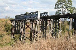
Spring Creek, Queensland (Lockyer Valley Region)

Last updated

Spring Creek
Queensland
Australia Queensland location map.svg
Red pog.svg
Spring Creek
Coordinates 27°26′30″S152°19′19″E / 27.4416°S 152.3219°E / -27.4416; 152.3219 (Spring Creek (centre of locality))
Population494 (2021 census) [1]
 • Density10.953/km2 (28.37/sq mi)
Postcode(s) 4343
Area45.1 km2 (17.4 sq mi)
Time zone AEST (UTC+10:00)
LGA(s) Lockyer Valley Region
State electorate(s) Lockyer
Federal division(s) Wright
Suburbs around Spring Creek:
Buaraba Buaraba Churchable
Vinegar Hill Spring Creek Lockyer Waters
Adare Lake Clarendon Morton Vale

Spring Creek is a rural locality in the Lockyer Valley Region, Queensland, Australia. [2] In the 2021 census, Spring Creek had a population of 494 people. [1]

Contents

History

Clarendon Provisional School opened on circa 1882. In 1903 it was renamed Springdale Provisional School. It became Springdale State School on 1 January 1909, but closed later in 1909. Its precise location is not known but it was in the vicinity of the intersection of (present day) Adare, Lake Clarendon and Spring Creek. [3]

Southern Queensland Correctional Centre opened in January 2012. [4]

Demographics

In the 2016 census, Spring Creek had a population of 601 people. [5]

In the 2021 census, Spring Creek had a population of 494 people. [1]

Facilities

Southern Queensland Correctional Centre is a 300-bed high security prison in Millers Road ( 27°28′12″S152°18′25″E / 27.4701°S 152.3069°E / -27.4701; 152.3069 (detention centre) ). [6] [4]

Related Research Articles

<span class="mw-page-title-main">Clarendon, Queensland</span> Suburb of Somerset Region, Queensland, Australia

Clarendon is a rural locality in the Somerset Region, Queensland, Australia. In the 2021 census, Clarendon had a population of 232 people.

<span class="mw-page-title-main">Lockrose</span> Suburb of Lockyer Valley Region, Queensland, Australia

Lockrose is a rural locality split between the Lockyer Valley Region and Somerset Region of Queensland, Australia. In the 2021 census, Lockrose had a population of 564 people.

Flagstone Creek is a rural locality in the Lockyer Valley Region, Queensland, Australia. In the 2021 census, Flagstone Creek had a population of 256 people.

<span class="mw-page-title-main">Atkinsons Dam, Queensland</span> Suburb of Somerset Region, Queensland, Australia

Atkinsons Dam is a rural locality in the Somerset Region, Queensland, Australia. In the 2021 census, Atkinsons Dam had a population of 191 people.

<span class="mw-page-title-main">Mount Whitestone, Queensland</span> Suburb of Lockyer Valley Region, Queensland, Australia

Mount Whitestone is a rural locality in the Lockyer Valley Region, Queensland, Australia. In the 2021 census, Mount Whitestone had a population of 129 people.

<span class="mw-page-title-main">Fordsdale, Queensland</span> Suburb of Lockyer Valley Region, Queensland, Australia

Fordsdale is a rural locality in the Lockyer Valley Region, Queensland, Australia. In the 2021 census, Fordsdale had a population of 50 people.

Lefthand Branch is a rural locality in the Lockyer Valley Region, Queensland, Australia. In the 2021 census, Lefthand Branch had a population of 69 people.

Lockyer is a rural locality in the Lockyer Valley Region, Queensland, Australia. In the 2021 census, Lockyer had a population of 89 people.

Adare is a rural locality in the Lockyer Valley Region, Queensland, Australia. In the 2021 census, Adare had a population of 1,027 people.

Kentville is a rural locality in the Lockyer Valley Region, Queensland, Australia. In the 2021 census, Kentville had a population of 108 people.

Lake Clarendon is a rural locality in the Lockyer Valley Region, Queensland, Australia. In the 2021 census, Lake Clarendon had a population of 294 people.

Thornton is a rural locality in the Lockyer Valley Region, Queensland, Australia. In the 2021 census, Thornton had a population of 214 people.

Iredale is a rural locality in the Lockyer Valley Region, Queensland, Australia. In the 2021 census, Iredale had a population of 177 people.

Rockmount is a rural locality in the Lockyer Valley Region, Queensland, Australia. In the 2021 census, Rockmount had a population of 82 people.

Townson is a rural locality in the Lockyer Valley Region, Queensland, Australia. In the 2021 census, Townson had a population of 52 people.

Black Duck Creek is a rural locality in the Lockyer Valley Region, Queensland, Australia. In the 2021 census, Black Duck Creek had a population of 12 people.

Laidley Creek West is a rural locality in the Lockyer Valley Region, Queensland, Australia. In the 2021 census, Laidley Creek West had a population of 143 people.

<span class="mw-page-title-main">Lockyer Waters, Queensland</span> Suburb of Lockyer Valley Region, Queensland, Australia

Lockyer Waters is a rural locality in the Lockyer Valley Region, Queensland, Australia. In the 2021 census, Lockyer Waters had a population of 538 people.

Veradilla is a rural locality in the Lockyer Valley Region, Queensland, Australia. In the 2021 census, Veradilla had a population of 125 people.

Forest Springs is a rural locality in the Southern Downs Region, Queensland, Australia. In the 2021 census, Forest Springs had a population of 104 people.

References

  1. 1 2 3 Australian Bureau of Statistics (28 June 2022). "Spring Creek (SAL)". 2021 Census QuickStats. Retrieved 28 February 2023. OOjs UI icon edit-ltr-progressive.svg
  2. "Spring Creek – locality in Lockyer Valley Region (entry 44990)". Queensland Place Names. Queensland Government . Retrieved 27 December 2020.
  3. Queensland Family History Society (2010), Queensland schools past and present (Version 1.01 ed.), Queensland Family History Society, ISBN   978-1-921171-26-0
  4. 1 2 "Southern Queensland Correctional Centre". Prison locations. Queensland Government. Archived from the original on 11 March 2019. Retrieved 26 January 2021.
  5. Australian Bureau of Statistics (27 June 2017). "Spring Creek (SSC)". 2016 Census QuickStats. Retrieved 20 October 2018. OOjs UI icon edit-ltr-progressive.svg
  6. "Landmark Areas - Queensland". Queensland Open Data. Queensland Government. 18 November 2020. Archived from the original on 21 November 2020. Retrieved 21 October 2020.