
River Heads is a coastal town and locality in the Fraser Coast Region, Queensland, Australia. In the 2021 census, the locality of River Heads had a population of 2,044 people.

Woodgate is a coastal locality in the Bundaberg Region, Queensland, Australia. In the 2021 census, Woodgate had a population of 1,521 people.

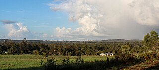
Booral is a coastal locality in the Fraser Coast Region, Queensland, Australia. In the 2021 census, Booral had a population of 1,636 people.

Torbanlea is a rural town and locality in the Fraser Coast Region, Queensland, Australia. In the 2021 census, the locality of Torbanlea had a population of 841 people.
Dundowran is a rural locality in the Fraser Coast Region, Queensland, Australia. In the 2021 census, Dundowran had a population of 1,085 people.
Nikenbah is a rural town and locality in the Fraser Coast Region, Queensland, Australia. In the 2021 census, the locality of Nikenbah had a population of 1,234 people.

Boonooroo is a coastal town and locality in the Fraser Coast Region, Queensland, Australia. In the 2021 census, the locality of Boonooroo had a population of 371 people.
Craignish is a coastal locality in the Fraser Coast Region, Queensland, Australia. In the 2021 census, Craignish had a population of 2,190 people.

Takura is a rural locality in the Fraser Coast Region, Queensland, Australia. In the 2021 census, Takura had a population of 553 people.

Toogoom is a coastal town and rural locality in the Fraser Coast Region, Queensland, Australia. At the 2021 census, Toogoom had a population of 2,596.

Walligan is a rural locality in the Fraser Coast Region, Queensland, Australia. In the 2021 census, Walligan had a population of 447 people.
Eli Waters is a coastal suburb of Hervey Bay in the Fraser Coast Region, Queensland, Australia. In the 2021 census, Eli Waters had a population of 3,758 people.
Dundowran Beach is a coastal suburb in the Fraser Coast Region, Queensland, Australia. In the 2021 census, Dundowran Beach had a population of 2,299 people.
Bidwill is a locality in the Fraser Coast Region, Queensland, Australia. In the 2021 census, Bidwill had a population of 517 people.
Susan River is a rural locality in the Fraser Coast Region, Queensland, Australia. In the 2021 census, Susan River had a population of 115 people.
Walliebum is a rural locality in the Fraser Coast Region, Queensland, Australia. In the 2021 census, Walliebum had "no people or a very low population".
Beelbi Creek is a rural locality in the Fraser Coast Region, Queensland, Australia. In the 2021 census, Beelbi Creek had a population of 143 people.
Burrum River is a rural locality in the Fraser Coast Region, Queensland, Australia. In the 2021 census, Burrum River had a population of 259 people.
Burrum Town is a rural locality in the Fraser Coast Region, Queensland, Australia. In the 2021 census, Burrum Town had a population of 197 people.
Dundathu is a rural locality in the Fraser Coast Region, Queensland, Australia. In the 2021 census, Dundathu had a population of 238 people.
