A request that this article title be changed to December 2023 Tennessee tornado outbreak is under discussion . Please do not move this article until the discussion is closed. |
This article may require copy editing for grammar, style, cohesion, tone, or spelling.(January 2024) |
Tornado outbreak | |
---|---|
Tornadoes | 18 |
Maximum rating | EF3 tornado |
Duration | December 9–10,2023 |
Highest winds | 150 mph (240 km/h) (Clarksville,Tennessee EF3 on December 9) |
Overall effects | |
Fatalities | 7 |
Injuries | 71 |
Areas affected | Southeastern United States |
Part of the tornado outbreaks of 2023 |
A significant,late-season severe weather and tornado outbreak affected portions of the Southern United States,primarily across the states of Tennessee,Kentucky,and Mississippi. [1] Tennessee was most affected by the outbreak,with multiple damaging tornadoes touching down,including a high-end EF1 tornado that damaged a National Guard Armory site near Dresden, [2] a long-tracked,intense EF3 tornado that caused heavy damage in northwestern portion of Clarksville, [3] and another strong,long-tracked high-end EF2 tornado that prompted a tornado emergency for the city of Hendersonville. [4]
The tornadoes resulted in a total of seven casualties and injured 71 others,including 61 from the Clarksville tornado alone. [5] [6] [7] [8] The tornado outbreak scored 15 points on the Outbreak Intensity Score,ranking it as a significant tornado outbreak. [9] This system also caused significant winter storm impacts to the Northeastern United States.
On December 5,the Storm Prediction Center issued a 5-day severe weather risk ahead of predictions that strong convective instability and wind shear would occur across portions of the Southern United States,from east Texas to western Mississippi. [10]
By December 7,a slight risk was posted in a large region from Louisiana to Kentucky. Uncertainties remained over the instability of airmass and the development of low-level flow conducive to tornado-inducing thunderstorms. [11] By the next day,the slight risk was maintained for the same general area,and a 5% risk corridor for tornadoes was introduced for all of the northern sections of the main risk area,extending from extreme eastern Texas,south and southeastern Arkansas,northern Mississippi,northwestern Alabama,western and central Tennessee,and southwestern Kentucky. [12] In this outlook,the SPC described the atmosphere and conditions as favorable for severe weather,as convective available potential energy (CAPE) values reached 500 J/kg in the main risk area,favorable low-level wind shear ahead of the expected upper-level trough,and moderate instability were all present to allow for sustained thunderstorm development. [12]
On December 9,the outlook was maintained at slight risk up until 1630 UTC. In this last outlook,the main 5% corridor was enlarged to include portions of extreme northwestern Georgia,most of northern Alabama,and central portions of Tennessee,all the way to the Knoxville vicinity. Elevated dew points reaching 60 °F were expected to be present ahead of the passing of an advancing cold front,which,in combination with the aforementioned factors,created a very favorable atmosphere for severe weather. However,uncertainties in the extent of the tornado threat were still sufficient to avoid a categorical upgrade. [13] The first area of concern that the SPC identified extended from southeastern Arkansas northeastward through portions of Mississippi,Alabama,and Tennessee into southwestern Kentucky. Within this area,tornadoes and large hail were expected to be the primary hazards with isolated supercells before the damaging wind potential increased as storm coverage increased. [14] The first of what would be eight tornado watches during this event was issued shortly before this outlook,mentioning a moderate (60%) chance for tornadoes,and a low (20%) probability for strong (EF2+) tornadoes. [15]
EFU | EF0 | EF1 | EF2 | EF3 | EF4 | EF5 | Total |
---|---|---|---|---|---|---|---|
0 | 4 | 9 | 4 | 1 | 0 | 0 | 18 |
EF# | Location | County / Parish | State | Start Coord. | Time (UTC) | Path length | Max width |
---|---|---|---|---|---|---|---|
EF1 | NNE of Yorkville to S of Sharon to SSE of Dresden | Gibson,Weakley | TN | 36°30′N87°44′W / 36.50°N 87.73°W | 17:32–18:03 | 25.27 mi (40.67 km) | 600 yd (550 m) |
This long-tracked tornado was the first one associated with the long-lived Clarksville supercell. The tornado touched down at mid-EF1 intensity as it began snapping hardwood trees. A home was heavily damaged near the beginning of the path, and its carport was demolished. Trees next to the home were snapped. As the tornado passed northwest of the town of Rutherford, it ripped the roof and some walls off two homes. After crossing US 45 to the north of Rutherford, an outbuilding was severely damaged, and several hardwood trees were snapped at high-end EF1 intensity. In this area, the tornado also caused damage to the Gibson County Rescue 9 fire station and flipped a semi-truck and a van. After continuing to the northeast, the tornado continued inflicting damage to multiple homes, tearing roofs and snapping hardwood trees for several miles. The tornado then entered the community of Kimery at low-to-mid EF1 intensity, damaging several structures. After exiting Kimery, the tornado passed south of Sharon, where it reached its peak intensity as it snapped several wooden utility poles and hardwood trees with winds estimated at 110 mph (180 km/h). As the tornado passed south of Dresden, it maintained EF1 intensity, and caused a stretch of concentrated damage along Summers Road. A double-wide mobile home was rolled off its foundation, injuring two people inside. Several homes and businesses were damaged before the tornado struck the National Guard Armory on SR 22, causing minor damage. The tornado dissipated soon after impacting the armory. In total, the tornado injured three people. [16] [17] | |||||||
EF1 | Indian Mound | Stewart, Montgomery | TN | 36°30′N87°44′W / 36.50°N 87.73°W | 19:20–19:30 | 7.31 mi (11.76 km) | 75 yd (69 m) |
This tornado, which was the second one associated with the long-lived Clarksville supercell, touched down just east of the Cumberland River at EF1 intensity, snapping several hardwood trees and causing minor damage to a home. The tornado began moving northeast towards the community of Indian Mound, snapping dozens of trees and uprooting several others. As the tornado entered Indian Mound, it caused damage to several structures, including a church overhang awning, greenhouses, barns, and outbuildings. On the northeastern side of Indian Mound, the tornado reached its peak intensity as it snapped several hardwood trees at high-end EF1 intensity with winds estimated at 110 mph (180 km/h). For several miles, the tornado crossed and/or parallel Gillum Hollow Road, where it struck dozens of structures and snapped or uprooted dozens of trees at EF1 intensity. The tornado lifted close to US 79. [16] | |||||||
EF3 | WNW of Clarksville, TN to Allensville, KY to SE of Auburn, KY | Montgomery (TN), Todd (KY), Logan (KY), Simpson (KY) | TN, KY | 36°34′N87°28′W / 36.57°N 87.47°W | 19:41–20:49 | 47.76 mi (76.86 km) | 600 yd (550 m) |
4 deaths – See section on this tornado – 61 people were injured. [16] | |||||||
EF1 | Southern Bowling Green | Warren | KY | 36°55′N86°27′W / 36.92°N 86.45°W | 21:07–21:13 | 2.24 mi (3.60 km) | 125 yd (114 m) |
This tornado destroyed a greenhouse, inflicted roof and siding damage to numerous homes, two metal warehouses, and a hotel, and snapped or uprooted trees. The last produced by the Clarksville supercell, the tornado maintained low-EF1 intensity though most of its track, causing damage to several structures, where winds were estimated to be 90 mph (140 km/h). The tornado tracked just south of the path of the deadly EF3 tornado nearly two years earlier. [16] | |||||||
EF2 | N of Cumberland Furnace | Dickson | TN | 36°17′N87°25′W / 36.28°N 87.41°W | 21:29–21:39 | 5.83 mi (9.38 km) | 300 yd (270 m) |
A strong tornado developed over a rural area, before eventually striking multiple residences, toppling exterior walls and demolishing a double-wide mobile home. Preliminary information. [16] [18] | |||||||
EF2 | N of White Bluff to WNW of Bordeaux | Dickson, Cheatham, Davidson | TN | 36°10′N87°13′W / 36.16°N 87.22°W | 22:03–22:27 | 18.77 mi (30.21 km) | 500 yd (460 m) |
This strong tornado, the first associated with the Hendersonville supercell, touched down in eastern Dickson County snapping and uprooting several trees and destroying an outbuilding. It quickly intensified to low-end EF2 strength, as it demolished a single story manufactured home. It then did minor damage to high-tension power lines and continued to snap large trees as it moved into Cheatham County. Uprooted trees and minor roof damage occurred in the Griffintown area of Cheatham County. Sporadic tree damage was noted as it moved into the Cheatham Wildlife Management Area. It strengthened once more, causing severe structure damage to homes along Dry Creek Road south of Ashland City. It then crossed into Davidson County, crossing the Cumberland River, where additional homes sustained damage before it dissipated. [16] | |||||||
EF2 | Southeastern Springfield | Robertson | TN | 36°29′N86°53′W / 36.48°N 86.88°W | 22:19–22:24 | 3.23 mi (5.20 km) | 300 yd (270 m) |
The tornado, which was produced by the same storm that spawned the Cumberland Furnace EF2 tornado, touched down next to the NorthCrest Medical Center and began moving to the northeast, where it caused minor damage to several homes. As the tornado crossed through this residential section, it snapped or uprooted several softwood trees. As the tornado crossed US 41, it quickly strengthened as it struck several businesses, causing low-end EF2 damage to five businesses and high-end EF1 damage to several others. A large Kroger store sustained mid-EF1 damage from the tornado, and 25 vehicles in the parking lot were flipped by the tornado, with some being thrown into a nearby ditch. The tornado reached its peak intensity after striking the Kroger as it impacted the Burley Stabilization Corporation (BSC) building, which was destroyed, with winds estimated at 120 mph (190 km/h). The National Weather Service noted the support columns holding the warehouse-like building up had grade 5 bolts anchoring them. The tornado also caused EF1 damage to nearby businesses and bent a metal utility pole. Just past the BSC building. The tornado significantly weakened as it entered a subdivision along Greystone Drive, where it caused only minor damage to a few homes. After impacting the subdivision, the tornado strengthened back to EF1 intensity as it struck a few homes and vehicles along Roy Pitt Road. The tornado dissipated near Oakland Road and SR 76. In total, the tornado injured four people. [16] [19] [20] | |||||||
EF2 | WSW of Madison to Hendersonville to NW of Hartsville | Davidson, Sumner, Trousdale | TN | 36°16′N86°47′W / 36.26°N 86.79°W | 22:39–23:31 | 35.27 mi (56.76 km) | 600 yd (550 m) |
3 deaths – See section on this tornado – 22 people were injured. | |||||||
EF1 | SSW of Hestand, KY | Clay (TN), Monroe (KY) | TN, KY | 36°37′N85°43′W / 36.62°N 85.72°W | 00:06–00:11 | 2.51 mi (4.04 km) | 50 yd (46 m) |
This brief tornado was the last one produced by the Hendersonville supercell. A home had its porch destroyed, numerous trees were blown down, and chicken barns were damaged. [16] | |||||||
EF0 | N of Braxton to S of Puckett | Simpson, Rankin | MS | 32°03′N89°59′W / 32.05°N 89.99°W | 03:18–03:35 | 13.96 mi (22.47 km) | 75 yd (69 m) |
This tornado, which closely straddled the Simpson-Rankin county line, damaged trees, one of which was toppled onto power lines. [16] | |||||||
EF0 | W of Raleigh | Smith | MS | 32°01′N89°37′W / 32.02°N 89.62°W | 03:45–03:48 | 3.71 mi (5.97 km) | 75 yd (69 m) |
This tornado developed soon after the previous one occluded, causing damage to trees and vegetation, one of which included a fallen tree, which fell onto a house. [16] | |||||||
EF1 | NNW of Montrose to Enterprise | Jasper, Clarke | MS | 32°13′N89°17′W / 32.21°N 89.28°W | 04:05–04:43 | 27.30 mi (43.94 km) | 30 yd (27 m) |
This small but long-lived tornado snapped and uprooted numerous trees in its path. The tornado then crossed into Clarke County, passing near Enterprise, where both trees and power lines were downed before it dissipated. The path was inaccessible at certain points due to the lack of roads. [16] |
EF# | Location | County / Parish | State | Start Coord. | Time (UTC) | Path length | Max width |
---|---|---|---|---|---|---|---|
EF1 | Homewood | Jefferson | AL | 33°26′N86°50′W / 33.44°N 86.84°W | 06:09–06:12 | 3.02 mi (4.86 km) | 600 yd (550 m) |
A tornado embedded within a larger area of straight-line wind damage heavily damaged a five-story office building, blowing out the windows, and heavily damaged a tire business. Two hotels, several stores, and a few apartment buildings sustained roof damage, a hotel sign was blown out, and a vehicle was flipped. Much of the path consisted of many snapped or uprooted trees falling on homes, vehicles, and power lines. The tornado dissipated near Samford University. [16] | |||||||
EF1 | Homewood to Mountain Brook | Jefferson | AL | 33°28′N86°47′W / 33.47°N 86.78°W | 06:13–06:15 | 1.78 mi (2.86 km) | 200 yd (180 m) |
A second tornado embedded within a larger area of straight-line wind damage developed just east of Samford University, and moved across US 31 and US 280 near Brookwood Village. Numerous trees were downed, with several falling on homes and power lines. [16] | |||||||
EF0 | NW of Clopton to SSW of Bakerhill | Barbour, Henry | AL | 31°37′N85°26′W / 31.62°N 85.44°W | 07:19–07:37 | 8.01 mi (12.89 km) | 200 yd (180 m) |
Sporadic tree damage was observed, and a chicken farm was damaged. [16] | |||||||
EF1 | N of Caryville | Holmes | FL | 30°48′N85°50′W / 30.80°N 85.83°W | 09:30–09:37 | 2.97 mi (4.78 km) | 250 yd (230 m) |
This tornado remained over rural areas, snapping numerous trees and tree branches along its path. [16] | |||||||
EF1 | Garner | Wake | NC | 35°41′N78°39′W / 35.69°N 78.65°W | 10:28–10:32 | 1.42 mi (2.29 km) | [ to be determined ] |
This high-end EF1 tornado snapped or uprooted dozens of trees, some of which damaged homes, and tossed lawn furniture. Preliminary information. [16] | |||||||
EF0 | S of Auburn | Lee | AL | 32°28′N85°26′W / 32.46°N 85.43°W | 10:36–10:39 | 2.43 mi (3.91 km) | 400 yd (370 m) |
This brief tornado caused roof damage to one home, and minor tree damage along its path. [16] |
Meteorological history | |
---|---|
Duration | 68 minutes |
Formed | December 9,1:41 p.m. CST (UTC−06:00) |
Dissipated | December 9,2:49 p.m. CST (UTC−06:00) |
EF3 tornado | |
on the Enhanced Fujita scale | |
Highest winds | 150 mph (240 km/h) |
Overall effects | |
Fatalities | 4 [21] [5] [8] |
Injuries | 61 [21] [22] |
This intense tornado touched down approximately 5 miles (8 km) south of Fort Campbell North,Kentucky in Montgomery County,Tennessee and moved northeast. [21] [16] [7] After initially causing minor EF0 tree damage,the tornado quickly intensified to high-end EF1 intensity,completely destroying the Clarksville School of Fine Arts,inflicting heavy roof damage to homes and a church,and snapping several large trees. For nine days,the National Weather Service did not release a specific rating for the school's damage but noted that the tornado “destroyed a building next to a church.”. [23] [24] [21] [16] On December 18,the National Weather Service surveyed and rated the damage to the school high-end EF1 with winds estimated at 110 miles per hour (180 km/h),however,the building was marked as a motel,rather than a school. [25]
Further rapid intensification occurred,and the tornado reached EF2 intensity as it passed just north of SR 374 and through multiple neighborhoods in the northwestern city limits of Clarksville. Numerous poorly anchored homes in this area were shifted off their foundations and leveled;many other homes had their roofs partially or completely removed;and hundreds of trees were snapped. A person who was injured when her mobile home was destroyed died from her injuries a week after the tornado struck the area. The tornado then further intensified to high-end EF2 intensity,crested a hill,and entered a heavily wooded area,where dozens of mobile and manufactured homes south of Britton Springs Road were completely obliterated with some being swept away with no debris left behind. [21] [16] The tornado killed three people here,including a ten-year-old boy. [21] [26] [27] Additional homes suffered partial to total roof removal,another poorly anchored home was shifted off its foundations and leveled,and hundreds of trees were snapped. [21] [16]
As it crossed US 41A in the community of Ringgold,the tornado briefly intensified to low-end EF3 strength with wind speeds up to 140 mph (230 km/h) and destroyed a strip mall with only interior walls left standing. [21] Vehicles in the strip mall parking lot were flipped over,several other businesses were also destroyed,a church lost its roof,and more trees were snapped. [16] [21] The tornado slightly weakened but remained strong at high-end EF2 intensity,flipping multiple 18-wheelers at a post office,inflicting significant roof and exterior wall damage to multiple well-built apartment townhouses,shifting and leveling more poorly anchored homes while inflicting severe roof and exterior damage to others,and snapping more trees. [21] [16] Continuing northeastward,the tornado crossed a wooded area surrounding Little West Fork Creek before strengthening to its peak intensity as it struck a subdivision just south of the West Creek High School. [21] [16] Four two-story brick and vinyl homes in this subdivision were completely leveled,with debris from the homes scattered 200 yards (180 m) towards the northeast. [21] [16] All homes received ratings of EF3,with winds estimated at 150 mph (240 km/h). [28]
The National Weather Service noted that at this time,the tornado was “very narrow and intense,”and they also noted that the homes were partially screwed and anchor bolted to the foundation,with mostly nails being used as the foundation anchoring. [16] Other two-story homes in the area had their roofs partially or completely removed,with exterior walls knocked down,including multiple homes that had their entire second floor removed. The nearby West Creek Elementary School sustained roof damage,and hundreds of trees were snapped as well. [21] The tornado then weakened slightly to low-end EF3 intensity as it crossed Peachers Mill Road,where it struck an apartment complex. [28] Two dozen brand new,two-story apartment buildings were severely damaged,with at least a dozen of them having their roofs entirely torn off. Winds in this area were estimated to be at140 mph (230 km/h). [21] [16] [28] As the tornado continued towards the Tennessee-Kentucky border,it caused severe EF2 roof damage to dozens of homes in neighborhoods along Needmore Road and SR 236,leaving behind cycloidal ground scouring in the fields between the two areas. The latter area also had several apartment or condo buildings sustaining high-end EF2 damage,along with at least two dozen steel electrical poles being bent. [21] [16] As the tornado crossed I-24 at the SR 48 exit,it uprooted numerous cedar trees and collapsed a portion of a warehouse. Northeast of the interstate,the tornado impacted several neighborhoods and subdivisions,producing widespread EF1 to EF2 damage to over 100 homes,many of which had roofs partially or totally removed along with some exterior wall collapse. Some additional tree damage also occurred before the tornado crossed into Kentucky [16] In all,the tornado struck at least 1,000 homes and dozens of businesses in the Clarksville,Tennessee,area. with at least 114 homes were destroyed,and 268 others sustained major damage. [21]
The tornado then moved northeastward into Todd County,Kentucky,where damage was mainly confined to hundreds of trees being snapped and uprooted while the tornado traveled through rural areas and over US 41 to the north of Guthrie at EF1 to EF2 intensity. [21] At least a dozen outbuildings were damaged or destroyed in the county,including a silo that was blown over and barns that were leveled,and homes suffered generally minor to moderate roof and garage door damage,although at least one home suffered severe roof and exterior damage. [21] Just before crossing into Logan County,the tornado crossed US 79 and moved through the southern part of Allensville at EF2 intensity. At least 51 structures were struck by the tornado,with several outbuildings being destroyed,homes suffering moderate roof damage with some partial removal noted,and dozens of trees being snapped. Debris from the structures was blown into farm fields as the tornado continued into Logan County. [29] [21] [16] The tornado weakened to EF1 after crossing into Logan County,damaging crops,trees,and outbuildings. It strengthened again to low-end EF2 intensity as it struck the community of Lickskillet,where every structure was damaged. A well-built two-story house in the town sustained extensive roof damage,had its foundation shifted,windows blown out,and three vehicles thrown and severely damaged. Two barns were also destroyed,with the impalement of barn boards into the home noted. [16] The tornado then weakened back to EF1 strength as it moved further northeast,but continued to inflict severe roof damage to homes,damage or destroy outbuildings,and snap or uproot trees for several more miles.
The tornado then struck the community of Williams Store along KY 96 at EF1 intensity,damaging multiple homes and outbuildings,including one home that had parts of its middle section blown out. [16] The tornado then continued moving northeastward at EF0-EF1 intensity,causing additional damage to homes and trees and damaging or destroying more outbuildings as it crossed US 431 and KY 100 south of Russellville. It then continued south of Auburn,where an outbuilding had its roof collapsed,and additional outbuilding,residence,and tree damage was noted. The tornado crossed into Simpson County,where it damaged the siding from an outbuilding roof before finally dissipating. [16]
In total,the tornado killed four people and injured 61 others along its path of 47.76 miles (76.86 km) while reaching a maximum width of 600 yards (550 m). [7] [30] The fourth victim passed away a week later due to complications from their injuries. [8] 114 homes were destroyed while another 857 were damaged, [21] [31] and at least 20,000 people were without power after the tornado in Clarksville alone. [32] The tornado also caused $45,000 in uninsured damage to the Clarksville School of Fine Arts. [33] Originally,the school was set to have a Christmas play on December 9 at 1 p.m. However,to accommodate a student leaving the country,the play was moved up to December 2,which had 300 in attendance. The director of the school later stated,“If we would have had 300 people in the building on the ninth instead of the second,we would be talking about the destruction of possibly hundreds of lives because there's nothing left of the theater.” [33]
Meteorological history | |
---|---|
Duration | 52 minutes |
Formed | December 9,2023,4:39 p.m. CST (UTC−06:00) |
Dissipated | December 9,2023,5:31 p.m. CST (UTC−06:00) |
EF2 tornado | |
on the Enhanced Fujita scale | |
Highest winds | 130 mph (210 km/h) |
Overall effects | |
Fatalities | 3 [21] [5] |
Injuries | 22 [21] [22] |
This strong tornado was first observed by numerous storm spotters and residents at 4:39 p.m. CST (21:39 UTC) before tracking through areas of the Nashville metropolitan area. [5] [34] [35] The tornado initially touched down near Trail Hollow Lane,just to the east of I-24,and began tracking east-northeast,causing minor EF0 damage to trees and residences. [16] The tornado then quickly intensified,reaching high-end EF1 intensity as it approached and crossed US 31W/US 41. Multiple outbuildings and warehouses were heavily damaged or destroyed,a motel suffered severe damage,and multiple trees were snapped. Further to the northeast,additional damage occurred to the residences,trees,and power lines as the tornado crossed Old Hickory Boulevard (SR 45),and I-65. Significant intensification occurred as the tornado entered the north side of Madison,where dozens of trees and power poles were snapped or uprooted,and numerous buildings,including businesses,warehouses,churches,and residences were significantly damaged or destroyed at EF2 intensity. All three fatalities occurred in this area along Nesbitt Lane,where multiple mobile homes were destroyed.
Right before crossing US 31E,the tornado impacted an electrical substation,triggering multiple large power flashes before causing a large explosion when it impacted an oil reservoir. The explosion,as well as direct heat from substation,caused a drop in relative humidity inside the tornado's condensation funnel,which,in turn,significantly reduced the tornado's visibility. The explosion was seen and captured by numerous residents inside the Nashville metro;it was also streamed live by a public live camera in Hendersonville. [36] [37] This was the first time a tornado had directly struck a Nashville Electric Service power substation since the 1974 Super Outbreak. [38]
The tornado continued past the substation and crossed US 31E while maintaining EF2 intensity,heavily damaging or destroying homes and warehouses,and snapping or uprooting trees and power poles. The tornado continued northeastward and reached its peak intensity of a high-end EF2 as it moved along and over the Cumberland River and Old Hickory Lake into the western part of Hendersonville in Sumner County. Hundreds of trees were blown down at the Old Hickory Dam,multiple buildings and warehouses at the dam site and a nearby marina were heavily damaged or destroyed;and a 75 ft (23 m) microwave tower was crumpled to the ground. The tornado then weakened to high-end EF1 intensity as it approached and moved through the center of Hendersonville along US 31E.
Heavy damage occurred throughout the area,with multiple businesses at a strip mall reporting heavy roof damage with exterior wall collapses,several warehouses,other businesses,and outbuildings being heavily damaged or collapsed,homes suffering severe roof,siding,and exterior wall damage,and dozens of trees and power poles being snapped or uprooted. One two-story home in the area also had its entire roof removed,causing severe damage to the second floor's exterior walls. Past Hendersonville,the tornado caused more sporadic damage,mainly in the form of fallen trees and snapped power poles. Some homes and businesses suffered roof and siding damage,and a barn was heavily damaged with debris from the structure damaging a home. Two homes near the SR 386/US 31E interchange suffered heavy roof damage,with one of them also having its garage cave in. As the tornado approached Station Camp Creek,more homes,apartments,and condos were damaged,including another two-story home that had the second floor roof removed,a gas station canopy was blown over,and more trees were snapped. [16]
After crossing the creek,the tornado intensified as it moved into neighborhoods to the southwest of Gallatin from the southwest. Multiple well-built homes in the area suffered partial to complete roof removal;other homes suffered minor to moderate roof damage;trees were snapped (including at least one that fell on a home);and a metal truss tower was collapsed. Damage in this area was rated high-end EF1 to EF2. The tornado weakened to EF1 intensity again,but continued to cause heavy damage to homes as it moved through the southern part of Gallatin and crossed SR 109.
Several homes had their roofs partially or totally removed,and many trees and power poles were knocked down. Warehouses at the nearby Music City Executive Airport were also heavily damaged,and more homes northeast of there had varying degrees of roof damage,with another home having its roof removed,along with more down trees. The tornado then passed just south of Cairo,heavily damaging an old barn country store along SR 25,knocking down trees,and inflicting minor damage to outbuildings. It passed north of Castalian Springs. It then continued into Trousdale County,inflicting one last area of EF1 damage to trees near Templow before it dissipated northwest of Hartsville. [16]
The tornado killed three people and injured another three along its 35.27 miles (56.76 km) path that reached a peak width of 600 yards (550 m). The substation in Madison supplied 161,000 volts to a DuPont Plant in Old Hickory, [39] [40] while the one in Hendersonville served power to customers,though it was in need of repairs. [41] [42]
A winter storm in relation to the system closed I-29 from Fargo,North Dakota to the Canadian border from Manitoba. [43]
Strong storms affected the Northeastern United States on December 10–11. The heaviest rain in the New York metropolitan area was on Long Island,where over 4 in (100 mm) of rain fell in certain areas. High winds were also reported,with gusts reaching 48 mph (77 km/h) in Kew Gardens and 46 mph (74 km/h) in Orient. Light backend snow was observed in Sullivan County. [44] Nearby,the highest snowfall of 13.7 in (35 cm) was in Roxbury,New York. [45] The storm resulted in ground delay programs at LaGuardia Airport and John F. Kennedy International Airport. [46] Parts of Connecticut saw rainfall exceed 5 in (130 mm). [47]
On December 10,daily rainfall records were set in Philadelphia,Atlantic City and Wilmington. [48] The storm resulted in a brief stretch of I-76 shutting down in Montgomery County following a downed tree and a 3-way car crash. [49] Further south,light snow at Dulles International Airport accumulated 0.4 in (1.0 cm),but that was more snow then what fell during the entirety of the previous winter. 0.1 in (0.25 cm) of snow was recorded at Ronald Reagan Washington National Airport. [50] Richmond,Virginia received their first measurable snow since March 12,2022. [51]
This section needs expansion. You can help by adding to it. (December 2023) |
Singer-songwriter Taylor Swift donated $1 million dollars to the Tennessee Emergency Response Fund at the Community Foundation of Middle Tennessee in support of tornado victims. [52]
On March 2 and 3, 2012, a deadly tornado outbreak occurred over a large section of the Southern United States into the Ohio Valley region. The storms resulted in 41 tornado-related fatalities, 22 of which occurred in Kentucky. Tornado-related deaths also occurred in Alabama, Indiana, and Ohio. The outbreak was the second deadliest in early March for the U.S. since official records began in 1950; only the 1966 Candlestick Park tornado had a higher death toll for a tornadic system in early March.
This page documents notable tornadoes and tornado outbreaks worldwide in 2015. Strong and destructive tornadoes form most frequently in the United States, Bangladesh, Brazil and Eastern India, but they can occur almost anywhere under the right conditions. Tornadoes also develop occasionally in southern Canada during the Northern Hemisphere's summer and somewhat regularly at other times of the year across Europe, Asia, and Australia. Tornadic events are often accompanied with other forms of severe weather including strong thunderstorms, winds and hail.
On December 23, 2015, an outbreak of supercell thunderstorms produced tornadoes across northern Mississippi and middle Tennessee, resulting in 13 tornado-related deaths and numerous injuries. Other tornadoes occurred as far north as Indiana and Michigan. Scattered tornado activity continued over the next two days before the outbreak ended. This was the first of two deadly tornado outbreaks to impact the southern United States during December 2015 with the other occurring just a day after this one ended.
This page documents notable tornadoes and tornado outbreaks worldwide in 2016. Strong and destructive tornadoes form most frequently in the United States, Bangladesh, Brazil and Eastern India, but they can occur almost anywhere under the right conditions. Tornadoes also develop occasionally in southern Canada during the Northern Hemisphere's summer and somewhat regularly at other times of the year across Europe, Asia, and Australia. Tornadic events are often accompanied with other forms of severe weather, including strong thunderstorms, strong winds, and hail.
This page documents notable tornadoes and tornado outbreaks worldwide in 2017. Strong and destructive tornadoes form most frequently in the United States, Brazil, Bangladesh, and Eastern India, but they can occur almost anywhere under the right conditions. Tornadoes also develop occasionally in southern Canada during the Northern Hemisphere's summer and somewhat regularly at other times of the year across Europe, Asia, Argentina and Australia. Tornadic events are often accompanied with other forms of severe weather, including strong thunderstorms, strong winds, and hail.
The tornado outbreak of February 28 – March 1, 2017 was a widespread and significant outbreak of tornadoes and severe weather that affected the Midwestern United States at the end of February 2017 and beginning of March. Fueled by the combination of ample instability, strong wind shear, and rich low-level moisture, the event led to 71 confirmed tornadoes and thousands of other non-tornadic severe weather reports. The most notable aspect of the outbreak was a long-tracked EF4 tornado—the first violent tornado of 2017 and the first violent tornado during the month of February since the 2013 Hattiesburg, Mississippi tornado—that tracked from Perryville, Missouri to near Christopher, Illinois, killing one person. Three EF3 tornadoes were recorded during the event, including one that caused two fatalities in Ottawa, Illinois, one that caused a fatality near Crossville, and one that heavily damaged or destroyed homes in and around Washburn. In addition to the deaths, 38 people were injured by tornadoes and an additional 30 were injured by non-tornadic impacts, mainly by fallen trees.
This page documents notable tornadoes and tornado outbreaks worldwide in 2019. Strong and destructive tornadoes form most frequently in the United States, Argentina, Brazil, Bangladesh, and Eastern India, but can occur almost anywhere under the right conditions. Tornadoes also develop occasionally in southern Canada during the Northern Hemisphere's summer and somewhat regularly at other times of the year across Europe, Asia, Argentina, and Australia. Tornadic events are often accompanied by other forms of severe weather, including strong thunderstorms, strong winds, and hail.
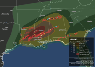
A significant severe weather and tornado outbreak affected the Southern United States between December 16–17, 2019. Discrete supercells developed in the early morning on December 16 and moved northeast, spawning multiple strong, long-tracked tornadoes in cities such as Alexandria and in Laurel before congealing into an eastward-moving squall line. During the outbreak, the National Weather Service issued several PDS tornado warnings as well as a rare tornado emergency for Alexandria. In addition to this, the Storm Prediction Center issued six tornado watches for the outbreak. The event happened to take place on the same date of another outbreak in a similar area 19 years earlier.
This page documents notable tornadoes and tornado outbreaks worldwide in 2020. Strong and destructive tornadoes form most frequently in the United States, Argentina, Brazil, Bangladesh, and eastern India, but can occur almost anywhere under the right conditions. Tornadoes also develop occasionally in southern Canada during the Northern Hemisphere's summer and somewhat regularly at other times of the year across Europe, Asia, Argentina, Australia and New Zealand. Tornadic events are often accompanied by other forms of severe weather, including strong thunderstorms, strong winds, and hail.
A small but deadly tornado outbreak affected West and Middle Tennessee on the night of March 2 and into the morning of March 3, 2020, including a high-end EF3 tornado that hit Nashville and Mount Juliet, becoming the 6th costliest tornado in United States history, and a violent EF4 tornado that impacted areas in and just west of Cookeville. A total of 25 people were killed by the tornadoes, with an additional 309 being injured, and more than 70,000 lost electricity. The path of the Nashville tornado was very similar to the one that hit East Nashville in 1998. A few additional tornadoes were also confirmed in Alabama, southeastern Missouri, and western Kentucky. Total damage from the event reached $1.607 billion according to the National Centers for Environmental Information.
A widespread and deadly tornado outbreak affected the Southeastern United States on Easter Sunday and Monday, April 12–13, 2020. Several tornadoes were responsible for prompting tornado emergencies, including the first one to be issued by the National Weather Service in Charleston, South Carolina. A large squall line formed and tracked through the mid-Atlantic on April 13, prompting more tornado warnings and watches. A total of 15 watches were produced during the course of the event, two of which were designated Particularly Dangerous Situations.
This page documents notable tornadoes and tornado outbreaks worldwide in 2021. Strong and destructive tornadoes form most frequently in the United States, Argentina, Brazil, Bangladesh, and Eastern India, but can occur almost anywhere under the right conditions. Tornadoes also develop occasionally in southern Canada during the Northern Hemisphere's summer and somewhat regularly at other times of the year across Europe, Asia, Argentina, Australia and New Zealand. Tornadic events are often accompanied by other forms of severe weather, including strong thunderstorms, strong winds, and hail.
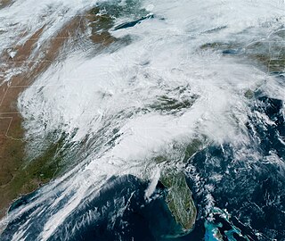
A significant tornado outbreak sequence took place from March 24–28, 2021 in the Southern United States just one week after another outbreak affected similar regions. There were 43 tornadoes confirmed across 11 states, with the bulk of activity primarily on March 25, which resulted in the Storm Prediction Center (SPC) issuing its second high-risk outlook for the month of March, as well as the second high-risk outlook for 2021. Several intense tornadoes touched down on that day, including ones that prompted the issuance of rare tornado emergencies near Hoover, Alabama, Brent and Centreville, Alabama, and in the Newnan, Georgia area. March 27 also saw widespread tornado activity mainly across East Texas, Southern Arkansas, Louisiana, and Western Tennessee with several strong tornadoes touching down. Scattered to widespread wind and hail damage occurred throughout the outbreak sequence, and repeated rounds of heavy rain caused widespread severe flash and river flooding across much of Tennessee.
A deadly late-season tornado outbreak, the deadliest on record in December, produced catastrophic damage and numerous fatalities across portions of the Southern United States and Ohio Valley from the evening of December 10 to the early morning of December 11, 2021. The event developed as a trough progressed eastward across the United States, interacting with an unseasonably moist and unstable environment across the Mississippi Valley. Tornado activity began in northeastern Arkansas, before progressing into Missouri, Illinois, Tennessee, and Kentucky.
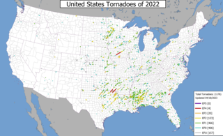
This page documents notable tornadoes and tornado outbreaks worldwide in 2022. Strong and destructive tornadoes form most frequently in the United States, Argentina, Brazil, Bangladesh, and Eastern India, but can occur almost anywhere under the right conditions. Tornadoes also develop occasionally in southern Canada during the Northern Hemisphere's summer and somewhat regularly at other times of the year across Europe, Asia, Argentina, Australia and New Zealand. Tornadic events are often accompanied by other forms of severe weather, including strong thunderstorms, strong winds, and hail.
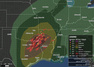
A significant late-season tornado outbreak took place on November 4, 2022, across Northeast Texas, southwestern Arkansas, southeastern Oklahoma, and northwestern Louisiana with multiple large, destructive tornadoes occurring over a span of several hours. Major damage was reported in Sulphur Springs, Powderly, Caviness, Paris, Cason, Daingerfield, Athens, New Boston, Texas, and Idabel, Oklahoma, with the latter two communities being placed under tornado emergencies. Two fatalities occurred in Cason, Texas, and Pickens, Oklahoma respectively. Numerous PDS tornado warnings were issued as well. An additional tornado embedded within a narrow, but intense line of showers with damaging winds was also confirmed in Illinois the following morning as the system progressed eastward. Strong winds affected most of the western Great Lakes throughout the day before moving into Canada that evening. Two fatalities and at least 34 injuries were confirmed from tornadoes, and an additional fatality occurred near Stilwell, Oklahoma from drowning.
This page documents notable tornadoes and tornado outbreaks worldwide in 2023. Strong and destructive tornadoes form most frequently in the United States, Argentina, Brazil, Bangladesh, and Eastern India, but can occur almost anywhere under the right conditions. Tornadoes also develop occasionally in southern Canada during the Northern Hemisphere's summer and somewhat regularly at other times of the year across Europe, Asia, Argentina, Australia and New Zealand. Tornadic events are often accompanied by other forms of severe weather, including thunderstorms, strong winds, and hail.
An early-season tornado outbreak impacted the Southeastern United States on January 12, 2023. The result of a mid-level trough moving through, moisture and the presence of a strong low-level jet aided in the development of numerous severe and tornadic thunderstorms. Early in the outbreak, a strong EF2 tornado caused considerable damage in Winston County, Alabama, while another EF2 tornado struck just south of Greensboro. A destructive high-end EF2 tornado struck Selma, causing widespread damage and two injuries. The same storm produced a long-lived EF3 tornado that moved through or near Old Kingston, Titus, Equality, and Lake Martin, resulting in seven fatalities and several injuries in Autauga County alone. Another EF2 tornado from the storm struck areas in or around Five Points and Standing Rock before crossing into Georgia. After the dissipation of that tornado, nine more tornadoes, five of which were strong, caused heavy damage across west-central Georgia, especially in LaGrange, Griffin, and Experiment, the second one of which was impacted by four tornadoes in the span of 10 minutes, including two that were rated EF2 and EF3 respectively. Another EF2 tornado from the storm caused major damage and another fatality in the Jackson Lake area as well; an indirect death from the tornado also occurred the following day. Elsewhere, other tornadoes caused damage in Sumter and Mobile counties in Alabama, as well as parts of Mississippi, Tennessee, Kentucky, Illinois, and the Carolinas. In all, 41 tornadoes were confirmed.
On March 24, 2023, a severe weather and tornado outbreak began across portions of the lower Mississippi River Valley in the United States. A slow-moving trough moved eastward across the United States and interacted with a moist and unstable airmass originating from the Gulf of Mexico, resulting in widespread heavy rainfall, severe thunderstorms, and significant tornadoes over a four-day period. A violent high-end EF4 tornado moved through the towns of Rolling Fork, Midnight, and Silver City in western Mississippi, causing catastrophic damage and many fatalities. Multiple tornado emergencies were issued for that tornado and two subsequent EF3 tornadoes from the same supercell that struck Winona and Amory.
A widespread, deadly, and historic tornado outbreak affected large portions of the Midwestern, Southern and Eastern United States on the last day of March and the first of April, the result of an extratropical cyclone that also produced blizzard conditions in the Upper Midwest. The Storm Prediction Center (SPC) issued a rare high risk for severe weather in two areas of the Mississippi Valley on March 31, the first high risk issuance since March 25, 2021. Approximately 28 million people were placed under tornado watches, including multiple PDS tornado watches, from the evening of March 31 through the overnight hours into the morning of April 1. This included the Little Rock, St. Louis, Chicago, and Memphis metropolitan areas, all of which were hit by multiple rounds of severe squall lines and supercell thunderstorms that produced damaging winds, large hail, and tornadoes. EF3 tornadoes in Arkansas, Tennessee, and Illinois prompted the issuance of tornado emergencies and multiple mass casualty incidents were declared for some of the hardest hit areas. One of these tornadoes was a high-end EF3 tornado that passed through the northern Little Rock metro, causing extensive damage and dozens of injuries. The strongest tornado was a low-end EF4 tornado that swept away homes on the west side of Keota, Iowa. Severe and tornadic weather also affected the Northeastern United States in the afternoon and evening of April 1, including a rare EF3 tornado that caused a death in Sussex County, Delaware. At certain points of the outbreak, over 20 simultaneous tornado warnings were active, with a total of 175 tornado warnings issued on March 31 with an additional 51 issued on April 1.
{{cite web}}
: CS1 maint: multiple names: authors list (link){{cite web}}
: CS1 maint: multiple names: authors list (link)The tornado that hit Clarksville, Tennessee, on Saturday, killing three people and injuring 62, was an EF3, with peak winds of 150 mph (241 kph), the weather service office in Nashville announced. It was on the ground for more than an hour, traveling 43 miles (69 kilometers) across Montgomery County, Tennessee, and Todd and Logan counties in Kentucky. At its widest point the tornado's path was 600 yards (549 meters).