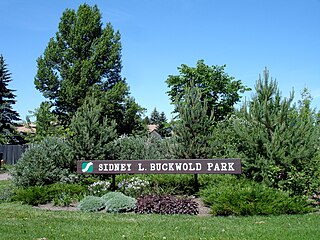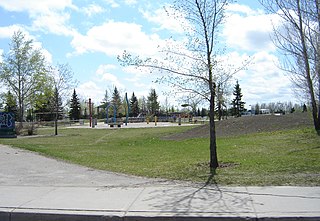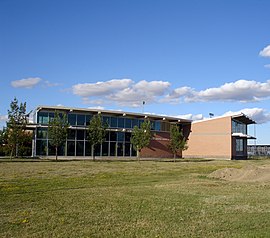
Saskatoon Chief Mistawasis is a provincial electoral district for the Legislative Assembly of Saskatchewan, Canada. It covers the neighbourhoods of Lawson Heights, Silverwood Heights and the surrounding area. This constituency includes the Saskatoon Provincial Correctional Centre and the SaskTel Centre.

Sutherland is a mostly residential neighbourhood located in east-central Saskatoon, Saskatchewan, Canada. It is an older suburban subdivision, composed of a near-even mix of single-family detached houses and multiple-unit apartment and semi-detached dwellings. As of 2006, the area was home to 5,206 residents. The neighbourhood is a middle-income area, with an average family income of $51,857, an average dwelling value of $204,213 and a home ownership rate of 43.8%. According to MLS data, the average sale price of a home as of 2013 was $288,651. Sutherland was administered as a separate town outside of Saskatoon before being annexed by the city in 1956.
Lawson Suburban Development Area (SDA) is an area in Saskatoon, Saskatchewan (Canada). It is a part of the west side community of Saskatoon. It lies (generally) south of the outskirts of the North West Industrial SDA, west of the South Saskatchewan River and the University Heights SDA, north of the Core Neighbourhoods SDA, and east of the North West Industrial SDA.

University Heights Suburban Development Area (SDA) is an area in Saskatoon, Saskatchewan (Canada). It is a part of the east side community of Saskatoon. It lies (generally) south of the outskirts of the City and the Rural Municipality of Corman Park No. 344, east of the South Saskatchewan River, and Lawson SDA, north of the Lakewood SDA, and Nutana SDA.

Nutana Suburban Centre is a mixed-development neighbourhood located in south-central Saskatoon, Saskatchewan, Canada. It is a classified as a "suburban centre" subdivision, composed of medium to high-density multiple-unit dwellings, commercial areas and civic facilities. As of 2009, the area is home to 2,962 residents. Housing in the neighbourhood consists of high-density apartment-style dwellings and row houses. The neighbourhood is considered a lower-income area, with an average family income of $34,474, an average dwelling value of $266,311 and a home ownership rate of 29.3%. The low average income but comparatively high dwelling value is due to the number of senior citizens residing in the neighbourhood. The age distribution of Nutana SC's population is skewed very highly toward residents age 65 and older.

Silverspring is a residential neighbourhood located in northeast Saskatoon, Saskatchewan, Canada. It is a suburban subdivision, composed mostly of low-density, single detached houses. As of 2007, the area is home to 4,936 residents. The neighbourhood is considered a high income area, with an average family income of $85,084, an average dwelling value of $322,670 and a home ownership rate of 97.8%. According to MLS data, the average sale price of a home as of 2013 was $407,171.

College Park is a primarily residential neighbourhood located in the east-central part of Saskatoon, Saskatchewan, Canada. The majority of its residents live in single-family detached dwellings, with a sizable minority of high-density, multiple-unit dwellings. As of 2011, the area is home to 5,470 residents. The neighbourhood is considered a middle-income area, with an average family income of $65,133, an average dwelling value of $232,228 and a home ownership rate of 58.9%.

Lawson Heights is a residential neighbourhood located in northern Saskatoon, Saskatchewan, which was developed beginning in the late 1970s.

College Park East is a primarily residential neighbourhood located in the east-central part of Saskatoon, Saskatchewan, Canada. The majority of its residents live in single-family detached dwellings, with a sizeable minority of high-density, multiple-unit dwellings. As of 2021, the area is home to 4,747 residents with an average household size of 2.5 people. The neighbourhood is considered a middle-income area, with a median personal income of $40,340, a home ownership rate of 77.0%, and an average single family dwelling value of $324,875.

Lawson Heights Suburban Centre is a neighbourhood that is maturing, and is located in north west Saskatoon. The neighbourhood features high density residential areas, major commercial suburban development area centre, transit mall, large green space parks which are slated for upgrade, and secondary institution. It is situated just east of the North West Industrial SDA and near the South Saskatchewan River Lawson Heights Suburban Centre combines a proximity to amenities offered by a comprehensive industrial development and the scenic river and river bank park system.

Lakewood Suburban Centre is a mixed-development neighbourhood located in southeast Saskatoon, Saskatchewan, Canada. It is a classified as a "suburban centre" subdivision, composed of mostly medium to high-density multiple-unit dwellings, commercial areas and civic facilities. As of 2011, the area is home to 1,850 residents. The neighbourhood is considered a middle-income area, with an average family income of $65,927, an average dwelling value of $227,522 and a home ownership rate of 76.8%.

Briarwood is a residential neighbourhood located in the southeast part of Saskatoon, Saskatchewan, Canada. The majority of its residents live in low-density, single detached dwellings. As of 2009, the area is home to 4,473 residents. The neighbourhood is considered a very high-income area, with an average family income of $117,619, an average dwelling value of $449,158 and a home ownership rate of 97.0%.

Erindale is a primarily residential neighbourhood located in northeast Saskatoon, Saskatchewan, Canada. It is mostly made up of low-density single detached dwellings. As of 2011, the area is home to 4,338 residents. The neighbourhood is considered a high-income area, with an average family income of $123,336, an average dwelling value of $340,990 and a home ownership rate of 95.3%.
Pacific Heights is geographically located in north west Saskatoon. The main construction boom for this community was the 1970s, during which the City of Saskatoon annexed the land. Following elementary school, students usually attend Tommy Douglas Collegiate or Bethlehem Catholic High School on Bowlt Crescent a part of Blairmore SDA community. According to MLS data, the average sale price of a home as of 2013 was $279,500.

Forest Grove is a primarily residential neighbourhood located in northeast Saskatoon, Saskatchewan, Canada. It is mostly made up of low-density single detached dwellings, with a sizeable minority of multiple-unit apartment dwellings. As of 2011, the area is home to 5,907 residents. The neighbourhood is considered a middle-income area, with an average family income of $70,487, an average dwelling value of $246,680 and a home ownership rate of 62.4%.

Willowgrove is a primarily residential neighbourhood located in the east side of Saskatoon, Saskatchewan, Canada. It comprises a mix of mainly single-family detached houses and fewer multiple-unit dwellings. As of 2011, the area is home to 3,973 residents. The neighbourhood is considered a middle to high-income area, with an average family income of $96,002, an average dwelling value of $218,357 and a home ownership rate of 84.8%.

Sutherland Industrial is an industrial subdivision located in east-central Saskatoon, Saskatchewan, Canada. It was originally part of Sutherland, a town outside of Saskatoon before being annexed by the city in 1956. The subdivision also contains the first urban reserve in Saskatchewan, the Muskeg Lake Cree Nation.

Evergreen is a residential neighbourhood under construction within the University Heights Suburban Development Area of Saskatoon, Saskatchewan. The residential area is constructed around the village centre and a larger district village. The subdivision was created in 2010. Evergreen is projected to have a density of 8.6 units per acre, becoming one of the densest neighbourhoods in Saskatoon when complete.

Aspen Ridge is a neighbourhood located in northeast Saskatoon, Saskatchewan, Canada, construction on which began in 2014. At full build-out, Aspen Ridge will eventually house an estimated 13,000 people. Unlike many of the city's suburban neighbourhoods, it will feature higher density housing on a grid network of roads.


