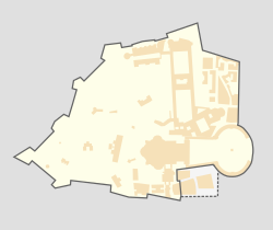
The Gallery of Maps[1] (Italian: Galleria delle carte geografiche) is a gallery located on the west side of the Belvedere Courtyard in the Vatican containing a series of painted topographical maps of Italy based on drawings by friar and geographer Ignazio Danti.[1]
The gallery was commissioned in 1580 by Pope Gregory XIII as part of other artistic works commissioned by the Pope to decorate the Vatican. It took Danti three years (1580–1583) to complete the 40 panels of the 120m long gallery. The painter was Antonio Danti, brother of Ignazio.
The panels map the entirety of the Italian peninsula in large-scale frescoes, each depicting a region as well as a perspective view of its most prominent city. It is said that these maps are approximately 80% accurate.
With the Apennines as a partition, one side depicts the regions surrounded by the Ligurian and Tyrrhenian Seas and the other depicts the regions surrounded by the Adriatic Sea.
Regional maps
If noted the map shows the Italian geographic region and not the current Italian state. Below is a list of the maps in the gallery.[2]
Ager anconitanus, that is, the territory of Ancona, with the map of Loreto (the representation of Ancona appears among the views of the main port cities of the 16th century),
Picenum, that is, the Marches south of Fano, with a representation of the city of Macerata,
Forum Iulii, that is, the Venetian coast, Friuli, Venezia Giulia, and part of Trentino-Alto Adige (the representation of Venice is among the views of the main port cities of the 16th century);
Transpadana Venetorum ditio, that is, western Veneto, with maps of Vicenza and Padua;
Perspective views of major 16th-century Italian ports are grouped at one end of the gallery. They possess significant artistic value and even offer glimpses into the lives of these cities during the Renaissance.[2]
↑McKelway, Matthew (2006). "The Azuchi Screens and Images of Castles". Capitalscapes Folding Screens and Political Imagination in Late Medieval Kyoto. University of Hawaii Press. p.296. ISBN978-0824861773.
This page is based on this Wikipedia article Text is available under the CC BY-SA 4.0 license; additional terms may apply. Images, videos and audio are available under their respective licenses.