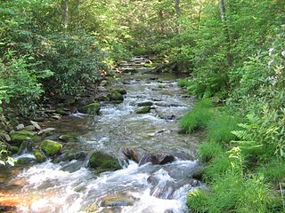
The Yukon River is a major watercourse of northwestern North America. The river's source is in British Columbia, Canada, from which it flows through the Canadian Yukon Territory. The lower half of the river lies in the U.S. state of Alaska. The river is 3,190 kilometres (1,980 mi) long and empties into the Bering Sea at the Yukon–Kuskokwim Delta. The average flow is 6,430 m3/s (227,000 ft3/s). The total drainage area is 832,700 km2 (321,500 mi2), of which 323,800 km2 (126,300 mi2) is in Canada. The total area is more than 25% larger than Texas or Alberta.

The Muscogee, also known as the Mvskoke, Creek and the Muscogee Creek Confederacy, are a related group of indigenous peoples of the Southeastern Woodlands. Mvskoke is their autonym. Their original homelands are in what now comprises southern Tennessee, all of Alabama, western Georgia and part of northern Florida.

The Chattahoochee River forms the southern half of the Alabama and Georgia border, as well as a portion of the Florida - Georgia border. It is a tributary of the Apalachicola River, a relatively short river formed by the confluence of the Chattahoochee and Flint rivers and emptying from Florida into Apalachicola Bay in the Gulf of Mexico. The Chattahoochee River is about 430 miles (690 km) long. The Chattahoochee, Flint, and Apalachicola rivers together make up the Apalachicola–Chattahoochee–Flint River Basin. The Chattahoochee makes up the largest part of the ACF's drainage basin.

The Creek War (1813–1814), also known as the Red Stick War and the Creek Civil War, was a regional war between opposing Creek factions, European empires and the United States, taking place largely in today's Alabama and along the Gulf Coast. The major conflicts of the war took place between state militia units and the "Red Stick" Creeks.

James Springer White, also known as Elder White, was a co-founder of the Seventh-day Adventist Church and husband of Ellen G. White. In 1849 he started the first Sabbatarian Adventist periodical entitled "The Present Truth", in 1855 he relocated the fledgling center of the movement to Battle Creek, Michigan, and in 1863 played a pivotal role in the formal organization of the denomination. He later played a major role in the development of the Adventist educational structure beginning in 1874 with the formation of Battle Creek College.
Mill Creek Hundred is an unincorporated subdivision of New Castle County, Delaware. Hundreds were once used as a basis for representation in the Delaware General Assembly, and while their names still appear on all real estate transactions, they presently have no meaningful use or purpose except as a geographical point of reference.
White Clay Creek Hundred is an unincorporated subdivision of New Castle County, Delaware. Hundreds were once used as a basis for representation in the Delaware General Assembly, and while their names still appear on all real estate transactions, they presently have no meaningful use or purpose except as a geographical point of reference.

White Deer Hole Creek is a 20.5-mile (33.0 km) tributary of the West Branch Susquehanna River in Clinton, Lycoming and Union counties in the U.S. state of Pennsylvania. A part of the Chesapeake Bay drainage basin, the White Deer Hole Creek watershed drains parts of ten townships. The creek flows east in a valley of the Ridge-and-valley Appalachians, through sandstone, limestone, and shale from the Ordovician, Silurian, and Devonian periods.

White Deer Creek is a tributary of the West Branch Susquehanna River in Centre County and Union County, in Pennsylvania, in the United States. It is approximately 28 miles (45 km) long and flows through Miles Township in Centre County and Hartley Township, Lewis Township, West Buffalo Township, and White Deer Township in Union County. The watershed of the creek has an area of 45.1 square miles (117 km2). Parts of the creek are designated as impaired. The creek's discharge near White Deer can be as low as 3 cubic feet per second (0.085 m3/s) or as high as 169 cubic feet per second (4.8 m3/s).

White Clay Creek Preserve is a 1,255-acre (508 ha) Pennsylvania state park along the valley of White Clay Creek in London Britain Township in Chester County, Pennsylvania in the United States. The park was donated by the DuPont Company in 1984 for the purpose of "preserving the diverse and unique plant and animal species, and the rich cultural heritage of the area". Dupont also donated an additional 528 acres (214 ha) for the adjoining White Clay Creek State Park to the state of Delaware. White Clay Creek Preserve is 3 miles (4.8 km) north of Newark, Delaware on Pennsylvania Route 896.

The White Wolf of Icicle Creek is the 16th installment in the Nancy Drew point-and-click adventure game series by Her Interactive. The game is available for play on Microsoft Windows platforms as well as the Nintendo Wii. It has an ESRB rating of E, though the game does have a premise unlikely to be understood by children and it does have some moments of mild violence and references to alcoholic beverages. Players take on the first-person view of fictional amateur sleuth Nancy Drew and must solve the mystery through interrogation of suspects, solving puzzles, and discovering clues. There are two levels of gameplay, Junior and Senior detective modes, each offering a different difficulty level of puzzles and hints, however neither of these changes affect the actual plot of the game. The game is loosely based on a book entitled The Mystery of the Mother Wolf (2000).

Battle Creek is a city in the U.S. state of Michigan, in northwest Calhoun County, at the confluence of the Kalamazoo and Battle Creek rivers. It is the principal city of the Battle Creek, Michigan Metropolitan Statistical Area (MSA), which encompasses all of Calhoun County. As of the 2010 census, the city had a total population of 52,347, while the MSA's population was 136,146.


