Alewife Brook Parkway

Last updated

Alewife Brook Parkway

US 3.svg

MA Route 2.svg

MA Route 16.svg

Alewife Brook Parkway Map.svg
Map of Middlesex County in eastern Massachusetts with Alewife Brook Parkway highlighted in red
Maintained by Department of Conservation and Recreation and MassDOT
Length2.05 mi (3.30 km) [1]
Location Alewife Brook Reservation, Middlesex County, Massachusetts
South endUS 3.svgMA Route 2.svgMA Route 16.svg US 3  / Route 2  / Route 16 in Cambridge
North endMA Route 16.svg Route 16  / Mystic Valley Parkway in Somerville
Construction
Completion1916
Alewife Brook Parkway
AlewifeBrookParkway at PowderHouseBlvd.jpg
The parkway at Powder House Boulevard in Somerville
USA Massachusetts location map.svg
Red pog.svg
Usa edcp location map.svg
Red pog.svg
Location Cambridge and Somerville, Massachusetts
Built1908
Architect Charles Eliot; Olmsted Brothers
MPS Metropolitan Park System of Greater Boston MPS
NRHP reference No. 04000249 [2]
Added to NRHPMarch 18, 2004

Alewife Brook Parkway is a short parkway in Cambridge and Somerville, Massachusetts. It is listed on the National Register of Historic Places. It begins at Fresh Pond in Cambridge (linking to Fresh Pond Parkway via Concord Avenue), and heads north on the east bank of Alewife Brook, crossing into West Somerville and ending at the Mystic River on the Medford town line, where it becomes Mystic Valley Parkway. The entire length of Alewife Brook Parkway is designated as part of Massachusetts Route 16 (Route 16), while the southernmost sections are also designated as part of Route 2 and U.S. Route 3 (US 3). It is managed by the Department of Conservation and Recreation with the Massachusetts Department of Transportation responsible for bridge maintenance.

Contents

Route description

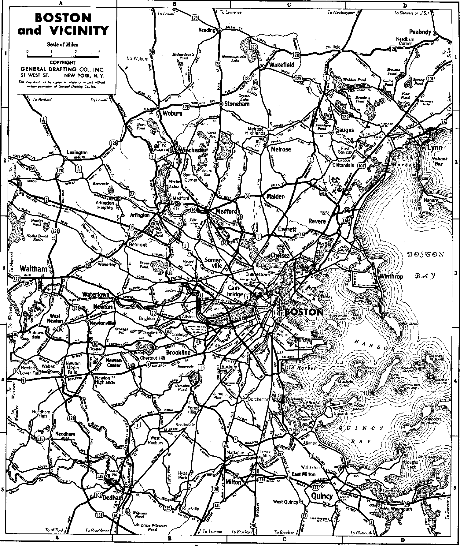
The southern terminus of the parkway is the westernmost of the two Fresh Pond rotaries, with Concord Avenue connecting the parkway to Fresh Pond Parkway at the eastern rotary. The road is designated Massachusetts Routes 2 (northbound) and 16 (eastbound), and US Route 3 (northbound). The parkway runs roughly north, skirting just east of the Alewife T station to a large intersection (formerly a rotary), where the limited access highway carrying Route 2 to the west begins. The parkway runs north from this intersection, paralleling just east of the course of Alewife Brook, which forms the western boundary of Cambridge with Arlington. The first major intersection is with Massachusetts Avenue, which carries Massachusetts Route 2A eastward toward Porter Square, and Routes 2A and 3 westward into Arlington. The parkway continues to parallel Alewife Brook as it heads north into Somerville. After crossing Broadway, the parkway passes through a rotary-like interchange with Powder House Boulevard. It then passes Dilboy Stadium, on the left, and reaches its northern terminus at a small rotary near where Alewife Brook empties into the Mystic River. There it meets Mystic Valley Parkway, which runs from Arlington just to the west to Medford to the northeast. The Route 16 designation continues northeast. The parkway's total length is just over two miles (about three kilometers).

History

The parkway, with the surrounding Alewife Brook Reservation (115 acres (47 ha)), forms part of the Metropolitan Park System of Greater Boston, established in 1893. It was originally planned by landscape architect Charles Eliot as one section of a web of pleasure roads designed for their aesthetics. Nearby Alewife Brook was straightened and channelized between 1909 and 1912, and construction of the parkway was completed by 1916. Landscaping was performed by the famed Olmsted Brothers firm.[ citation needed ] Route 2 connected to Alewife Brook Parkway as a highway in the present right-of-way at some point before 1937. [3]

A drive-in theater was built in 1950, replaced by the Fresh Pond Shopping Center in 1962. [4] The current indoor movie theater next to the shopping center was added in 1964. [4]

Along the southern end, Alewife Brook Parkway underwent further changes beginning in the late 1980s, including a new four lane overpass spanning the Fitchburg Line, [5] [6] new dedicated shoulder turning-lanes for exiting and entering the shopping centers, enlarged roundabouts with obstructive center trees removed, new raised grassy medians down the center of the parkway, and new trees, light poles, and bike lanes integrated into the sidewalks. Some of the other amenities integrated in the new design included accessible ramps and stairs on the northbound side of the bridge leading to the Rindge Towers, new sidewalk access to Alewife station, Alewife Linear Park, bike trail adjacent to Jerry's Pond, and a dedicated road for large trucks to service the shopping areas by passing below the overpass. [7]

As traffic has grown over the past century, the original aesthetics of the parkway's southernmost sections have been largely lost. It is now a section of the principal route between the northwestern suburbs and Boston on the other, and consequently carries a large volume of commuter traffic. The Alewife MBTA station is a prominent feature on the parkway, and there are shopping centers, parking lots, and office and apartment buildings lining the parkway between Alewife station and the southern terminus.

Major intersections

The entire route is in Middlesex County.

Locationmi [8] kmDestinationsNotes
Cambridge 0.00.0East plate.svg
MA Route 2.svg
West plate.svg
MA Route 16.svg
South plate.svg
US 3.svg
Route 2 east / Route 16 west / US 3 south / Concord Avenue Boston, Belmont
Traffic circle; all routes continue south
0.71.1West plate.svg
MA Route 2.svg
Route 2 west Concord
Route 2 continues west
1.11.8MA Route 2A.svgWest plate.svg
US 3.svg
Route 2A  / US 3 west (Massachusetts Avenue) Winchester, Lexington, Cambridge
US 3 continues north
Somerville 2.13.4East plate.svg
MA Route 16.svg
Route 16 east / Mystic Valley Parkway west Arlington, Medford, Revere
Traffic circle; Route 16 continues along Mystic Valley Parkway
1.000 mi = 1.609 km; 1.000 km = 0.621 mi
  •        Route transition

See also

Related Research Articles

<span class="mw-page-title-main">U.S. Route 3</span> Highway in the United States

U.S. Route 3 (US 3) is a United States Numbered Highway running 277.90 miles (447.24 km) from Cambridge, Massachusetts, through New Hampshire, to the Canada–US border near Third Connecticut Lake, where it connects to Quebec Route 257.

<span class="mw-page-title-main">Alewife station</span> Rapid transit station in Cambridge, Massachusetts, US

Alewife station is a Massachusetts Bay Transportation Authority (MBTA) intermodal transit station in the North Cambridge neighborhood of Cambridge, Massachusetts. It is the northwest terminal of the rapid transit Red Line and a hub for several MBTA bus routes. The station is at the confluence of the Minuteman Bikeway, Alewife Linear Park, Fitchburg Cutoff Path, and Alewife Greenway off Alewife Brook Parkway adjacent to Massachusetts Route 2, with a five-story parking garage for park and ride use. The station has three bike cages. Alewife station is named after nearby Alewife Brook Parkway and Alewife Brook, themselves named after the alewife fish.

<span class="mw-page-title-main">Massachusetts Route 2</span> State highway in Massachusetts, United States

Route 2 is a 142.29-mile-long (228.99 km) major east–west state highway in Massachusetts, United States. Along with Route 9 and U.S. Route 20 to the south, these highways are the main alternatives to the Massachusetts Turnpike/I-90 toll highway. Route 2 runs the entire length of the northern tier of Massachusetts, beginning at the New York border, where it connects with New York State Route 2, and ending near Boston Common in Boston. Most of the route is an expressway through the northern tier of Massachusetts, with the longest surface road segments being the western portion. Older alignments of Route 2 are known as Route 2A.

<span class="mw-page-title-main">Minuteman Bikeway</span> Rail trail in Massachusetts, United States

The Minuteman Bikeway is a 10-mile (16-kilometre) paved multi-use rail trail located in the Greater Boston area of Massachusetts. It runs from Bedford to Alewife station, at the northern end of the Red Line in Cambridge, passing through the towns of Lexington and Arlington along the way. Also along the route are several notable regional sites, including Alewife Brook Reservation, the Cyrus Dallin Art Museum, Spy Pond, "Arlington’s Great Meadows", the Battle Green in Lexington, and Hanscom Air Force Base.

<span class="mw-page-title-main">Alewife Brook Reservation</span> State park and reservation in Massachusetts, USA

Alewife Brook Reservation is a Massachusetts state park and urban wild located in Cambridge, Arlington, and Somerville. The park is managed by the state Department of Conservation and Recreation and was established in 1900. It is named for Alewife Brook, which was also historically known as Menotomy River, a tributary of the Mystic River.

<span class="mw-page-title-main">Massachusetts Route 28</span> Highway in Massachusetts

Route 28 is a 151.93-mile-long (244.51 km) nominally south–north state highway in the U.S. state of Massachusetts, running from the town of Eastham via Boston to the New Hampshire state line in Methuen. Following the route from its nominally southern end, Route 28 initially heads south to the town of Chatham then turns west to follow along the south shore of Cape Cod. In Falmouth, Route 28 turns north and continues through the western part of Plymouth County and the eastern part of Norfolk County; it then passes through downtown Boston before heading north via Lawrence to the New Hampshire state line, where it continues as New Hampshire Route 28.

<span class="mw-page-title-main">Massachusetts Route 2A</span> Highway in Massachusetts, United States

Route 2A is a 98.5-mile-long (158.5 km) east–west state highway in Massachusetts. It exists in several sections of Massachusetts, mainly as parts of former Route 2 that have been moved or upgraded. Route 2A runs from Greenfield in the west to Boston in the east. It formerly extended to Shelburne Falls in Buckland in the west, but as of 2007, the route terminates at Interstate 91 (I-91) in Greenfield.

<span class="mw-page-title-main">National Register of Historic Places listings in Massachusetts</span>

This is a list of properties and districts in Massachusetts listed on the National Register of Historic Places. There are over 4,300 listings in the state, representing about 5% of all NRHP listings nationwide and the second-most of any U.S. state, behind only New York. Listings appear in all 14 Massachusetts counties.

<span class="mw-page-title-main">Massachusetts Route 38</span> State highway in Massachusetts, US

Route 38 is a state highway in the U.S. state of Massachusetts, traveling 26.5 miles (42.6 km) from Route 28 in Somerville north via Lowell to the New Hampshire state line in Dracut, where it continues as New Hampshire Route 38 in Pelham, New Hampshire. Although its southern terminus is at Route 28, some signage indicates that Route 38 continues south towards Sullivan Square in Boston.

<span class="mw-page-title-main">Memorial Drive (Cambridge)</span>

Memorial Drive, colloquially referred to as Mem Drive, is a 3.9-mile (6.3 km) parkway along the north bank of the Charles River in Cambridge, Massachusetts, United States.

<span class="mw-page-title-main">Massachusetts Route 60</span> East-west state highway in Massachusetts, US

Route 60 is a 14.33-mile-long (23.06 km) east–west state highway running through the northern suburbs of Boston. Its western terminus is at U.S. Route 20 in Waltham and its eastern terminus is at Route 1A and Route 16 in Revere.

<span class="mw-page-title-main">Fitchburg Cutoff</span> Former rail line in Massachusetts, US

The Fitchburg Cutoff was a rail line running 2.8 miles (4.5 km) from Brighton Street in Belmont, Massachusetts, to Somerville Junction in Somerville, Massachusetts. It was constructed in two segments in 1870 and 1881 to connect the Lexington Branch and Central Massachusetts Railroad to the Boston and Lowell Railroad. Passenger service lasted until 1927. Freight service ended in 1979–80 to allow construction of the Red Line Northwest Extension; the line was abandoned in three sections in 1979, 1983, and 2007.

<span class="mw-page-title-main">Mystic Valley Parkway</span> Historic road in Massachusetts

Mystic Valley Parkway is a parkway in Arlington, Medford, Somerville, and Winchester, Massachusetts, United States. It is listed on the National Register of Historic Places, and forms part of Route 16.

<span class="mw-page-title-main">Fresh Pond Parkway</span>

Fresh Pond Parkway is a historic park and parkway on the western end of Cambridge, Massachusetts, part of the Metropolitan Park System of Greater Boston. The parkway was built in 1899 and added to the National Register of Historic Places in 2005.

<span class="mw-page-title-main">Johnnie's Foodmaster</span>

Johnnie's Foodmaster, more commonly known as simply Foodmaster, was a chain of supermarkets in the Boston Metro Area. It had its headquarters in Chelsea, Massachusetts and all stores were located in the state. On November 18, 2012, all ten stores closed, with six leases being transferred to Austin, Texas–based Whole Foods Market, and two to Quincy–based Stop & Shop; the future of the remaining locations was unknown at the time of closure.

<span class="mw-page-title-main">Fells Connector Parkways</span> United States historic place

The Fells Connector Parkways are a group of historic parkways in the cities of Malden and Medford, Massachusetts, suburbs north of the city of Boston. The three parkways, The Fellsway, Fellsway West, and Fellsway East serve to provide access from the lower portion of the Mystic River Reservation to the Middlesex Fells Reservation. The latter two parkways continue northward, providing access to the interior of the Fells and providing a further connection to Lynn Fells Parkway. Significant portions of these parkways south of the Fells, which were among the first connecting parkways designed to be part of the Metropolitan Park System of Greater Boston by Charles Eliot, were listed on the National Register of Historic Places in 2003.

<span class="mw-page-title-main">Middlesex Fells Reservation Parkways</span> United States historic place

The Middlesex Fells Reservation Parkways are the roadways within and bordering on the Middlesex Fells Reservation, a state park in the northern suburbs of Boston, Massachusetts, United States. The park includes portions of the towns of Malden, Medford, Melrose, Stoneham, and Winchester. The roads inside the park and around its perimeter have been listed on the National Register of Historic Places. Other portions of some of the roads are covered by more than one listing in the national register; see Fellsway Connector Parkways and Middlesex Fells Reservoirs Historic District.

<span class="mw-page-title-main">North Cambridge, Massachusetts</span>

North Cambridge, also known as "Area 11", is a neighborhood of Cambridge, Massachusetts bounded by Porter Square and the Fitchburg Line railroad tracks on the south, the city of Somerville on the northeast, Alewife Brook and the town of Arlington on the northwest, and the town of Belmont on the west. In 2005 it had a population of 10,642 residents living in 4,699 households, and the average income was $44,784. In 2010, the racial demographics for the neighborhood were 57.6% White, 20% Black, 15.1% Asian/Pacific Islander, 7.3% Hispanic origin, 0.3% Native American, 2.4% other race.

<span class="mw-page-title-main">Massachusetts Route 16</span> Highway in Massachusetts

Route 16 is a 59.8646-mile-long (96.3427 km) east–west state highway in Massachusetts. It begins in the west at an intersection with Route 12 and Route 193 in Webster, just north of the Connecticut state border. It runs in a generally southwest-northeast routing through a number of Boston's suburbs and runs to the west and then north of the city before ending in Revere at an intersection with Route 1A and Route 60.

This is a list of roundabouts in the state of Massachusetts in the United States. Intersections that are called traffic circles or roundabouts in the rest of the US are referred to as "rotaries" in Massachusetts, as well as other parts of New England including parts of Connecticut, New Hampshire, Maine Rhode Island, & Vermont.

References

  1. Executive Office of Transportation - Office of Transportation Planning Roads - June 2008
  2. "National Register Information System". National Register of Historic Places . National Park Service. January 23, 2007.
  3. Imageschlichtman.org Archived May 17, 2011, at the Wayback Machine
  4. 1 2 A Brief Chronology of Fresh Pond
  5. Palmer Jr., Thomas C. (August 27, 1993). "Ground finally broken for $10.7m Alewife Brook bridge". Boston Globe. p. 27 via Newspapers.com. Open Access logo PLoS transparent.svg
  6. Rosenberg, Ronald (April 22, 1990). "Panel Tables Bill To Scale Back Route 2 Project". Boston Globe. p. 72 via Newspapers.com. Open Access logo PLoS transparent.svg
  7. "A Cambridge Compromise". Boston Globe. July 1, 1989 via Newspapers.com. Open Access logo PLoS transparent.svg
  8. Google (May 25, 2019). "Alewife Brook Parkway" (Map). Google Maps . Google. Retrieved May 25, 2019.
Template:Attached KML/Alewife Brook Parkway
KML is from Wikidata