Fells Connector Parkways

Last updated
Fells Connector Parkways, Metropolitan System of Greater Boston
MedfordMA FellswayWest.jpg
Fellsway West in Medford
USA Massachusetts location map.svg
Red pog.svg
Usa edcp location map.svg
Red pog.svg
Location Malden and Medford, Massachusetts
Coordinates 42°26′40″N71°4′45″W / 42.44444°N 71.07917°W / 42.44444; -71.07917 Coordinates: 42°26′40″N71°4′45″W / 42.44444°N 71.07917°W / 42.44444; -71.07917
Built1895
ArchitectEliot, Charles; Olmsted Brothers
MPS Metropolitan Park System of Greater Boston MPS
NRHP reference No. 03000379 [1]
Added to NRHPMay 9, 2003

The Fells Connector Parkways are a group of historic parkways in the cities of Malden and Medford, Massachusetts, suburbs north of the city of Boston. The three parkways, The Fellsway, Fellsway West, and Fellsway East serve to provide access from the lower portion of the Mystic River Reservation to the Middlesex Fells Reservation. The latter two parkways continue northward, providing access to the interior of the Fells and providing a further connection to Lynn Fells Parkway. Significant portions of these parkways south of the Fells, which were among the first connecting parkways designed to be part of the Metropolitan Park System of Greater Boston by Charles Eliot, were listed on the National Register of Historic Places in 2003.

Contents

Background

Following the enactment of authorizing legislation in 1894, the Metropolitan Parks Commission (predecessor to the Metropolitan District Commission (MDC) and today's Massachusetts Department of Conservation and Recreation (DCR)) began working with Charles Eliot to plan a parkway to provide access from Boston to the Middlesex Fells Reservation. This job was made difficult due to the existence of relatively densely populated areas between the Mystic River and the reservation. The plan that the commission and Eliot finally drafted called for an arterial trunk (The Fellsway), which would run north through Medford and Malden, and then split into two branches. Fellsway West would provide access to the promontory point at Pine Hill in Medford (now visible on the west side of Interstate 93) and the western parts of the reservation, while Fellsway East would provide access to Bear's Den Hill in Malden, and points east. These corridors were wide (120-foot (37 m)) rights of way, in order to provide for several modes of transportation: automobile, street car, and pedestrians and cyclists. [2]

The Fellsway

MA Route 28.svg

Fellsway

Location SomervilleMedford
Length2.2 mi [3]  (3.5 km)
Existed1896–present

Land for The Fellsway was acquired in 1896. Its original southern terminus was at Mystic Avenue in Somerville, and was further extended south to Broadway in 1898. The Somerville section of the parkway south of Mystic Avenue later became part of the McGrath Highway, and the intervening section was extensively altered by the construction of I-93. The Fellsway is designated Massachusetts Route 28 for its entire length. From Somerville it crosses the Mystic River into Medford on the Wellington Bridge and soon enters the Wellington Circle interchange, where it joins with Mystic Valley Parkway and Revere Beach Parkway, both designated Massachusetts Route 16. It crosses into Malden near Devir Park, shortly before it ends at the junction with Fellsway West and Fellsway East. The Medford and Malden portions of The Fellsway, including its medians and Wellington Circle, are part of the National Register listing for the Fells Connector Parkways. [2]


Major intersections

The entire route is in Middlesex County.

Locationmi [3] kmDestinationsNotes
Somerville 0.00.0South plate.svg
MA Route 28.svg
Route 28 south (McGrath Highway) Somerville
Route 28 continues south
I-93.svgMA Route 38.svg I-93  / Route 38  Boston, Sullivan Square, Medford, Concord, NH Exit 29 on I-93
Mystic River 0.50.80Wellington Bridge
Medford 0.81.3MA Route 16.svg Route 16  Arlington, Watertown, Everett, Revere Intersection with Mystic Valley and Revere Beach Parkways
Malden 2.23.5US 1.svg Fellsway East to US 1 Route 28 continues north as Fellsway West
1.000 mi = 1.609 km; 1.000 km = 0.621 mi
  •        Route transition

Fellsway West

MA Route 28.svg

Fellsway West

Location MedfordStoneham
Length3.6 mi [4]  (5.8 km)
Existed1896–present

Portions of the Fellsway West right of way were acquired in 1896; the rest were obtained in 1897. The eastern portion followed an existing alignment along Medford's Valley Street. The road runs west from the northern end of The Fellsway, soon after crossing Massachusetts Route 60 just across the Malden-Medford line in Medford. At Fulton Street the road turns north, paralleling Interstate 93 to Roosevelt Circle, which is where it terminated when completed in 1898. From Roosevelt Circle it continues northward into the Fells, in an extension constructed between 1905 and 1908, and was fully extended to Stoneham in 1931. The section from a point about 2,000 feet (610 m) north of Roosevelt Circle has been extensively altered due to the construction of I-93. Only the section between Fulton Street and The Fellsway is part of the National Register listing for the Fells Connector Parkways; the section immediately north of Roosevelt Circle is included in the Middlesex Fells Reservation Parkways listing. Fellsway West is designated Massachusetts Route 28 for its entire length. [2]


Major intersections

The entire route is in Middlesex County.

Locationmi [4] kmDestinationsNotes
Malden 0.00.0South plate.svg
MA Route 28.svg
Route 28 south (Fellsway) / Fellsway East north
No southbound access to Fellsway East
Medford 0.20.32MA Route 60.svg Route 60  Malden, Revere, Waltham
1.01.6I-93.svg I-93  / South Border Road Boston, Winchester, Concord, NH Roosevelt Circle; exit 33 on I-93
Stoneham 2.6–
3.3
4.2–
5.3
South plate blue.svg
I-93.svg
I-93 south Boston
Entrance from I-93 north only; exit 34 on I-93
3.65.8MA Route 28.svgI-93.svg Route 28 north / North Border Road to I-93 north – Lawrence, Concord, NH Route 28 continues north
1.000 mi = 1.609 km; 1.000 km = 0.621 mi

Fellsway East

Fellsway East

Location MaldenStoneham
Length2.6 mi [5]  (4.2 km)
Existed1896–present

Fellsway East runs north from the interchange with The Fellsway and Fellsway West, with its entire length in Malden, Melrose, and Stoneham. The oldest portion runs to East Border Road at the southern edge of the Fells, crossing Massachusetts Route 60 and passing Fellsmere Park. Except for a brief section, it is a broad multilane boulevard with an impressive tree canopy over the northern part, and is the best preserved section of the Fells Connector Parkways. [2] From the junction with East Border Road, it becomes a narrow park road, passing into a heavily wooded section of the Fells Reservation in Melrose. It then becomes a border road, skirting the eastern edge of the reservation in Melrose before reaching its end at a junction with Pond Street and Lynn Fells Parkway in Stoneham. [6] The section of this parkway south of East Border Road is listed as part of the Fellsway Connector Parkways; the northern section is listed as part of the Middlesex Fells Reservation Parkways. [2]


Major intersections

The entire route is in Middlesex County.

Locationmi [5] kmDestinationsNotes
Malden 0.00.0MA Route 28.svg Route 28 (Fellsway south / Fellsway West north) Boston, Stoneham
0.20.32Pleasant Street (Route 60)No signage for Route 60
Stoneham 2.64.2I-93.svgMA Route 28.svg Pond Street / Lynn Fells Parkway to I-93 / Route 28Spot Pond, Medford Continues north as Lynn Fells Parkway
1.000 mi = 1.609 km; 1.000 km = 0.621 mi

Alterations

Several significant alterations have been made to these roadways since they were first laid out. Streetcar lines ran all the way along The Fellsway and Fellsway West from 1907 into the 1940s, and eventually reached all the way to Stoneham Square. This service was cut back to run only along the Fellsway, and completely discontinued in the 1950s. The Wellington Bridge, originally a drawbridge, was replaced in 1914. Roosevelt Circle was built (as a surface rotary) in the 1930s to address increasing traffic volume, and was replaced by the present aerial rotary with the construction of I-93 in the late 1950s. Wellington Circle, originally a rotary, was extensively redesigned in 1941 and again in 1956. The southernmost section of the Fellsway was effectively obliterated by the construction of I-93 through Somerville. [2]

See also

Related Research Articles

<span class="mw-page-title-main">Malden, Massachusetts</span> City in Massachusetts, United States

Malden is a city in Middlesex County, Massachusetts, United States. At the time of the 2020 U.S. Census, the population was 66,263 people.

<span class="mw-page-title-main">Medford, Massachusetts</span> City in Massachusetts, United States

Medford is a city 6.7 miles (10.8 km) northwest of downtown Boston on the Mystic River in Middlesex County, Massachusetts, United States. At the time of the 2020 U.S. Census, Medford's population was 59,659. It is home to Tufts University, which has its campus along the Medford and Somerville border.

<span class="mw-page-title-main">Melrose, Massachusetts</span> City in Massachusetts, United States

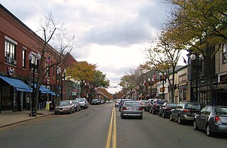
Melrose is a city located in the Greater Boston metropolitan area in Middlesex County, Massachusetts, United States. Its population, per the 2020 United States Census, is 29,817. It is a suburb located approximately seven miles north of Boston. It is situated in the center of the triangle created by Interstates 93, 95 and U.S. Route 1.

<span class="mw-page-title-main">Wellington station (MBTA)</span> Rapid transit station in Medford, Massachusetts, US

Wellington station is a Massachusetts Bay Transportation Authority (MBTA) Orange Line rapid transit station in Medford, Massachusetts, near the border of Everett. It is located on the Revere Beach Parkway, slightly east of its intersection with Route 28. Wellington functions as a park and ride with more than 1,300 spaces, and a bus hub with 10 routes terminating at the station. The Station Landing development, connected to the station by an overhead walkway, includes residential and retail buildings and additional parking. Wellington Carhouse, the primary repair and maintenance facility for the Orange Line, is located adjacent to the station.

<span class="mw-page-title-main">Department of Conservation and Recreation</span> State agency of the Commonwealth of Massachusetts

The Department of Conservation and Recreation (DCR) is a state agency of the Commonwealth of Massachusetts, situated in the Executive Office of Energy and Environmental Affairs. It is best known for its parks and parkways. The DCR's mission is "To protect, promote and enhance our common wealth of natural, cultural and recreational resources for the well-being of all." The agency is the largest landowner in Massachusetts.

<span class="mw-page-title-main">Middlesex Fells Reservation</span> Recreation area in Massachusetts, United States

Middlesex Fells Reservation, often referred to simply as the Fells, is a public recreation area covering more than 2,200 acres (890 ha) in Malden, Medford, Melrose, Stoneham, and Winchester, Massachusetts. The state park surrounds two inactive reservoirs, Spot Pond and the Fells Reservoir, and the three active reservoirs that are part of the water supply system for the town of Winchester. Spot Pond and the Fells Reservoir are part of the Wachusett water system, one of six primary water systems that feed metropolitan Boston's waterworks. The park is managed by the Massachusetts Department of Conservation and Recreation and is part of the Metropolitan Park System of Greater Boston.

<span class="mw-page-title-main">Revere Beach Parkway</span> Historic road near Boston, Massachusetts, United States

Revere Beach Parkway is a historic parkway in the suburbs immediately north of Boston, Massachusetts. It begins at Wellington Circle in Medford, where the road leading to the west is Mystic Valley Parkway, and the north–south road is the Fellsway, designated Route 28. The parkway proceeds east, ending at Eliot Circle, the junction of Revere Beach Boulevard and Winthrop Parkway in Revere. In between, the parkway passes through the cities of Everett and Chelsea. The parkway was built between 1896 and 1904 to provide access from interior communities to Revere Beach. It underwent two major periods of capacity expansion, in the 1930s and again in the 1950s. The parkway is designated as part of Route 16 west of Route 1A, and as part of Route 145 east of that point.

<span class="mw-page-title-main">Massachusetts Route 28</span> Highway in Massachusetts

Route 28 is a 151.93-mile-long (244.51 km) nominally south–north state highway in the U.S. state of Massachusetts, running from the town of Eastham via Boston to the New Hampshire state line in Methuen. Following the route from its nominally southern end, Route 28 initially heads south to the town of Chatham then turns west to follow along the south shore of Cape Cod. In Falmouth, Route 28 turns north and continues through the western part of Plymouth County and the eastern part of Norfolk County; it then passes through downtown Boston before heading north via Lawrence to the New Hampshire state line, where it continues as New Hampshire Route 28.

<span class="mw-page-title-main">National Register of Historic Places listings in Massachusetts</span>

This is a list of properties and districts in Massachusetts listed on the National Register of Historic Places. There are over 4,300 listings in the state, representing about 5% of all NRHP listings nationwide and the second-most of any U.S. state, behind only New York. Listings appear in all 14 Massachusetts counties.

<span class="mw-page-title-main">Massachusetts Route 60</span> East-west state highway in Massachusetts, US

Route 60 is a 14.33-mile-long (23.06 km) east–west state highway running through the northern suburbs of Boston. Its western terminus is at U.S. Route 20 in Waltham and its eastern terminus is at Route 1A and Route 16 in Revere.

<span class="mw-page-title-main">Malden River</span>

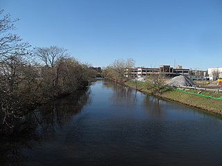
The Malden River is a 2.3-mile-long (3.7 km) river in Malden, Medford, and Everett, Massachusetts. It is roughly 675 feet (206 m) wide at its widest point and is very narrow at its smallest point. Its banks are largely occupied by industrial business, and the river is scarcely used or even mentioned. Its water quality is worse than most local waters, including the Mystic River, into which it flows.

<span class="mw-page-title-main">Alewife Brook Parkway</span>

Alewife Brook Parkway is a short parkway in Cambridge and Somerville, Massachusetts. It is listed on the National Register of Historic Places. It begins at Fresh Pond in Cambridge, and heads north on the east bank of Alewife Brook, crossing into West Somerville and ending at the Mystic River on the Medford town line, where it becomes Mystic Valley Parkway. The entire length of Alewife Brook Parkway is designated as part of Massachusetts Route 16 (Route 16), while the southernmost sections are also designated as part of Route 2 and U.S. Route 3 (US 3). It is managed by the Department of Conservation and Recreation with the Massachusetts Department of Transportation responsible for bridge maintenance.

The Haymarket North Extension is a section of the Massachusetts Bay Transportation Authority's rapid transit Orange Line which currently constitutes the northern section of the line. It runs from North Station through an underground crossing of the Charles River, then along the Haverhill Line right-of-way to Oak Grove station in Malden, Massachusetts. Built to replace the Charlestown Elevated and originally intended to be extended as far as Reading, it opened in stages between 1975 and 1977.

<span class="mw-page-title-main">Mystic Valley Parkway</span> Historic road in Massachusetts

Mystic Valley Parkway is a parkway in Arlington, Medford, Somerville, and Winchester, Massachusetts. It is listed on the National Register of Historic Places, and forms part of Route 16.

<span class="mw-page-title-main">Lynn Fells Parkway</span>

Lynn Fells Parkway is a parkway in Greater Boston, Massachusetts, in the United States. It is maintained by the Massachusetts Department of Conservation and Recreation. The road runs from the end of Fellsway East in Stoneham, eastward through Melrose, and ends in Saugus at US Route 1. The parkway serves as a connector between the Middlesex Fells Reservation and Breakheart Reservation.

<span class="mw-page-title-main">Fresh Pond Parkway</span>

Fresh Pond Parkway is a historic park and parkway on the western end of Cambridge, Massachusetts, part of the Metropolitan Park System of Greater Boston. The parkway was built in 1899 and added to the National Register of Historic Places in 2005.

<span class="mw-page-title-main">Middlesex Fells Reservation Parkways</span> United States historic place

The Middlesex Fells Reservation Parkways are the roadways within and bordering on the Middlesex Fells Reservation, a state park in the northern suburbs of Boston, Massachusetts. The park includes portions of the towns of Malden, Medford, Melrose, Stoneham, and Winchester. The roads inside the park and around its perimeter have been listed on the National Register of Historic Places. Other portions of some of the roads are covered by more than one listing in the national register; see Fellsway Connector Parkways and Middlesex Fells Reservoirs Historic District.

<span class="mw-page-title-main">Middlesex Fells Reservoirs Historic District</span> Historic district in Massachusetts, United States

The Middlesex Fells Reservoirs Historic District is a historic district roughly bounded by Pond St., Woodland Rd., I-93, and MA 28 in Stoneham and Medford, Massachusetts. It encompasses a portion of the Middlesex Fells Reservation, a state park managed by the Massachusetts Department of Conservation and Recreation (DCR). The principal features of the district are three reservoirs and their associated gate houses and pumping stations, which were developed by the Metropolitan District Commission starting in the late 19th century. The district was listed on the National Register of Historic Places in 1990.

<span class="mw-page-title-main">Metropolitan District Commission Pumping House</span> Historic building in Stoneham, Massachusetts

The Metropolitan District Commission Pumping House is a historic water pumping station, adjacent to Spot Pond in the Middlesex Fells Reservation, on Woodland Road in Stoneham, Massachusetts. Built in 1901 by the Metropolitan District Commission (MDC), it is one of Stoneham's finest examples of Renaissance Revival architecture. The building was listed on the National Register of Historic Places in 1984, and included in the Middlesex Fells Reservoirs Historic District in 1990.

<span class="mw-page-title-main">Massachusetts Route 16</span> Highway in Massachusetts

Route 16 is a 59.8646-mile-long (96.3427 km) east–west state highway in Massachusetts. It begins in the west at an intersection with Route 12 and Route 193 in Webster, just north of the Connecticut state border. It runs in a generally southwest-northeast routing through a number of Boston's suburbs and runs to the west and then north of the city before ending in Revere at an intersection with Route 1A and Route 60.

References

  1. "National Register Information System". National Register of Historic Places . National Park Service. April 15, 2008.
  2. 1 2 3 4 5 6 "NRHP nomination for Fells Connector Parkways". Commonwealth of Massachusetts. Retrieved 2014-01-24.
  3. 1 2 Google (May 27, 2019). "Fellsway" (Map). Google Maps . Google. Retrieved May 27, 2019.
  4. 1 2 Google (May 27, 2019). "Fellsway West" (Map). Google Maps . Google. Retrieved May 27, 2019.
  5. 1 2 Google (May 27, 2019). "Fellsway East" (Map). Google Maps . Google. Retrieved May 27, 2019.
  6. "NRHP nomination for Middlesex Fells Reservation Parkways". Commonwealth of Massachusetts. Retrieved 2014-01-23.
Fellsway East in Malden MaldenMA EastFellsway.jpg
Fellsway East in Malden