Bahu Fort

Last updated

Bahu Fort
Part of Forts in India
Jammu, J&K, India
Bahu Fort, Jammu, India.jpg
Bahu Fort
India Jammu and Kashmir Union Territory location map.svg
Red pog.svg
Bahu Fort
India location map.svg
Red pog.svg
Bahu Fort
Coordinates 32°43′34″N74°52′49″E / 32.7261°N 74.8803°E / 32.7261; 74.8803
Type Fort & Temple
Site information
Controlled by J&K Government
Open to
the public
Yes
ConditionGood
Site history
Built by Bahu Lochan
Materials Sandstone Stones
Garrison information
OccupantsTemple

The Bahu Fort is a historic fort in the city of Jammu, the winter capital of the Indian union territory of Jammu and Kashmir. Constructed on the banks on Tawi River, the ancient fort is believed to have been constructed by Bahu Lochan - brother of the traditional founder of Jammu, Jambu Lochan. It is believed that the first renovation of this fort was undertaken during Dogra Rule in 18th century. [1] The fort is a religious place, and within its precincts has a temple dedicated to the Hindu goddess Kali. The temple is known locally as the "Bawe Wali Mata temple". [1] [2]

Contents

Legend

The building of the city of Jammu and the Bahu Fort [3] are linked to a legend. Raja Jambu Lochan, when on a hunting trip, witnessed a curious scene of a tiger and a goat drinking water side by side at the same location in the Tawi River, without the tiger attacking. The Raja considered this a divine direction to establish his new capital here, as the scene he witnessed at this site represented peaceful coexistence. His brother, Bahu Lochan, is credited with building the fort. [2] [4]

Topography

The fort is located on a high plateau land overlooking the Tawi River on its rocky left bank with an average elevation of 325m. The forest area that surrounds the fort has been developed into a well laid out park called the "Bagh-e-Bahu", from where a commanding view of the city of Jammu could be seen. The garden attracts a large number of visitors. [1]

The fort, the temple, and the Bagh-e-Bahu garden are located 5 kilometres (3.1 mi) from the Jammu city centre. [5] The city road to Surinsar was widened for providing approach to an Oil drilling exploration project. However, this project was shelved and consequently the widened new road provided better access to the fort and the temple, and the number of visitors to these places has since increased. [6]

History

Map of the city of Jammu, ca 1890 National Museum in Delhi 18 - map of the city of Jammu (42236738694).jpg
Map of the city of Jammu, ca 1890

The earliest historical recorded link to the fort is that of Raja Jambu Lochan and his brother Bahu Lochan, sons of a powerful ruler Agnigarbha II of the Jammu dynasty of Suryavanshi kings. Bahu, the eldest of Agnigarbha's 18 sons, is credited with establishing the Jammu city and building the fort. The earlier fort structure was modified over the years to a stronger fortified structure. The present fort was rebuilt, probably at the same location as the ancient fort, by Autar Dev, the grandson of King Kapoor Dev in 1585. Over the years the fort underwent demolitions and reconstructions from time to time, until during Sikh Empire the then new Governor/Raja of Jammu Maharaja Gulab Singh reconstructed the present fort in the 19th century, which was further refurbished during the rule of Maharaja Ranbir Singh. They first established temples for their tutelary deities; the image of Mahakali deity in the temple in the fort was brought from Ayodhya. [2] [7]

Bahu fort

The fort structure is located at an elevation of 325 metres (1,066 ft), opposite to the old town of Jammu. The fortified structure has thick walls made of sandstones built with lime and brick mortar. It has eight octagonal towers or turrets connected by thick walls. The towers have enclosures to house guards. The main entry is fit to allow passage of elephants into the fort. A water tank with access for pilgrims to take bath is located on the left entry into the fort. This tank or pond is 6.1× in size and has a water depth of 4.6 metres (15 ft). A pyramidal structure is on the right flank (with very thick walls to withstand any gun attack) of the fort was an ammunition store. An underground chamber here was used a prison. This chamber has a secret exit to escape from the fort in case of any emergencies. The first floor is lavishly built with arches and decorated with floral designs like a Baradari or a palace. [2] [8] [9]

To the right of the temple, there are a few halls which were used in the past as assembly halls and offices of the Quiledar (master of the fort). However, they are not maintained at all. The royal stables were also located within this fort. Substantial renovation and additions to attract visitors have been added during recent years.

Mahakali temple

It is a renowned Shakti temple built within the fort during the 8th century. It has been built in white marble on a raised platform of 1.2 metres (3.9 ft) height. While it is claimed that it was built during 8th or 9th century, the temple as built looks modern. It is a small temple which can accommodate only a few worshippers at a time at the Mandapa, outside the sanctum sanctorum. In the past, animal sacrifice was practiced at this temple, which has since been discontinued. Today, a priest performs a few rites uttering some religious incantations and sprinkles holy water over the animal (usually a sheep or goat) and then lets it go free. Other food offering made by devotees is a sweet dish called Kadah (pudding), after their wishes placed before the deity are fulfilled. [6] [10]

Another special feature seen in the temple precincts is the presence of a large group of Rhesus monkeys, the largest such group in Jammu and Kashmir State. The monkeys are fed by devotees with sweets, gram etc. [6] [9]

Development works

The fort, which is a heritage site declared by the state government, is proposed to be linked with a rope way running from the Mubarak Mandi Palace, another heritage site in the city. The immediate surroundings have been converted into park with fountains and a small lake for boating. Considering the heritage status of the fort, further conservation works have been planned at a cost of Rs 6.97 million. [11]

Festivals

A popular Hindu festival is known as "Bahu Mela" [12] is held during the Navaratras in the fort area, twice a year, during March–April and September–October. This attracts a very large number of pilgrims to the fort and the temple located within it. Every week, Tuesday and Sunday are special days of worship at the temple. During the main festival time, special stalls are opened near the fort area selling paraphernalia such as sweets, flowers, incense, coconuts, red cloth and so forth, to make special offerings to the deity in the temple. [6]

Demolition due to heavy rains

On 18 August 2013, a portion of the fort wall collapsed due to many days of heavy rains. No casualties were reported. [13] [14] [15]

Notes

  1. 1 2 3 "Bahu Fort/Temple". National Informatics centre. Archived from the original on 21 June 2002. Retrieved 7 April 2010.
  2. 1 2 3 4 Jeratha, Aśoka (2000). Forts and palaces of the Western Himalaya. Indus Publishing. pp. 59–65. ISBN   81-7387-104-3.
  3. Adnan, Ahazz (4 September 2020). "Stunning Bahu Fort [ Exciting Place To Visit Now In 2020]". Fort Trek. Retrieved 13 October 2020.
  4. Silas, Sandeep (2005). Discover India by Rail. Sterling Publishers Pvt. Ltd. p. 47. ISBN   81-207-2939-0 . Retrieved 7 April 2010.
  5. "The Official Website of Jammu & Kashmir Government, India". 21 June 2002. Archived from the original on 21 June 2002. Retrieved 26 July 2019.
  6. 1 2 3 4 Travel in Jammu and Kashmir. Jammu: Pustak Sansar. 2007.
  7. Mittal, J.P. (2006). History of Ancient India: From 4250 BC to 637 AD. Atlantic Publishers & Distributors. pp. 397–398. ISBN   81-269-0616-2 . Retrieved 7 April 2010.
  8. "Ancient Temples of Jammu". National Informatics Centre. Archived from the original on 10 April 2009. Retrieved 7 April 2010.
  9. 1 2 Gupta; Anil K. Verma; V. K. Gupta (2004). Perspectives in Animal Ecology and Reproduction, Volume 2. Daya Books. p. 202. ISBN   81-7035-322-X . Retrieved 7 April 2010.
  10. Sharma, Shiv Chander (1997). Antiquities, history, culture, and shrines of Jammu. Vinod Publishers & Distributors. p. 65. ISBN   81-85599-46-7 . Retrieved 7 April 2010.
  11. "Bahu Fort to be developed as major tourist attraction". National Informatics Centre. Archived from the original on 25 January 2010. Retrieved 7 April 2010.
  12. "Mela Bahu Fort".
  13. "Bahu Fort wall collapse shocks city". tribuneindia.com. Jammu Tribune. 17 August 2013. Retrieved 30 November 2013.
  14. "Portion of Historic Bahu Fort Collapses in Jammu". freepresskashmir.com. Free Press Kashmir. 17 August 2013. Archived from the original on 3 December 2013. Retrieved 30 November 2013.
  15. "A Geotechnical Note on the Failure of Northwestern Part of Bahu Fort During Recent Rains, Jammu District, J&K" (PDF). portal.gsi.gov.in. Geological Survey of India. Archived from the original (PDF) on 3 December 2013. Retrieved 30 November 2013.

Related Research Articles

<span class="mw-page-title-main">Hari Singh</span> Last ruling Maharaja of Jammu and Kashmir from 1925–1952

Maharaja Sir Hari Singh was the last ruling Maharaja of the princely state of Jammu and Kashmir.

<span class="mw-page-title-main">Vaisakhi</span> Religious, harvest and traditional new year festival for Dogras

Vaisakhi, also pronounced Baisakhi as well as Basoa, marks the first day of the month of Vaisakh and is traditionally celebrated annually on 13 April and sometimes 14 April. It is seen as a spring harvest celebration primarily in Northern India. Further, other Indian cultures and diaspora celebrate this festival too. Whilst it is culturally significant as a festival of harvest, in many parts of India, Vaisakhi is also the date for the Indian Solar New Year.

Katoch is a Chandravanshi Rajput clan. Their traditional areas of residence was Trigarta Kingdom, Jalandhar, Multan i.e. the areas of residence are mainly in the Indian states of Punjab, Uttarakhand, Himachal Pradesh and Jammu. and at Kangra Fort. They descent from the Trigarta dynasty mentioned in the Mahabharata. Historically, they ruled from Multan, Jalandhar, and Kangra. The Multan Fort (1000-800 B.C and Kangra fort were also built by Katoch clan, establishing their antiquity. Katochs have only 4 sub-clans that came into existence from Katoch Rajputs are Dadwal Dynasty, Guleria Dynasty, Sibaia Dynasty, Jaswal Dynasty.

<span class="mw-page-title-main">Raghunath Temple</span> Hindu Temple in Jammu, India

Raghunath Temple is a Hindu temple located in Jammu in the Indian union territory of Jammu and Kashmir. It consists of a complex of seven Hindu shrines. Raghunath Temple was constructed by the first Dogra ruler Maharaja Gulab Singh in the year 1835 and later his son Maharaja Ranbir Singh got it completed in the year 1860 During Dogra rule. The temple has many gods in its complex of shrines, but the presiding deity is Rama – also known as Raghunath, an Avatar of Vishnu. All the spiral-shaped towers have gold plated spires. The niches in the walls of the shrines are decorated with 300 well-crafted icons of gods and goddesses including those of Surya and Shiva, but most are particularly related to the life stories of Rama and Krishna. The paintings in the 15 panels of the main shrine are based on themes from Ramayana, Mahabharata, and Bhagavad Gita. The temple premises include a school and a library that preserves over 6,000 manuscripts in many Indian languages, with a notable collection of Sarada script Sanskrit manuscripts.

<span class="mw-page-title-main">Kangra Fort</span> Fort in Himachal Padesh, India

<span class="mw-page-title-main">Rajouri district</span> District of Jammu and Kashmir administered by India.

Rajouri or Rajpur is a district in the Jammu division of Indian-administered Jammu and Kashmir in the disputed Kashmir region. The Line of Control lies to its west, Poonch to its north, the Reasi district to the east and the Jammu district to its south. Rajouri is famous for its "Kalari". Representing an ancient principality, Rajouri was a joint district, along with Reasi, at the time of princely state's accession to India in 1947. The two tehsils were separated and Rajouri was merged with the Poonch district. Rajouri again became a separate district in 1968. The Rajouri district comprises 13 tehsils (boroughs). The land is mostly fertile and mountainous. Maize, wheat and rice are the main crops of the area and the main source of the irrigation is the river Tawi that originates from the mountains of Pir Panjal.

Nowshera is a town and the headquarters of an eponymous tehsil of Rajouri district in the Jammu division of the Indian Union Territory of Jammu and Kashmir. It is governed by a Municipal committee and in rural area of Nowshera consists of 14 panchayats governed by local bodies under the supervision of district administration Rajouri.

<span class="mw-page-title-main">Rajouri</span> City in Jammu & Kashmir, India

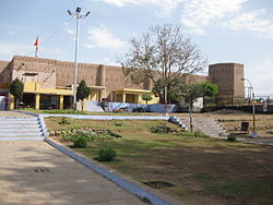
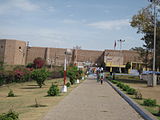
Rajouri or Rajauri is a city in the Rajouri district in the Jammu division of the Indian union territory of Jammu and Kashmir. It is located about 155 kilometres (96 mi) from Srinagar and 150 km (93 mi) from Jammu city on the Poonch Highway. The city is the location of the birthplace of Sikh General Banda Singh Bahadur. Baba Ghulam Shah Badshah University is also situated in this district.

<span class="mw-page-title-main">Chamba, Himachal Pradesh</span> Town in the Himachal Pradesh, India

Chamba is a town in the Chamba district in the Indian state of Himachal Pradesh. According to the 2001 Indian census, Chamba has a population of 20,312 people. Located at an altitude of 1,006 metres (3,301 ft) above mean sea level, the town is situated on the banks of the Ravi River, at its confluence with the Sal River.

Baldev Raj Gupta is an Indian academic in the field of linguistics, and a Punjabi and Hindi writer.

<span class="mw-page-title-main">Jamwal</span> Surname list

Jamwal is a toponymic surname for a Dogra Rajput clan of the same name from Jammu, in Jammu and Kashmir, India. They claim descent from the traditional founder of Jammu, Jambu Lochan, and there at one time some of their members were rulers of the princely state of Jammu and Kashmir, often referred to as the Dogra dynasty.

<span class="mw-page-title-main">Amar Mahal Palace</span> Building in Jammu, India

The Amar Mahal Palace is a palace in Jammu, in the Indian erstwhile Kingdom of Jammu and Kashmir, India. The palace has now been converted into a museum. Commissioned by Maharaja Amar Singh, a Dogra king, the palace was built in the nineteenth century by a French architect on the lines of a French Chateau. The palace was donated to the Hari-Tara Charitable Trust by Karan Singh for use as a museum. It has many exhibits including a golden throne weighing 120kg, a Pahari miniature, Kangra miniature paintings, a library of 25,000 antique books, many rare art collections, and a large collection of portraits of the royal family.

<span class="mw-page-title-main">Jasrota</span> Jasrota kingdom from Jammu and Kashmir

Jasrota kingdom in the Himalayan foothills of India was founded in 1064 A.D at south-eastern Jammu between the Ravi and the Ujh rivers which ended in 1815. The remainants of Jasrota kingdom exists as ruined forts, restored temples, water bodies and canals in Hiranagar tehsil, Narowal tehsil, Nagri tehsil, Kathua tehsil, Marheen tehsil, Dinga Amb tehsil, Ramkot tehsil, Mahanpur tehsil, Billawar tehsil.

<span class="mw-page-title-main">Dogra dynasty</span> Hindu dynasty of Jammu and Kashmir (1846–1952)

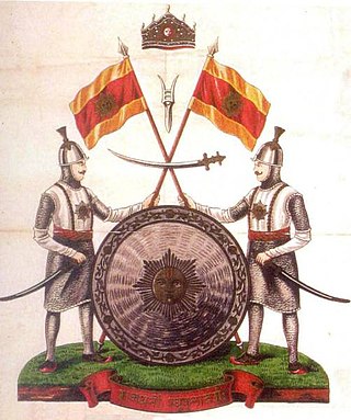
The Dogra dynasty of Dogra Rajputs from the Shivalik hills created Jammu and Kashmir when all dynastic kingdoms in India were being absorbed by the East India Company. Events led the Sikh Empire to recognise Jammu as a vassal state in 1820, and later the British added Kashmir to Jammu with the Treaty of Amritsar in 1846. The founder of the dynasty, Gulab Singh, was an influential noble in the court of the Sikh emperor Maharaja Ranjit Singh, while his brother Dhian Singh served as the prime minister of the Sikh Empire. Appointed by Ranjit Singh as the hereditary Raja of the Jammu principality, Gulab Singh established his supremacy over all the hill states surrounding the Kashmir Valley. After the First Anglo-Sikh War in 1846, under the terms of the Treaty of Lahore, 1846, the British Indian government acquired Kashmir from the Sikh Empire and transferred it to Gulab Singh, recognising him as an independent maharaja. Thus, Jammu and Kashmir was established as one of the largest princely states in British India, receiving a 21-gun salute for its Maharaja in 1921. It was ruled by Gulab Singh and his descendants till 1947.

Pakhrals also known as Minhas and Jamwal in different regions were founders of the city and the state of Jammu and its governors from ancient times. Their ancestors were rajput warrior clans who later accepted Islam after the Muslim influence in Indian Region and moved from Rajasthan (India) to Kashmir and Pakistan. Pakhral Rajputs are known to be warriors, hospitable and aggressive people. Pakhrals reside mainly in Pothowar including Rawalpindi, Islamabad, Upper Salt Range region, while some tribes are in Azad Jammu Kashmir, Indian Occupied Kashmir, Punjab, Hazara and Dera Ismail Khan. Potohar area is famous as Pakhral Rajputs area. Raja is mostly used as a title in Pakhral Rajputs which is derived from the word Rajput. Many Pakhral Rajputs were included in the so called khana number 10 during the British rule in India. Since partition Pakhrals have been involved in different enterprises, while many adopted government careers, law, politics, anthropology, education etc. and a good chunk are in foreign countries.

The Saryara's are a Hindu caste found in the Jammu and Kashmir. According to the 2001 Census of India, their population was 13,327. The Saryara's observe their annual congregation on 15 Āṣāḍha in Bahu Fort at community's Devsathan, Mahatma Atma Ram Samadhi in Bahu Fort Jammu.

<span class="mw-page-title-main">Jammu division</span> Administrative division in Jammu and Kashmir, India

The Jammu division is a revenue and administrative division of the Indian-administered Jammu and Kashmir in the disputed Kashmir region. It is bordered by the Kashmir division to the north. It consists of the districts of Jammu, Doda, Kathua, Ramban, Reasi, Kishtwar, Poonch, Rajouri, Udhampur and Samba. Most of the land is hilly or mountainous, including the Pir Panjal Range which separates it from the Kashmir Valley and part of the Great Himalayas in the eastern districts of Doda and Kishtwar. Its principal river is the Chenab.

<span class="mw-page-title-main">Jammu</span> City in Indian-administered Jammu and Kashmir

Jammu is a city in Indian-administered Jammu and Kashmir in the disputed Kashmir region. It is the winter capital of Jammu and Kashmir, which is an Indian-administered union territory. It is the headquarters and the largest city in Jammu district. Lying on the banks of the river Tawi, the city of Jammu, with an area of 240 km2 (93 sq mi), is surrounded by the Himalayas in the north and the northern plains in the south. Jammu is the second-most populous city of the union territory. Jammu is known as "City of Temples" for its ancient temples and Hindu shrines.

Maharaja Jambu Lochan was a Kshatriya King who belonged to Sialkot Sangala after whom the Indian city of Jammu is believed to have been named. According to historical texts, he is the earliest known King of Jammu. He had another brother named Bahu Lochan. The fort of Bahu present in Jammu on the side of Tawi river was attributed to him. Jamboo lochan once was on hunting and then he found a lion and a goat was drinking water from same spot at same time, that spot was the Bank of Tawi river also known as Surya putri Tawi, he then concluded this place divine and built a fort there which today is known as Bahu fort there is also a garden facing the divine river Tawi and also a Divine temple inside the fort known as " Bawe wali mata " temple.

References