Dhule is a city located in the Dhule District in the northwestern part of Maharashtra state, India known as West Khandesh. Situated on the banks of Panzara River, Dhule is the regional headquarters of MIDC, RTO, and MTDC.

Shahada is a town in Nandurbar district of the Indian state of Maharashtra. It is a Municipal council. It is the second biggest town and the biggest Tehsil in Nandurbar district
Dhule district is a district of Maharashtra, India. The city of Dhule is the administrative headquarters of the district. It is part of North Maharashtra.
Parola is a city and a municipal council in Jalgaon district in the Indian state of Maharashtra. It is located on the Hajira (Surat)–Dhule–Kolkata national highway 6. The municipal council was established by the British government before the independence of India. This City is centuries old known for the two main features such as the Shree Balaji Temple and The Parola fort Also known as the native of Rani Laxmibai of Jhansi. City and Fort Build by Jahagirdar Sadashiv Rao Damodar Newalkar the great grandfather in law of Rani Lakshmibai Jhansi.
Shirpur is a town and taluka in Dhule district of Nashik Division, Maharashtra, India. It is located on National Highway 3, which runs from Agra in Uttar Pradesh to Mumbai, Maharashtra. The Arunavati River and Tapi river flows through the city. Shirpur is 50 km from the city of Dhule. It houses Asia's largest and India's first gold refinery. Narsee Monjee Institute of Management Studies has a campus in Shirpur. Ahead of Shirpur there is a small private airport at Village Tande.
The Farooqi dynasty or the Farooq Shahi was the ruling dynasty of the Khandesh Sultanate from its inception in 1382 till its annexation by the Mughal emperor Akbar in 1601. The founder of the dynasty, Malik Ahmad participated in a rebellion against the Bahmani ruler Muhmmad Shah I in his early years. When he was compelled to flee from Deccan, he established in Thalner on the Tapti River. After receiving the grant of the fiefdoms of Thalner and Karanda from Firuz Shah Tughluq in 1370, he conquered the region around Thalner, which later became known as Khandesh. By 1382, he started ruling independently.

Thalner is an Shirpur Tahsil's Village, the first capital of the Faruqi kings, stands on the banks of the Tapi river, in Shirpur tehsil about 46.67 km. north-east of Dhule in Maharashtra state, India. It was fortified and played a significant role in the history of Khandesh. At the foot of the fort is an old stone temple dedicated to Thaleshwar. The name Thalner probably derived from this temple. The capital was once a significant commercial centre.
Ner is a village standing on the Panjhara River in Dhule district of Maharashtra state in India.
Bhamer, is a village with a historical fort in Sakri tehsil of Maharashtra state in India. It is situated at the foot of a great fortified hill lying 48.28 km (30.00 mi) north-west from Dhule city and 4.82 km (3.00 mi) south of Nijampur.

Tringalwadi fort is located in the Igatpuri taluka of Nashik district. It is located on the ancient trade route passing through Thal ghat. The fort is located near village Tringalwadi. The Tringalwadi irrigation dam which is close to the village was built in 1978.

Surgad, is a hill fort located in a spur, fragmented from the Sahyadri ranges of Maharashtra. The fort is situated near Roha, next to the village of Vaijanath in the Raigad district. This fort was an observation fort, which guarded the trade route along the Kundalika river from Sudhagad to Revdanda fort.

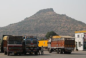
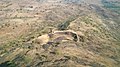
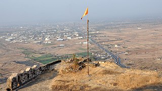
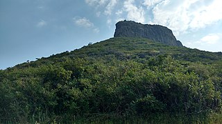
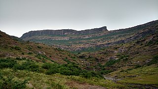
Galna was a major fort in Malegaon talukain in the south Khandesh area of Maharashtra, India. This fort was an important fort on the Burhanpur-Surat trade route. This is one of the forts in Maharashtra with the bastion and the entrance in good condition. This fort is located on hills between Malegaon and Dhule.
Indrai Fort / Indragiri Fort is a fort located 75 km from Nashik, in Nashik district, of Maharashtra. This fort though is an important fort in Nashik district but, it is less visited by the trekkers. In Chandwad taluka, there are 4 forts in a line on the Satmal hill range, the Chandwad fort, Indrai fort, Rajdher fort, and Koldher fort. This fort is easy to climb but requires 3 hours to reach the fort.

Vikatgad / Peb Fort is a fort located 19 km (12 mi) from Karjat, in Raigad district, of Maharashtra. This fort is in continuation with the Malang gad, Tauli Hill and Chanderi fort of the Matheran Hill Range. Vikatgad is a favourite destination for one-day trekkers. The trek path to Vikatgad is along deep ravines and cliffs. Its closeness to Matheran and Neral attracts many trekkers on weekends. The forest department and local villagers are doing plantation and some restoration works on the fort. The altitude of Vikatgad, also known as Peb fort is 640 meters above sea level.
Rajdeher Fort (Marathi: राजधेर किल्ला) is a fort located 10 km (6.2 mi) from chandwad, Nashik district, of Maharashtra. This fort is an important fort in Nashik district.

Hargad Fort is located in the Baglan area of Nashik district. There are two main hill ranges in Baglan area, the Selbari range is south of the Dolbari hill range. These two ranges run parallel to each other in east-west direction. Hargad is located on Selbari hill range. All these forts were maintained to keep watch on the Burhanpur-Surat ancient commercial road. The road passes between the two hill ranges. Hargad fort is a small fort, close to Mulher fort. These are key forts situated between fertile lands of Khandesh and port city of Surat.
Bitangad Fort is a fort in Nashik district in the Igatpuri taluka in Maharashtra state of India.
Dhunda Fort is located 106 km from Nashik, Nashik district, of Maharashtra.The Dhundya fort is located on a single hillock west of the road from Malegaon to Satana.
Mahipalgad Fort is a fort located 20 km (12 mi)from Belgaum. It is in the Chandgad taluka of Kolhapur district, of Maharashtra. This fort is an important fort in Kolhapur district. The fort is situated on the mountain ridge close to the line dividing Maharashtra and Karnataka state. The fort is amidst dense evergreen forest.
Pabargad Fort is a fort located 50 km (31 mi) from Igatpuri via Bhandardara. The fort is in Akole taluka in Ahmednagar district, of Maharashtra. The trek to this fort is difficult.