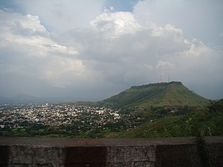
Satara is a city located in the Satara District of Maharashtra state of India, near the confluence of the river Krishna and its tributary, the Venna. The city was established in the 16th century and was the seat of the Chhatrapati of Maratha Empire, Shahu I.

Sinhagad is an ancient hill fortress located at around 49 km southwest of the city of Pune, India.

Pratapgad is a mountain fort located in Satara district, in the Western Indian state of Maharashtra. The fort is situated 24 kilometres from the Mahabaleshwar hill station. The fort is now a popular tourist destination.

Kolaba Fort located at Alibag beach is an old fortified maritime base in Alibag, Konkan, India. It is situated in the sea at a distance of 1–2 km from the shores of Alibag, 35 km south of Mumbai, in the Konkan region of Maharashtra, India. It is a popular tourist destination and a protected monument.
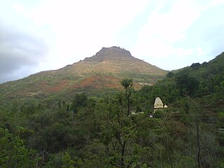
Mangalgad, also known as Kangori, is a fort in Maharashtra near the village of Dudhanewadi. Kangori, or Mangalgad Fort, is in the Mahad sub-division about eleven miles (18 km) east by south from Mahad town.

Ajinkyatara Fort, also known as the "Fort of the Sapta-Rishi," is a historical hill fort located on Ajinkyatara Mountain, one of the seven mountains surrounding the city of Satara in the Sahyadri Mountains of Maharashtra, India. Situated at an altitude of 3,300 feet, the fort overlooks Satara City and is considered one of the major heritage sites in Maharashtra.
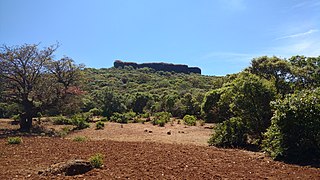
Kamalgad, also called Bhelanja or Kattalgad is a square hill fort in Wai Taluka in Maharashtra, India.

Panhala fort, is located in Panhala, 20 kilometres northwest of Kolhapur in Maharashtra, India. It is strategically located looking over a pass in the Sahyadri mountain range which was a major trade route from Bijapur in the interior of Maharashtra to the coastal areas. Due to its strategic location, it was the centre of several skirmishes in the Deccan involving the Marathas, the Mughals and the British East India Company, the most notable being the Battle of Pavan Khind. Here, the queen regent of Kolhapur, Tarabai Ranisaheb, spent her formative years. Several parts of the fort and the structures within are still intact. It is also called as the 'Fort of Snakes' as it is zigzagged in shape.
Kalyangad Fort/Nandgiri is in the taluka Koregaon of Satara district of Maharashtra. The fort stands at the end of a spur of the Mahadev range running south-west from the villages of Vikhale and Bhadle, eight miles north of Koregaon and about fourteen miles north-east of Satara. Its elevation is 3,537 feet above sea level.

Kenjalgad Fort in Wai, Maharashtra is a fort eleven miles (18 km) north-west of Wai. It is located on the Mandhardev spur of the Mahadev hill range. The fort is visible from quite a long distance as a stone scarp 30–40 feet high rising as a cap on the irregular hill. The fort is rhomboid in shape with 388m long axis and 175m short axis.
Banawadi is a census village of Satara district in the Indian state of Maharashtra. It is situated near to the Satara Phaltan state highway, about 21 km north of Satara, about 108 km from Pune and 220 km from Mumbai.

Ankai Fort is a historic site found in the Satmala Range hills in western India. It is located in Yeola Taluka of Nashik district in the state of Maharashtra. The fort was built by Yadava of Devgiri. Geographically, it is near Manmad. The Ankai fort and Tankai fort are two different forts on adjacent hills. A common fortification is constructed to secure both. The Ankai fort is located on a hill with perpendicular scarps on all the sides, except for a narrow nose on the eastern side.
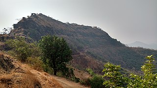
Rasalgad is a fort in the Maharashtra state of India. It lies 15 km east of Khed City. The fort has been developed as tourist attraction. Its fortification in good condition. The fort lied on a south end of a narrow spur which joins with Suamargad and Mahipatgad in the north direction. In 2003 the fort was declared a protected monument by the Archaeological Survey of India.

Vandan Fort is located in Satara District. This fort is situated on a hilly spur from the main ridge of Sahyadri. This fort is frequently visited by trekkers and pilgrims. The villages at the base are rich in sugarcane and other cultivation. The Chandan and Vandan are adjacent forts. The trek to both the fort can easily be completed in a day.

Vikatgad / Peb Fort is a fort located 19 km (12 mi) from Karjat, in Raigad district, of Maharashtra. This fort is in continuation with the Malang gad, Tauli Hill and Chanderi fort of the Matheran Hill Range. Vikatgad is a favourite destination for one-day trekkers. The trek path to Vikatgad is along deep ravines and cliffs. Its closeness to Matheran and Neral attracts many trekkers on weekends. The forest department and local villagers are doing plantation and some restoration works on the fort. The altitude of Vikatgad, also known as Peb fort is 640 meters above sea level.

Malegaon Fort is a land fort located in the town of Malegaon. It is located 104 km from Nashik, in Nashik district, of Maharashtra. The fort is on the north bank of the Mausam river, which is a tributary of the Girna river. It was built during the Maratha Empire.
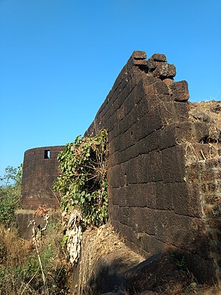
Gopalgad Fort / Anjanvel Fort is a fort located 51 km (32 mi) from Chiplun, in Ratnagiri district, of Maharashtra. This fort is an important fort in Ratnagiri district. The Fort is located on a prominent and commanding point for guarding the trade route along the Vashishti River, which runs till Govindgad near Chiplun and the Dabhol port which was a busy route in medieval times. It is a fort located on a hill near the sea.
Hatgad Fort is a fort located 71 km (44 mi)from Nashik, Nashik district, of Maharashtra. The base village is Hatgad on the Nashik-Saputara Road. The nearest town is Saputara, which is 6 km from Hatgad village. It is a historic monument located in Maharashtra, India, south of the hill station of Saputara and near the border with Gujarat. It was built by the Maratha king chhatrapati Shivaji Maharaj and is located at an elevation of about 3,600 feet. The way to reach the fort is through a trekking route via a narrow rocky path and car also go up to the stairs of fort. A statue of Lord Shivling is placed on the top of the fort.
Trymbakgad Fort/Brahmagiri Fort is a fort located 30 km from Nashik, in Nashik district, of Maharashtra, India. This is an important fort in Nashik district. It is located on a hill adjoining the famous Trimbakeshwar temple.
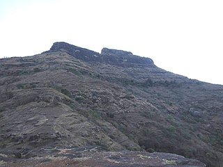
Chauler Fort is a small fort located 100 kilometres (62 mi) north of Nashik, in the Indian state of Maharashtra. This fort can be visited in a day from Nashik. The nearest town is Satana.


