Sarasgad fort is situated near village Pali in the Raigad district of Maharashtra. Pali lies about 10 kilometres East of Nagothane along the Nagothane-Khopoli road. This fort height from sea level is 490 meters
Khandas is a small village in Maharashtra India approximately 34 km from Karjat station.

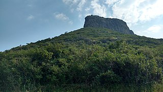
Kothaligad is a small fort (3100 ft) situated to the east of Karjat near Karjat-Murbad Road in the Indian state of Maharashtra. It is a famous trek in the Karjat area, because of its small height and easy climbing. It is also known as the Fort of Peth because of its vicinity to Peth village at its base.
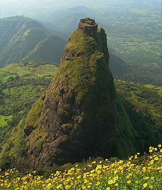
Kalavantin Durg is a 2,250 ft (686 m) high summit located in the Western Ghats, near the Prabalgad fort in the Raigad district of Maharashtra, India. It is also known as Kelve Teen, Kalavantinicha Sulka, or Kalavantin Pinnacle; alternative transliterations include Kalawantin, Kalavati, and Kalavanti. It is a popular trekking destination.

Tandulwadi Fort is located near Saphale, 104 km north of Mumbai. Tandulwadi is not a fully built up fort, but a series of structures spread over the top of the mountain. The fort dates back 800 years and was primarily used as a watch tower over the surrounding plains. At a height of 1524 feet, it has views of the surrounding towns of Saphale, the Zanzorli lake, and the confluence of the Surya and Vaitarna rivers.

Harihar fort / Harshagad is a fort located 40 km from Nashik City, 48 km from Igatpuri, 40 km from Ghoti in Nashik district, of Maharashtra, India. It is an important fort in Nashik district, and was constructed to look upon the trade route through Gonda Ghat. It receives many visitors because of its peculiar rock-cut steps.
Indrai Fort / Indragiri Fort is a fort located 75 km from Nashik, in Nashik district, of Maharashtra. This fort though is an important fort in Nashik district but, it is less visited by the trekkers. In Chandwad taluka, there are 4 forts in a line on the Satmal hill range, the Chandwad fort, Indrai fort, Rajdher fort, and Koldher fort. This fort is easy to climb but requires 3 hours to reach the fort.

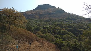
Vikatgad / Peb Fort is a fort located 19 km (12 mi) from Karjat, in Raigad district, of Maharashtra. This fort is in continuation with the Malang gad, Tauli Hill and Chanderi fort of the Matheran Hill Range. Vikatgad is a favourite destination for one-day trekkers. The trek path to Vikatgad is along deep ravines and cliffs. Its closeness to Matheran and Neral attracts many trekkers on weekends. The forest department and local villagers are doing plantation and some restoration works on the fort. The altitude of Vikatgad, also known as Peb fort is 640 meters above sea level.
Rajdeher Fort (Marathi: राजधेर किल्ला) is a fort located 10 km (6.2 mi) from chandwad, Nashik district, of Maharashtra. This fort is an important fort in Nashik district.

Asheri Fort / Asheri is a fort located 102 km from Mumbai and 88 km from Thane. It is in Palghar district, of Maharashtra. This fort is an important fort in Palghar district. The fort is located on the hills near Mendhavan Khind on Mumbai-Ahmedabad highway. The base village Khodkona is a very small tribal village. The Fort restoration is done by the local villagers.
Bankot Fort / Himmatgad Fort/ Fort Victoria is a fort located 47 km from Dapoli, in Ratnagiri district, of Maharashtra. This fort is an important fort in Ratnagiri district. The Fort is located on a prominent and commanding point for guarding the trade route along the Savitri River, which runs till, Mahad which was a busy route in medieval times. It is a fort located on a hill near the sea.

Hargad Fort is located in the Baglan area of Nashik district. There are two main hill ranges in Baglan area, the Selbari range is south of the Dolbari hill range. These two ranges run parallel to each other in east-west direction. Hargad is located on Selbari hill range. All these forts were maintained to keep watch on the Burhanpur-Surat ancient commercial road. The road passes between the two hill ranges. Hargad fort is a small fort, close to Mulher fort. These are key forts situated between fertile lands of Khandesh and port city of Surat.
Ghargad Fort / Gadgada Fort is a fort located 145 km from Mumbai, in Nashik district, of Maharashtra. This fort is less visited fort in Nashik district. This fort is quite difficult to climb.

Shivgad Fort is a fort located 89km from Kolhapur, in Kolhapur district, of Maharashtra. This fort was an important fort in Kolhapur district as a watch over for the Phonda ghat trade route from Kolhapur to coastal ports. The fort is surrounded by thick forest and hill slopes.
Tungi fort is a small 16th-century fort probably mainly used as a lookout post in the past. It is situated to the east of Karjat in the Indian state of Maharashtra. It is one of the easy-to-reach forts near the Bhimashanker trek route in the Karjat area.
Konkandiva Fort (transliteration: Konkandiva Qilа̄) is a fort located 70 km from Pune in Maharashtra. This fort is on the boundary of Raigad and Pune district. The fort was important as a surveillance fort to keep watch on the possible attack on the Raigad fort through Ghol Village side along the Mutha river.
Chandragad Fort / Dhavalgad Fort is a fort located 182 km from Mumbai, in raigad district, of Maharashtra. This fort was an important fort in raigad district as a watch over for the Varandha Ghattrade routes from Bhor to kokan. The fort is surrounded by forest and hill slopes.
Dategad Fort is a small fort located 75 kilometres (47 mi) South of Satara, in the Maharashtra state of India. This fort can be visited in a day from Satara. The nearest town is Patan. The base village is Tolewadi from where an easy trek of 45 minutes leads to the entrance of the fort.
Dermal Fort is a fort located 125 mi (201 km) from Nashik, in the Nashik district of Maharashtra, India. Though this fort is an important fort in Nashik district, it is less visited by trekkers. In Satana taluka, there are four forts in a line on the Galna hill range, the Pisola fort, Dermal fort, Kankrala fort and Galna fort. This fort is easy to climb but requires two hour to reach the fort. There are very few remains of old buildings on the fort.
Pabargad Fort is a fort located 50 km (31 mi) from Igatpuri via Bhandardara. The fort is in Akole taluka in Ahmednagar district, of Maharashtra. The trek to this fort is difficult.
