Gondwana is a region of India, named after the Gondi people who live there. The name of the ancient continent of Gondwanaland was derived from Gondwana, because some of the earliest rock formations of this continent were first investigated in part of the region, in modern Odisha.

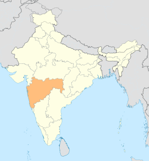
Vidarbha is a geographical region and a proposed state of central India and is now the eastern region of the Indian state of Maharashtra, comprising Nagpur Division and Amravati Division. Amravati Division's former name is Berar. It occupies 31.6% of the total area and holds 21.3% of the total population of Maharashtra. It borders the state of Madhya Pradesh to the north, Chhattisgarh to the east, Telangana to the south and Marathwada and North Maharashtra regions of Maharashtra to the west. Situated in central India. The largest city in Vidarbha is Nagpur followed by Amravati, Akola, and Chandrapur. A majority of Vidarbhians speak Varhadi and Zadi dialects of Marathi.

Yavatmal districtpronunciation (help·info), [jəʋət̪maːɭ] formerly known as Yeotmal, is a district of the Indian state of Maharashtra. It is located in the region of Vidarbha, in the east-central part of the state. It is Vidarbha's third-largest district by population, after Nagpur and Amravati. Yavatmal city is the administrative headquarters of the district.
Wardhapronunciation (help·info) is a city and a municipal council in Wardha district in the Indian state of Maharashtra. It is the administrative headquarters of Wardha district. Wardha gets its name from the Wardha River which flows at the north, west and south boundaries of the district. Founded in 1866, the town is now an important centre for the cotton trade. It was an important part of the Gandhian era.

Chandrapur district is a district in the Nagpur Division in the Indian state of Maharashtra. Chandrapur was the largest district in India until the Gadchiroli and Sironcha tehsils were separated as Gadchiroli district in 1981. In 2011, the district population was 2,204,307.

Chandrapur is a city and a municipal corporation in Chandrapur district, Maharashtra state, India. It is the district headquarters of Chandrapur district. Chandrapur is a fort city founded by Khandkya Ballal Sah, a Gond king of the 13th century. The city sits at the confluence of the Erai river and Zarpat river. The area around the city is rich in coal seams.. Hence, Chandrapur is also known as the "Black Gold City".
Gadchiroli is a city and a municipal council in Gadchiroli district in the state of Maharashtra, central India. It is located on eastern side of Maharashtra, and is the administrative headquarters of the district. Gadchiroli is called a lung of Maharashtra as it has almost 35% of this district has forest cover. The main river flowing through city is the Wainganga River. The landscape is lush and green during the monsoon season which is prone to flooding. Gadchiroli is known for its forests. Teak is grown commercially and bamboos are used for various crafts.
Ballarpur is a city and a municipal council in Chandrapur district in the state of Maharashtra, India. It is the second largest city in the district.
Manikgad / is an ancient fort in Chandrapur district, Maharashtra. It is a hill fort 507 metres above sea level built by the Naga kings in 9 CE. The fort is in ruins and is frequented by wild animals that live in the vicinity, such as panthers and boars. Several monuments of historical importance are nearby.
Chimur is a city and a municipal council in Chandrapur District, in the state of Maharashtra, India. It is one of the Indian Parliamentary Constituencies and a Vidhan Sabha constituency.

Sirpur (T) is a town and a mandal in Komaram Bheem district of the Indian state of Telangana.
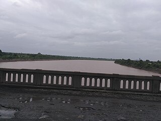
The Painganga River is the chief river of the Buldhana district, Hingoli district, Nanded district, Yavatmal district, Chandrapur district and Washim district in the Maharashtra state in India. It flows along the southeast boundaries of the district in a winding, meandering course. It is deeply entrenched and difficult to navigate. It rises in the Ajantha range and is a major tributary of the Wardha River, the other major river in the district. It is also divided Marathwada and Vidarbha near Umarkhed.
Maharashtra is famous for its varied fresh water resources, including lakes, tanks and rivers. A number of fishing communities have developed in response to these favorable factors. These communities can be divided into:
Arni is a town with & tehsil in Yavatmal district of Maharashtra State in India. It is situated on the banks of the Arunavati River. It Connected with National Highway-361. Nearest Railway Station is a Dhamangaon which is located 90 km approx & Nearest Airport is a Dr.Babasaheb Ambedkar International Airport, Nagpur is around 187 km from Arni.

Gowari is an Indian caste of cattleman or herdsmen, predominantly living in Maharashtra, Madhya Pradesh and Chhattisgarh. The number of scheduled tribal groups in India is more than 700. In which Gowari was also kept. In the censuses conducted in India from 1871 to 1941, tribals have been counted as a separate religion from other religions, such as Other religion-1871, Aboriginal 1881, Forest Tribe-1891, Animist-1901, Animist-1911, Primitive-1921, Tribal Religion -1931, "Tribe-1941" etc. have been described. However, after the 1951 census, tribals have been counted in Hinduism. Despite occasional errors in the literature, they do not speak a distinct language. Gowari The principal deities of the Gowāris are the Kode Kodwan or deified ancestors. They are worshipped at the annual festivals, and also at weddings.

Balharshah Junction railway station is a railway station serving Ballarpur town, in Chandrapur district of Maharashtra state in India. Established by the Nizam's Guaranteed State Railway, it is now under the Nagpur CR railway division of Central Railway Zone of Indian Railways. It is an important junction on New Delhi–Chennai main line of Indian Railways. It is located at 185 m above sea level and has 5 platforms. The Ballarshah–Wardha–Nagpur section was electrified in 1989.
Suresh Narayan Dhanorkar, also called Balubhau Dhanorkar, is the newly elected member of Lok Sabha from Chandrapur constituency. He belongs to the Indian National Congress political party. He is the only candidate for Indian national Congress to be elected as MP from Maharashtra. He was nominated as the Lok Sabha candidate after resigning as MLA from Shiv Sena and joined the Indian National Congress Party
Gondwana Kingdom was the ruling kingdom in Gondwana region of India. The Gondwana region includes core region of eastern part of the Vidarbha of Maharashtra, Garha Kingdom the parts of Madhya Pradesh immediately to the north of it, and parts of the west of Chhattisgarh. The wider region extends beyond these, also including parts of northern Telangana, western Odisha and southern Uttar Pradesh.

Vairagad is a small fort situated in the Gadchiroli district district of Maharashtra, India, at the confluence of rivers Khobragadhi and Satnalas. The small dusty village of same name is adjacent to the fort. The fort is situated 180 km from Nagpur and 80 km from Chandrapur.
The Kingdom of Chanda was one of the main Gond kingdoms, ruling parts of central India. In 1751, it was conquered by the Maratha ruler of Nagpur, Raghoji I Bhonsle.

