Nashik district, also known as Nasik district, is a district in Maharashtra, India. The city of Nashik is the administrative headquarters of the district. Nashik is well known for the production of wine. Nashik is also known as Mini Maharashtra, because the climate and soil conditions of Surgana, Peth, Igatpuri resembles with Konkan. Niphad, Sinnar, Dindori, Baglan blocks are like Western Maharashtra and Yeola, Nandgaon, Chandwad blocks are like Vidarbha Region. Nashik is the biggest city in the district while Malegaon is the second biggest city. Manmad, Igatpuri, sinnar are some of the big cities situated in the Nashik District. Manmad is one of the biggest railway junction in india while the city of Malegaon is famous for its powerloom.

Kolaba Fort located at Alibag beach is an old fortified maritime base in Alibaug, Konkan, India. It is situated in the sea at a distance of 1–2 km from the shores of Alibag, 35 km south of Mumbai, in the Konkan region of Maharashtra, India. It is a popular tourist destination and a protected monument.
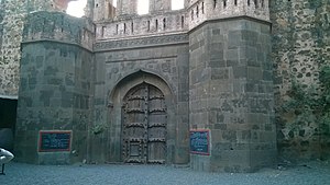
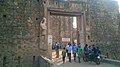
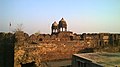
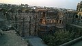
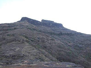
Ramsej or Ramshej Fort is a small fort located 10 kilometres (6.2 mi) north-west of Nashik, in the Indian state of Maharashtra. Lord Rama stayed in the fort for a short time while traveling to Sri Lanka. The fort is located on the Nashik-Vapi route.
Gowalkot is a small fort located on the southern bank of Vashishti River, about 10.0 km (6.2 mi) from Chiplun in Maharashtra, India. This fort is guarded by the river on three sides and a trench on the fourth side. Its population which includes Hindus, Muslims, and Buddhists. According to old natives of Gowalkot, the history of Gowalkot goes back to a King, who was Hindu and finally was converted in Muslim, his surname was "Chougle", and most of the land in Gowalkot is owned by the Chougle family. All other owner of land in Gowalkot must have either received the land as gift [or bought] from Chougle family must have lost in "kul kaida" a rule by the government.

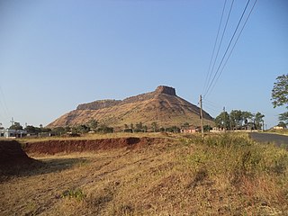
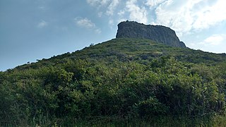
Ankai Fort is a historic site found in the Satmala Range hills in western India. It is located in Yeola Taluka of Nashik district in the state of Maharashtra. The fort was built by Yadava of Devgiri. Geographically, it is near Manmad. The Ankai fort and Tankai fort are two different forts on adjacent hills. A common fortification is constructed to secure both. The Ankai fort is located on a hill with perpendicular scarps on all the sides, except for a narrow nose on the eastern side.
Rasalgad is a fort in the Maharashtra state of India. It lies 15 km east of Khed City. The fort has been developed as tourist attraction. Its fortification in good condition. The fort lied on a south end of a narrow spur which joins with Suamargad and Mahipatgad in the north direction. In 2003 the fort was declared a protected monument by the Archaeological Survey of India.
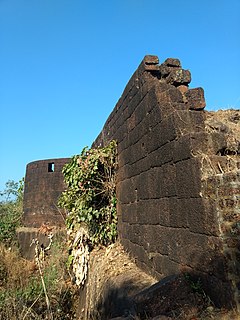
It is a fort located in malegaon taluka Galna was a major fort in the south Khandesh area of Maharashtra, India. This fort was an important fort on the Burhanpur -Surat trade route. This is one of the forts in Maharashtra with the bastion and the entrance in good condition. This fort is located on hills between Malegaon and Dhule.
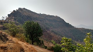
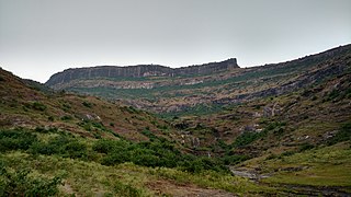
Indrai Fort / Indragiri Fort is a fort located 75 km from Nashik, in Nashik district, of Maharashtra. This fort though is an important fort in Nashik district but, it is less visited by the trekkers. In Chandwad taluka, there are 4 forts in a line on the Satmal hill range, the Chandwad fort, Indrai fort, Rajdher fort, and Koldher fort. This fort is easy to climb but requires 3 hours to reach the fort.
Rajdeher Fort (Marathi: राजधेर किल्ला) is a fort located 10 km (6.2 mi) from chandwad, Nashik district, of Maharashtra. This fort is an important fort in Nashik district.
Ahivant Fort is a fort located 55km from Nashik, in Nashik district, of Maharashtra. This fort is an important fort in Nashik district. The three forts Achala, Ahivant, and Mohandar are very close by. The other two forts were constructed to guard the Ahivant fort.
Gopalgad Fort / Anjanvel Fort is a fort located 51 km (32 mi) from Chiplun, in Ratnagiri district, of Maharashtra. This fort is an important fort in Ratnagiri district. The Fort is located on a prominent and commanding point for guarding the trade route along the Vashishti River, which runs till Govindgad near Chiplun and the Dabhol port which was a busy route in medieval times. It is a fort located on a hill near the sea.
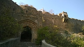
Hatgad Fort is a fort located 71 km (44 mi)from Nashik, Nashik district, of Maharashtra. The base village is Hatgad on the Nashik-Saputara Road. The nearest town is Saputara, which is 6 km from Hatgad village. It is a historic monument located in Maharashtra, India, south of the hill station of Saputara and near the border with Gujarat. It was built by the Maratha king Shivaji and is located at an elevation of about 3,600 feet. The way to reach the fort is through a trekking route via a narrow rocky path and car also go up to the stairs of fort. A statue of Lord Shivling is placed on the top of the fort.
Trymbakgad Fort/Brahmagiri Fort is a fort located 30 km from Nashik, in Nashik district, of Maharashtra, India. This is an important fort in Nashik district. It is located on a hill adjoining the famous Trimbakeshwar temple.

Hargad fort is located in the Baglan area of Nashik district. There are two main hill ranges in Baglan area, the Selbari range is south of the Dolbari hill range. These two ranges run parallel to each other in east-west direction. Hargad is located on Selbari hill range. All these forts were maintained to keep watch on the Burhanpur-Surat ancient commercial road. The road passes between the two hill ranges. Hargad fort is a small fort, close to Mulher fort. These are key forts situated between fertile lands of Khandesh and port city of Surat.
Ghargad Fort / Gadgada Fort is a fort located 145 km from Mumbai, in Nashik district, of Maharashtra. This fort is less visited fort in Nashik district. This fort is quiet difficult to climb.
Javlya Fort is located 43 km from Nashik, Nashik district, of Maharashtra. Ravlya fort and Javlya fort are twin forts located on a single hill plateau, Ravlya on the west and Javlya on the east side of the hill plateau.
Ravalya Fort is located 43 km from Nashik, Nashik district, of Maharashtra. The Ravlya fort and Javlya fort are twin forts located on a single hill plateau. Ravlya on the west and the Javlya on the east side of the hill plateau.
Bahadurgad is a fort in the Pedgaon village of Ahmednagar district in Maharashtra, India.
Chauler Fort is a small fort located 100 kilometres (62 mi) north of Nashik, in the Indian state of Maharashtra. This fort can be visited in a day from Nashik. The nearest town is Satana.
Ratnagiri Fort may refer to either of these forts in India: