
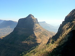
Tikona also known as Vitandgad) is the dominant hill fort in Maval in western India. It is located near Kamshet around 60 km from Pune. The village nearest to the fort is called Tikona-Peth. The 3500 ft high hill is pyramidal in shape and the name Tikona means "triangular".

Rohida fort / Vichitragad Fort is a fort located 10 km from Bhor, Pune district, of Maharashtra. This fort is an important fort in Pune district. The fort restoration is done by the Shree Shivdurga Samvardhan committee with the help of forest dept. and local villagers.

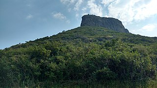
Kenjalgad Fort in Wai, Maharashtra is a fort eleven miles (18 km) north-west of Wai. It is located on the Mandhardev spur of the Mahadev hill range. The fort is visible from quite a long distance as a stone scarp 30–40 feet high rising as a cap on the irregular hill. The fort is rhomboid in shape with 388m long axis and 175m short axis.

Ankai Fort is a historic site found in the Satmala Range hills in western India. It is located in Yeola Taluka of Nashik district in the state of Maharashtra. Geographically, it is near Manmad. The Ankai fort and Tankai fort are two different forts on adjacent hills. A common fortification is constructed to secure both. The Ankai fort is located on a hill with perpendicular scarps on all the sides, except for a narrow nose on the eastern side.

Sankshi Fort सांक्शी किल्ला This fort is located in Pen Taluka of Raigad district of Maharashtra. It is 9 kilometres (5.6 mi) from Pen.

Mahipatgad is a hill fort situated on the east of the Khed. It is one of the largest forts in Maharashtra, with an area of 120 acres. This fort is located 19 km from the Khed City. The Mahipatgad. Suamargad and Rasalgad are situated on a same spur 8 km long, which runs parallel to the western ghats. The Mahipatgad is on the northernmost end of the spur. The altitude of Mahipatgad is 3090 feet.

Mora fort is located in the Baglan area of Nashik district. There are two main hill ranges in Baglan area, the Selbari range is south of the Dolbari hill range. These two ranges run parallel to each other in east-west direction. Moragad is located on Selbari hill range. All these forts were maintained to keep watch on the Burhanpur-Surat ancient commercial road. The road passes between the two hill ranges. Mora fort is a small fort, east of Mulher fort.

Hadsar fort is among the many forts in Junnar region of Pune district which were meant for protection of the ancient commercial trade route from Mawal region to Kalyan via Naneghat. There is a marvelous sculpture design of the bastion and the fort entrance, which is not seen elsewhere. They are all carved from a single rock.

Tringalwadi fort is located in the Igatpuri taluka of Nashik district. It is located on the ancient trade route passing through Thal ghat. The fort is located near village Tringalwadi. The Tringalwadi irrigation dam which is close to the village was built in 1978
Salota fort is a hill fort in Maharashtra, India. It is located in the Baglan region of Nashik. It lies close to the Salher fort.

Bhaskargad fort / Basgad Fort is a fort located 48 km from Igatpuri, Nashik district, of Maharashtra. This fort is one of the fort in Trimbak hill range. This fort is near to the Harihar fort.
Indrai Fort / Indragiri Fort is a fort located 75 km from Nashik, in Nashik district, of Maharashtra. This fort though is an important fort in Nashik district but, it is less visited by the trekkers. In Chandwad taluka, there are 4 forts in a line on the Satmal hill range, the Chandwad fort, Indrai fort, Rajdher fort, and Koldher fort. This fort is easy to climb but requires 3 hours to reach the fort.

Peb Fort / Vikatgad Fortis a fort located 19km from Karjat, in Raigad district, of Maharashtra. This fort is in continuation with the Malang gad, Tauli Hill and Chanderi fort of the Matheran Hill Range. Vikatgad is a favourite destination for one-day trekkers. The trek path to Vikatgad is along deep ravines and cliffs. Its closeness to Matheran and Neral attracts many trekkers on weekends. The forest department and local villagers are doing plantation and some restoration works on the fort.
Ahivant Fort is a fort located 55km from Nashik, in Nashik district, of Maharashtra. This fort is an important fort in Nashik district. The three forts Achala, Ahivant, and Mohandar are very close by. The other two forts were constructed to guard the Ahivant fort. Captain Briggs has described it as a large and shapeless hill, remarkably bleak and unhealthy

Hargad fort is located in the Baglan area of Nashik district. There are two main hill ranges in Baglan area, the Selbari range is south of the Dolbari hill range. These two ranges run parallel to each other in east-west direction. Hargad is located on Selbari hill range. All these forts were maintained to keep watch on the Burhanpur-Surat ancient commercial road. The road passes between the two hill ranges. Hargad fort is a small fort, close to Mulher fort. These are key forts situated between fertile lands of Khandesh and port city of Surat.
Bitangad Fort is a fort in Nashik district in the Igatpuri taluka in Maharashtra state of India.
Kurdugad Fort is a fort located 143 km (89 mi) from Mumbai and 113km from Pune in Raigad district, of Maharashtra. This fort was an important fort in Raigad district as a watch over for the trade route from Pune to coastal ports. The fort is surrounded by thick forest and hill slopes.
Dermal Fort is a fort located 125 mi (201 km) from Nashik, in the Nashik district of Maharashtra, India. Though this fort is an important fort in Nashik district, it is less visited by trekkers. In Satana taluka, there are four forts in a line on the Galna hill range, the Pisola fort, Dermal fort, Kankrala fort and Galna fort. This fort is easy to climb but requires two hour to reach the fort. There are very few remains of old buildings on the fort.

Mohandar Fort / Shidaka fort is a fort located 55 km from Nashik, in Nashik district, of Maharashtra, India. This fort is an important fort in Nashik district. The three forts Achala, Ahivant, and Mohandar are very close by. This fort was constructed to guard the Ahivant fort. This fort can be seen from a long distance due to the presence of needle hole in the cliff below this fort.
Pabargad Fort is a fort located 50 km (31 mi) from Igatpuri via Bhandardara. The fort is in Akole taluka in Ahmednagar district, of Maharashtra. The trek to this fort is difficult.


