Bajawa Soa Airport

Last updated
Bajawa Soa Airport

Bandar Udara Soa
Summary
Location Bajawa, Indonesia
Time zone WITA (UTC+08:00)
Elevation  AMSL 4,326 ft / 1,319 m
Coordinates 8°42′31″S121°03′28″E / 8.708612°S 121.057901°E
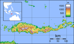
 / -8.708612; 121.057901
Map
Flores Locator Topography.png
Airplane silhouette.svg
BJW
Location in Flores
Indonesia Lesser Sunda Islands location map.svg
Airplane silhouette.svg
BJW
Location in the Lesser Sunda Islands
Indonesia location map.svg
Airplane silhouette.svg
BJW
Location in Indonesia
Runways
Direction LengthSurface
ftm
10/285,9051,800Asphalt

Bajawa Soa Airport, or Bajawa, Turelelo-Soa Airport,[ citation needed ] is located in Bajawa, Indonesia. [1] [2] [3]

Contents

Airlines and destinations

AirlinesDestinations
Wings Air Kupang [4] , Labuan Bajo [5]

Incidents

References

  1. "Paper Stack". Archived from the original on 2016-03-04. Retrieved 2012-11-22.
  2. "BJW - Bajawa Soa Airport Current Weather and Airport Delay Conditions". FlightStats.
  3. "Padhameleda - Indonesia". World Airport Codes.
  4. "Flight history for Wings Air flight IW1926". flightradar24.com. Retrieved 16 September 2025.
  5. "Flight history for Wings Air flight IW1927". flightradar24.com. Retrieved 16 September 2025.
  6. "District Head Denied Seat on Full Flight, Bars Airline from Airport - the Jakarta Globe". Archived from the original on 2013-12-24. Retrieved 2013-12-23.
  7. "Lawmakers Urge Sanctions Against District Head Who Closed NTT Airport - the Jakarta Globe". Archived from the original on 2013-12-24. Retrieved 2013-12-23.