Ambivere is a comune (municipality) in the Province of Bergamo in the Italian region of Lombardy, located about 40 kilometres (25 mi) northeast of Milan and about 9 kilometres (6 mi) west of Bergamo. As of 31 December 2004, it had a population of 2,265 and an area of 3.2 square kilometres (1.2 sq mi).

Boltiere is a comune (municipality) in the Province of Bergamo in the Italian region of Lombardy, located about 35 kilometres (22 mi) northeast of Milan and about 13 kilometres (8 mi) southwest of Bergamo. As of 31 December 2004, it had a population of 4,695 and an area of 4.1 square kilometres (1.6 sq mi).
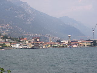
Castro is a comune (municipality) in the Province of Bergamo in the Italian region of Lombardy, located about 80 kilometres (50 mi) northeast of Milan and about 35 kilometres (22 mi) northeast of Bergamo on the western side of the lake Iseo. As of 31 December 2004, it had a population of 1,449 and an area of 3.5 square kilometres (1.4 sq mi).

Foresto Sparso is a comune (municipality) in the Province of Bergamo in the Italian region of Lombardy, located about 60 kilometres (37 mi) northeast of Milan and about 20 kilometres (12 mi) east of Bergamo. As of 31 December 2004, it had a population of 2,983 and an area of 7.7 square kilometres (3.0 sq mi).

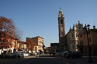
Ghisalba is a comune (municipality) in the Province of Bergamo in the Italian region of Lombardy, located about 50 kilometres (31 mi) northeast of Milan and about 13 kilometres (8 mi) southeast of Bergamo. As of 31 December 2010, it had a population of 5,967 and an area of 10.2 square kilometres (3.9 sq mi).

Gorle is a comune (municipality) in the Province of Bergamo in the Italian region of Lombardy, located about 50 kilometres (31 mi) northeast of Milan and about 4 kilometres (2 mi) east of Bergamo. As of 31 December 2004, it had a population of 5,506 and an area of 2.4 square kilometres (0.93 sq mi).
Luzzana is a comune (municipality) in the Province of Bergamo in the Italian region of Lombardy, located about 60 kilometres (37 mi) northeast of Milan and about 15 kilometres (9 mi) east of Bergamo. As of 31 December 2004, it had a population of 776 and an area of 3.4 square kilometres (1.3 sq mi).

Mozzo is a comune (municipality) in the Province of Bergamo in the Italian region of Lombardy, located about 45 kilometres (28 mi) northeast of Milan and about 5 kilometres (3 mi) west of Bergamo. As of 31 December 2004, it had a population of 7,202 and an area of 3.6 square kilometres (1.4 sq mi).
Osio Sotto is a comune (municipality) in the Province of Bergamo in the Italian region of Lombardy, located about 40 kilometres (25 mi) northeast of Milan and about 11 kilometres (7 mi) southwest of Bergamo. As of 31 December 2004, it had a population of 11,097 and an area of 7.5 square kilometres (2.9 sq mi).

Paladina is a comune (municipality) in the Province of Bergamo in the Italian region of Lombardy, located about 45 kilometres (28 mi) northeast of Milan and about 5 kilometres (3 mi) northwest of Bergamo.

Palazzago is a comune (municipality) in the Province of Bergamo in the Italian region of Lombardy, located about 45 kilometres (28 mi) northeast of Milan and about 12 kilometres (7 mi) northwest of Bergamo. As of 31 December 2004, it had a population of 3,658 and an area of 14.0 square kilometres (5.4 sq mi).

Parzanica is a comune (municipality) in the Province of Bergamo in the Italian region of Lombardy, located about 70 kilometres (43 mi) northeast of Milan and about 30 kilometres (19 mi) east of Bergamo. As of 31 December 2004, it had a population of 365 and an area of 10.8 square kilometres (4.2 sq mi).

Pedrengo is a comune (municipality) in the Province of Bergamo in the Italian region of Lombardy, located about 50 kilometres (31 mi) northeast of Milan and about 5 kilometres (3 mi) east of Bergamo. As of 31 December 2004, it had a population of 5,321 and an area of 3.6 square kilometres (1.4 sq mi).
Ponteranica is a comune (municipality) in the Province of Bergamo in the Italian region of Lombardy, located about 50 kilometres (31 mi) northeast of Milan and about 4 kilometres (2 mi) northwest of Bergamo. As of 31 December 2004, it had a population of 6,866 and an area of 8.4 square kilometres (3.2 sq mi).

Premolo is a comune (municipality) in the Province of Bergamo in the Italian region of Lombardy, located about 70 kilometres (43 mi) northeast of Milan and about 25 kilometres (16 mi) northeast of Bergamo. As of 31 December 2004, it had a population of 1,094 and an area of 18.3 square kilometres (7.1 sq mi).

Pumenengo is a comune (municipality) in the Province of Bergamo in the Italian region of Lombardy, located about 50 kilometres (31 mi) east of Milan and about 30 kilometres (19 mi) southeast of Bergamo. As of 31 December 2004, it had a population of 1,512 and an area of 10.1 square kilometres (3.9 sq mi).

Santa Brigida is a comune (municipality) in the Province of Bergamo in the Italian region of Lombardy, located about 70 kilometres (43 mi) northeast of Milan and about 30 kilometres (19 mi) north of Bergamo. As of 31 December 2004, it had a population of 623 and an area of 14.2 square kilometres (5.5 sq mi).

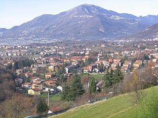
Sorisole is a comune (municipality) in the Province of Bergamo in the Italian region of Lombardy, located about 50 kilometres (31 mi) northeast of Milan and about 4 kilometres (2 mi) north of Bergamo. As of 31 December 2004, it had a population of 8,507 and an area of 12.3 square kilometres (4.7 sq mi).

Valbrembo is a comune (municipality) in the Province of Bergamo in the Italian region of Lombardy, located about 45 kilometres (28 mi) northeast of Milan and about 4 kilometres (2 mi) northwest of Bergamo. As of 31 December 2004, it had a population of 3,584 and an area of 3.7 square kilometres (1.4 sq mi).

Viadanica is a comune (municipality) in the Province of Bergamo in the Italian region of Lombardy, located about 70 kilometres (43 mi) northeast of Milan and about 25 kilometres (16 mi) east of Bergamo. As of 31 December 2004, it had a population of 1,093 and an area of 5.4 square kilometres (2.1 sq mi).