| Piario | |
|---|---|
| Comune | |
| Comune di Piario | |
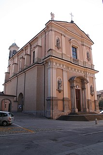
Church | |
 Piario Location of Piario in Italy | |
| Coordinates: 45°54′N9°55′E / 45.900°N 9.917°E Coordinates: 45°54′N9°55′E / 45.900°N 9.917°E | |
| Country | Italy |
| Region | Lombardy |
| Province | Province of Bergamo (BG) |
| Frazioni | Groppino |
| Area | |
| • Total | 1.5 km2 (0.6 sq mi) |
| Elevation | 539 m (1,768 ft) |
| Population (Dec. 2004) | |
| • Total | 990 |
| • Density | 660/km2 (1,700/sq mi) |
| Demonym(s) | Piariesi |
| Time zone | CET (UTC+1) |
| • Summer (DST) | CEST (UTC+2) |
| Postal code | 24020 |
| Dialing code | 0346 |
| Website | Official website |


Piario is a comune (municipality) in the Province of Bergamo in the Italian region of Lombardy, located about 80 kilometres (50 mi) northeast of Milan and about 30 kilometres (19 mi) northeast of Bergamo. As of 31 December 2004, it had a population of 990 and an area of 1.5 square kilometres (0.58 sq mi). [1]

The comune is a basic administrative division in Italy, roughly equivalent to a township or municipality.

The Province of Bergamo is a province in the Lombardy region of Italy. It has a population of 1,112,187 (2017), an area of 2,754.91 square kilometers (1,063.68 sq mi), and contains 243 comuni. Its capital is the city of Bergamo.

Italy, officially the Italian Republic, is a European country consisting of a peninsula delimited by the Italian Alps and surrounded by several islands. Located in the middle of the Mediterranean sea and traversed along its length by the Apennines, Italy has a largely temperate seasonal climate. The country covers an area of 301,340 km2 (116,350 sq mi) and shares open land borders with France, Slovenia, Austria, Switzerland and the enclaved microstates of Vatican City and San Marino. Italy has a territorial exclave in Switzerland (Campione) and a maritime exclave in the Tunisian sea (Lampedusa). With around 60 million inhabitants, Italy is the fourth-most populous member state of the European Union.
Contents
The municipality of Piario contains the frazione (subdivision) Groppino.
"Frazione" is the Italian name given in administrative law to a type of territorial subdivision of a comune; for other administrative divisions, see municipio, circoscrizione, quartiere. It is cognate to the English word fraction, but in practice is roughly equivalent to "parishes" or "wards" in other countries.
Piario borders the following municipalities: Clusone, Parre, Villa d'Ogna.

Clusone is an Italian town and comune in the province of Bergamo, Lombardy, Italy. Located in the Val Seriana, it received the honorary title of city on 15 May 1957 with a presidential decree which ratified a Napoleon's promise of the year 1801.

Parre is a comune (municipality) in the Province of Bergamo in the Italian region of Lombardy, located about 70 kilometres (43 mi) northeast of Milan and about 25 kilometres (16 mi) northeast of Bergamo. As of 31 December 2004, it had a population of 2,821 and an area of 22.5 square kilometres (8.7 sq mi).

Villa d'Ogna is a comune (municipality) in the Province of Bergamo in the Italian region of Lombardy, located about 80 kilometres (50 mi) northeast of Milan and about 30 kilometres (19 mi) northeast of Bergamo. As of 31 December 2004, it had a population of 1,891 and an area of 5.2 square kilometres (2.0 sq mi).