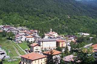
Incudine is a town and comune in the province of Brescia, in Lombardy, northern Italy.

Monterotondo is a town and comune in the Metropolitan City of Rome, central Italy.

Angri is a town and comune in the province of Salerno, Campania, southern Italy. It is around 15 miles (24 km) northwest of the town of Salerno.
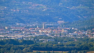
Arzignano is an industrial town and comune in the Province of Vicenza in Veneto, Italy. It is located c. 23 kilometres (14 mi) from Vicenza, in the Valle del Chiampo.

Pagani is a town and comune in Campania, Italy, administratively part of the Province of Salerno, in the region known as the Agro Nocerino Sarnese. Pagani has a population of 35,834, as of 2016.
San Cesareo is a town and comune in the Metropolitan City of Rome. In ancient times, it was on the Via Labicana or Via Latina, 29 kilometres (18 mi) from Rome.

Castelfidardo is a town and comune in the province of Ancona, in the Marche region of central-eastern Italy.

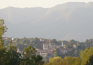
Sommacampagna is a town and comune in the province of Verona, Veneto, northern Italy. As of 2017, its population was of 14,746.
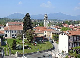
Besozzo is a town and municipality located in the province of Varese, in the Lombardy region of northern Italy. Besozzo hosts a small historical centre with churches and noble houses, so-called Palazzi, in its upper part which is in part pedestrian zone, and a vivid modern centre with shops, cafes, banks etc. in its lower part. The village is situated in the region of the lakes, with Lago Maggiore being only 6 kilometres (4 mi) away, and features views of the Alps.

Sapri is a town and comune in the province of Salerno in the Campania region of south-western Italy. It is one of the southernmost towns of the region of Cilento and its population is 6,783.
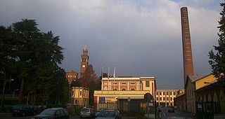
Castellanza is a town and comune located in the province of Varese, along the boundary of the province of Milan, in the Lombardy region of northern Italy.

Castrovillari is a town and comune in the province of Cosenza in the Calabria region of southern Italy.
Rogliano is a town and comune in the province of Cosenza in the Calabria region of southern Italy. It's located in the Savuto Valley. It was mostly destroyed in a violent earthquake in 1638. The town is 19 kilometers (12 mi) from Cosenza.
Brebbia is a comune (municipality) in the Province of Varese in the Italian region Lombardy, located about 60 kilometres (37 mi) northwest of Milan and about 14 kilometres (9 mi) west of Varese.

Antegnate is a comune (municipality) in the Province of Bergamo in the Italian region of Lombardy, located about 50 kilometres (31 mi) east of Milan and about 25 kilometres (16 mi) southeast of Bergamo.

Covo is a comune (municipality) in the Province of Bergamo in the Italian region of Lombardy, located about 45 kilometres (28 mi) east of Milan and about 25 kilometres (16 mi) southeast of Bergamo. As of 31 December 2021, it had a population of 4,218 and an area of 12.7 square kilometres (4.9 sq mi).

Fontanella is a comune (municipality) in the Province of Bergamo in the Italian region of Lombardy, located about 50 kilometres (31 mi) east of Milan and about 30 kilometres (19 mi) southeast of Bergamo. As of 31 December 2004, it had a population of 3,773 and an area of 17.9 square kilometres (6.9 sq mi).

Urgnano is a comune (municipality) in the Province of Bergamo in the Italian region of Lombardy, located about 45 kilometres (28 mi) northeast of Milan and about 11 kilometres (7 mi) south of Bergamo. As of 31 December 2004, it had a population of 8,704 and an area of 14.0 square kilometres (5.4 sq mi).

Bagnoli di Sopra is a comune (municipality) in the Province of Padua in the Italian region Veneto, located about 45 kilometres (28 mi) southwest of Venice and about 25 kilometres (16 mi) south of Padua. As of 31 December 2004, it had a population of 3,837 and an area of 34.9 square kilometres (13.5 sq mi).
Gratteri is a comune (municipality) in the Metropolitan City of Palermo in the Italian region Sicily, located about 60 kilometres (37 mi) southeast of Palermo. As of 31 December 2004, it had a population of 1,050 and an area of 38.4 square kilometres (14.8 sq mi).