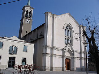
Ambivere is a comune (municipality) in the Province of Bergamo in the Italian region of Lombardy, located about 40 kilometres (25 mi) northeast of Milan and about 9 kilometres (6 mi) west of Bergamo. As of 31 December 2004, it had a population of 2,265 and an area of 3.2 square kilometres (1.2 sq mi).

Barzana is a comune (municipality) in the Province of Bergamo in the Italian region of Lombardy, located about 45 kilometres (28 mi) northeast of Milan and about 9 kilometres (6 mi) northwest of Bergamo. As of 31 December 2004, it had a population of 1,645 and an area of 2.1 square kilometres (0.81 sq mi).

Cenate Sopra is a comune (municipality) in the Province of Bergamo in the Italian region of Lombardy, located about 60 kilometres (37 mi) northeast of Milan and about 12 kilometres (7.5 mi) east of Bergamo. As of 31 December 2004, it had a population of 2,248 and an area of 6.9 square kilometres (2.7 sq mi).

Colzate is a comune (municipality) in the Province of Bergamo in the Italian region of Lombardy, located about 70 kilometres (43 mi) northeast of Milan and about 20 kilometres (12 mi) northeast of Bergamo. As of 31 December 2004, it had a population of 1,638 and an area of 6.7 square kilometres (2.6 sq mi).

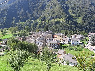
Fuipiano Valle Imagna is a comune (municipality) in the Province of Bergamo in the Italian region of Lombardy, located about 50 kilometres (31 mi) northeast of Milan and about 20 kilometres (12 mi) northwest of Bergamo. As of 31 December 2004, it had a population of 238 and an area of 4.2 square kilometres (1.6 sq mi).

Gorle is a comune (municipality) in the Province of Bergamo in the Italian region of Lombardy, located about 50 kilometres (31 mi) northeast of Milan and about 4 kilometres (2 mi) east of Bergamo. As of 31 December 2004, it had a population of 5,506 and an area of 2.4 square kilometres (0.93 sq mi).

Misano di Gera d'Adda is a comune (municipality) in the Province of Bergamo in the Italian region of Lombardy, located about 35 kilometres (22 mi) east of Milan and about 25 kilometres (16 mi) south of Bergamo. As of 31 December 2004, it had a population of 2,877 and an area of 6.1 square kilometres (2.4 sq mi).

Pianico is a comune (municipality) in the Province of Bergamo in the Italian region of Lombardy, located about 80 kilometres (50 mi) northeast of Milan and about 35 kilometres (22 mi) northeast of Bergamo. As of 31 December 2004, it had a population of 1,403 and an area of 2.6 square kilometres (1.0 sq mi).
Piazzolo is a comune (municipality) in the Province of Bergamo in the Italian region of Lombardy, located about 70 kilometres (43 mi) northeast of Milan and about 30 kilometres (19 mi) north of Bergamo. As of 31 December 2004, it had a population of 92 and an area of 4.2 square kilometres (1.6 sq mi).

Ponte Nossa is a comune (municipality) in the Province of Bergamo in the Italian region of Lombardy, located about 70 kilometres (43 mi) northeast of Milan and about 25 kilometres (16 mi) northeast of Bergamo. As of 31 December 2004, it had a population of 2,048 and an area of 5.6 square kilometres (2.2 sq mi).
Ponteranica is a comune (municipality) in the Province of Bergamo in the Italian region of Lombardy, located about 50 kilometres (31 mi) northeast of Milan and about 4 kilometres (2 mi) northwest of Bergamo. As of 31 December 2004, it had a population of 6,866 and an area of 8.4 square kilometres (3.2 sq mi).

Ranica is a comune (municipality) in the Province of Bergamo in the Italian region of Lombardy, located about 50 kilometres (31 mi) northeast of Milan and about 5 kilometres (3 mi) northeast of Bergamo. As of 31 December 2004, it had a population of 5,984 and an area of 4.2 square kilometres (1.6 sq mi).
Scanzorosciate is a comune (municipality) in the Province of Bergamo in the Italian region of Lombardy, located about 50 kilometres (31 mi) northeast of Milan and about 6 kilometres (4 mi) northeast of Bergamo. As of 30 April 2013, it had a population of 10,018 and an area of 10.8 square kilometres (4.2 sq mi).
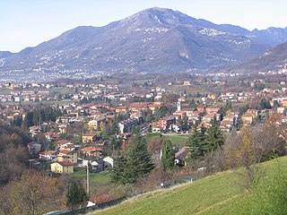
Selvino is a comune (municipality) in the Province of Bergamo in the Italian region of Lombardy, located about 60 kilometres (37 mi) northeast of Milan and about 11 kilometres (7 mi) northeast of Bergamo. As of 31 December 2004, it had a population of 2,045 and an area of 6.4 square kilometres (2.5 sq mi).

Serina is a comune (municipality) in the Province of Bergamo in the Italian region of Lombardy, located about 60 kilometres (37 mi) northeast of Milan and about 31 kilometres (19 mi) northeast of Bergamo. As of 31 December 2004, it had a population of 2,214 and an area of 27.6 square kilometres (10.7 sq mi).

Torre de' Roveri is a comune (municipality) in the Province of Bergamo in the Italian region of Lombardy, located about 50 kilometres (31 mi) northeast of Milan and about 9 kilometres (6 mi) east of Bergamo. As of 31 December 2004, it had a population of 2,134 and an area of 2.7 square kilometres (1.0 sq mi).

Villa di Serio is a comune (municipality) in the Province of Bergamo in the Italian region of Lombardy, located about 50 kilometres (31 mi) northeast of Milan and about 6 kilometres (4 mi) northeast of Bergamo. As of 31 December 2004, it had a population of 6,118 and an area of 4.6 square kilometres (1.8 sq mi).

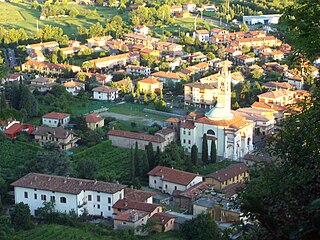
Zandobbio is a comune (municipality) in the Province of Bergamo in the Italian region of Lombardy, located about 60 kilometres (37 mi) northeast of Milan and about 20 kilometres (12 mi) east of Bergamo. As of 31 December 2004, it had a population of 2,412 and an area of 6.5 square kilometres (2.5 sq mi).

Zogno is a comune (municipality) in the Province of Bergamo in the Italian region of Lombardy, located about 50 kilometres (31 mi) northeast of Milan and about 11 kilometres (7 mi) north of Bergamo.


