
Casnigo is a comune (municipality) in the Province of Bergamo in the Italian region of Lombardy, located about 70 kilometres (43 mi) northeast of Milan and about 20 kilometres (12 mi) northeast of Bergamo.

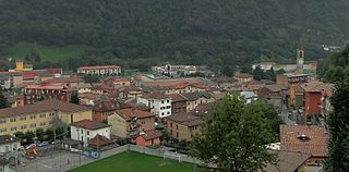
Cene is a comune (municipality) in the Province of Bergamo in the Italian region of Lombardy, located about 60 kilometres (37 mi) northeast of Milan and about 15 kilometres (9 mi) northeast of Bergamo.

Ciserano is a comune (municipality) in the Province of Bergamo in the Italian region of Lombardy, located about 35 kilometres (22 mi) northeast of Milan and about 14 kilometres (9 mi) southwest of Bergamo. As of 31 December 2004, it had a population of 5,270 and an area of 5.2 square kilometres (2.0 sq mi).
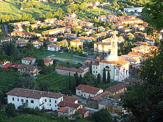
Fiorano al Serio is a comune (municipality) in the Province of Bergamo in the Italian region of Lombardy, located about 60 kilometres (37 mi) northeast of Milan and about 15 kilometres (9 mi) northeast of Bergamo.

Grassobbio is a comune (municipality) in the Province of Bergamo in the Italian region of Lombardy, located about 50 kilometres (31 mi) northeast of Milan and about 7 kilometres (4 mi) southeast of Bergamo.

Martinengo is a comune (municipality) in the Province of Bergamo in the Italian region of Lombardy, located about 50 kilometres (31 mi) east of Milan and about 15 kilometres (9 mi) southeast of Bergamo. As of 31 December 2004, it had a population of 9,138 and an area of 21.7 square kilometres (8.4 sq mi).

Morengo is a comune (municipality) in the Province of Bergamo in the Italian region of Lombardy, located about 40 kilometres (25 mi) east of Milan and about 20 kilometres (12 mi) south of Bergamo.

Mornico al Serio is a comune (municipality) in the Province of Bergamo in the Italian region of Lombardy, located about 50 kilometres (31 mi) northeast of Milan and about 14 kilometres (9 mi) southeast of Bergamo. As of 31 December 2004, it had a population of 2,632 and an area of 7.0 square kilometres (2.7 sq mi).

Orio al Serio is a comune (municipality) in the Province of Bergamo in the Italian region of Lombardy, located about 45 kilometres (28 mi) northeast of Milan and about 1 kilometre (1 mi) southeast of Bergamo.

Palosco is a comune (municipality) in the Province of Bergamo in the Italian region of Lombardy, located about 50 kilometres (31 mi) east of Milan and about 20 kilometres (12 mi) southeast of Bergamo. As of 31 December 2004, it had a population of 5,353 and an area of 10.4 square kilometres (4.0 sq mi).

Ranica is a comune (municipality) in the Province of Bergamo in the Italian region of Lombardy, located about 50 kilometres (31 mi) northeast of Milan and about 5 kilometres (3 mi) northeast of Bergamo. As of 31 December 2004, it had a population of 5,984 and an area of 4.2 square kilometres (1.6 sq mi).
Scanzorosciate is a comune (municipality) in the Province of Bergamo in the Italian region of Lombardy, located about 50 kilometres (31 mi) northeast of Milan and about 6 kilometres (4 mi) northeast of Bergamo. As of 30 April 2013, it had a population of 10,018 and an area of 10.8 square kilometres (4.2 sq mi).

Seriate is a comune (municipality) in the Province of Bergamo in the Italian region of Lombardy, located about 50 kilometres (31 mi) northeast of Milan and about 4 kilometres (2 mi) southeast of Bergamo. As of 31 December 2010, it had a population of 24,297 and an area of 12.4 square kilometres (4.8 sq mi).

Spirano is a comune (municipality) in the Province of Bergamo in the Italian region of Lombardy, located about 40 kilometres (25 mi) northeast of Milan and about 13 kilometres (8 mi) south of Bergamo.

Urgnano is a comune (municipality) in the Province of Bergamo in the Italian region of Lombardy, located about 45 kilometres (28 mi) northeast of Milan and about 11 kilometres (7 mi) south of Bergamo. As of 31 December 2004, it had a population of 8,704 and an area of 14.0 square kilometres (5.4 sq mi).
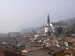
Vertova is a comune (municipality) in the Province of Bergamo in the Italian region of Lombardy, located about 70 kilometres (43 mi) northeast of Milan and about 20 kilometres (12 mi) northeast of Bergamo. As of 31 December 2004, it had a population of 4,793 and an area of 15.8 square kilometres (6.1 sq mi).

Villa di Serio is a comune (municipality) in the Province of Bergamo in the Italian region of Lombardy, located about 50 kilometres (31 mi) northeast of Milan and about 6 kilometres (4 mi) northeast of Bergamo. As of 31 December 2004, it had a population of 6,118 and an area of 4.6 square kilometres (1.8 sq mi).

Zanica is a comune (municipality) in the Province of Bergamo in the Italian region of Lombardy, located about 45 kilometres (28 mi) northeast of Milan and about 8 kilometres (5 mi) south of Bergamo. Zanica borders the following municipalities: Azzano San Paolo, Cavernago, Comun Nuovo, Grassobbio, Orio al Serio, Stezzano, Urgnano.


