Mapello

Last updated
Mapello
Comune
Comune di Mapello

Mapello, Bergamo, Italy - Parish church of St. Michael the archangel.jpg

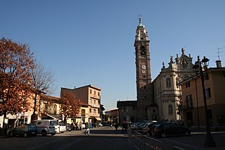
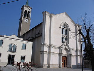
Church of Saint Michael in Mapello
Italy provincial location map 2015.svg
Red pog.svg
Mapello
Location of Mapello in Italy
Coordinates: 45°43′N9°33′E / 45.717°N 9.550°E / 45.717; 9.550 Coordinates: 45°43′N9°33′E / 45.717°N 9.550°E / 45.717; 9.550
Country Italy
Region Lombardy
Province Province of Bergamo (BG)
Area
  Total 8.5 km2 (3.3 sq mi)
Elevation 255 m (837 ft)
Population (Dec. 2004)
  Total 5,806
  Density 680/km2 (1,800/sq mi)
Demonym(s) Mapellesi
Time zone CET (UTC+1)
  Summer (DST) CEST (UTC+2)
Postal code24030
Dialing code 035

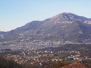
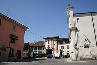
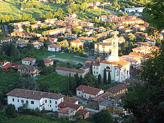
Mapello is a comune (municipality) in the Province of Bergamo in the Italian region of Lombardy, located about 40 kilometres (25 mi) northeast of Milan and about 9 kilometres (6 mi) west of Bergamo. As of 31 December 2004, it had a population of 5,806 and an area of 8.5 square kilometres (3.3 sq mi). [1]

<i>Comune</i> third-level administrative divisions of the Italian Republic

The comune is a basic administrative division in Italy, roughly equivalent to a township or municipality.

Province of Bergamo Province of Italy

The Province of Bergamo is a province in the Lombardy region of Italy. It has a population of 1,112,187 (2017), an area of 2,754.91 square kilometers (1,063.68 sq mi), and contains 243 comuni. Its capital is the city of Bergamo.

Italy republic in Southern Europe

Italy, officially the Italian Republic, is a country in Southern Europe. Located in the middle of the Mediterranean Sea, Italy shares open land borders with France, Switzerland, Austria, Slovenia and the enclaved microstates San Marino and Vatican City. Italy covers an area of 301,340 km2 (116,350 sq mi) and has a largely temperate seasonal and Mediterranean climate. With around 61 million inhabitants, it is the fourth-most populous EU member state and the most populous country in Southern Europe.

Mapello borders the following municipalities: Ambivere, Barzana, Bonate Sopra, Brembate di Sopra, Palazzago, Ponte San Pietro, Presezzo, Sotto il Monte Giovanni XXIII, Terno d'Isola.

Ambivere Comune in Lombardy, Italy

Ambivere is a comune (municipality) in the Province of Bergamo in the Italian region of Lombardy, located about 40 kilometres (25 mi) northeast of Milan and about 9 kilometres (6 mi) west of Bergamo. As of 31 December 2004, it had a population of 2,265 and an area of 3.2 square kilometres (1.2 sq mi).

Barzana Comune in Lombardy, Italy

Barzana is a comune (municipality) in the Province of Bergamo in the Italian region of Lombardy, located about 45 kilometres (28 mi) northeast of Milan and about 9 kilometres (6 mi) northwest of Bergamo. As of 31 December 2004, it had a population of 1,645 and an area of 2.1 square kilometres (0.81 sq mi).

Bonate Sopra Comune in Lombardy, Italy

Bonate Sopra is a comune (municipality) in the Province of Bergamo in the Italian region Lombardy, located about 40 kilometres (25 mi) northeast of Milan and about 8 kilometres (5 mi) west of Bergamo. As of 31 December 2004, it had a population of 7,042 and an area of 5.9 square kilometres (2.3 sq mi).

Demographic evolution

Mapello

Related Research Articles

Almenno San Bartolomeo Comune in Lombardy, Italy

Almenno San Bartolomeo is a comune (municipality) in the Province of Bergamo in the Italian region Lombardy, located about 45 kilometres (28 mi) northeast of Milan and about 9 kilometres (6 mi) northwest of Bergamo.

Barbata Comune in Lombardy, Italy

Barbata is a comune (municipality) in the Province of Bergamo in the Italian region of Lombardy, located about 50 kilometres (31 mi) east of Milan and about 25 kilometres (16 mi) southeast of Bergamo.

Brembate di Sopra Comune in Lombardy, Italy

Brembate di Sopra is a comune (municipality) in the Province of Bergamo in the Italian region of Lombardy, located about 45 kilometres northeast of Milan and about 7 km (4 mi) northwest of Bergamo. As of 31 December 2004, it had a population of 7,190 and an area of 4.3 square kilometres.

Cenate Sopra Comune in Lombardy, Italy

Cenate Sopra is a comune (municipality) in the Province of Bergamo in the Italian region of Lombardy, located about 60 kilometres (37 mi) northeast of Milan and about 12 kilometres (7.5 mi) east of Bergamo. As of 31 December 2004, it had a population of 2,248 and an area of 6.9 square kilometres (2.7 sq mi).

Cenate Sotto Comune in Lombardy, Italy

Cenate Sotto is a comune (municipality) in the Province of Bergamo in the Italian region of Lombardy, located about 60 kilometres (37 mi) northeast of Milan and about 12 kilometres (7 mi) east of Bergamo. As of 31 December 2004, it had a population of 2,947 and an area of 4.5 square kilometres (1.7 sq mi).

Chignolo dIsola Comune in Lombardy, Italy

Chignolo d'Isola is a comune (municipality) in the Province of Bergamo in the Italian region of Lombardy, located about 35 kilometres (22 mi) northeast of Milan and about 11 kilometres (7 mi) southwest of Bergamo. As of 31 December 2004, it had a population of 2,849 and an area of 5.3 square kilometres (2.0 sq mi).

Dalmine Comune in Lombardy, Italy

Dalmine is a comune (municipality) in the Province of Bergamo in the Italian region of Lombardy, located about 40 kilometres (25 mi) northeast of Milan and about 8 kilometres (5 mi) southwest of Bergamo. As of 31 December 2004, it had a population of 22,326 and an area of 11.6 square kilometres (4.5 sq mi).

Filago Comune in Lombardy, Italy

Filago is a comune (municipality) in the Province of Bergamo in the Italian region of Lombardy, located about 35 kilometres (22 mi) northeast of Milan and about 12 kilometres (7 mi) southwest of Bergamo.

Fontanella, Lombardy Comune in Lombardy, Italy

Fontanella is a comune (municipality) in the Province of Bergamo in the Italian region of Lombardy, located about 50 kilometres (31 mi) east of Milan and about 30 kilometres (19 mi) southeast of Bergamo. As of 31 December 2004, it had a population of 3,773 and an area of 17.9 square kilometres (6.9 sq mi).

Levate Comune in Lombardy, Italy

Levate is a comune (municipality) in the Province of Bergamo in the Italian region of Lombardy, located about 40 kilometres (25 mi) northeast of Milan and about 8 kilometres (5 mi) southwest of Bergamo.

Martinengo (Italy) Comune in Lombardy, Italy

Martinengo is a comune (municipality) in the Province of Bergamo in the Italian region of Lombardy, located about 50 kilometres (31 mi) east of Milan and about 15 kilometres (9 mi) southeast of Bergamo. As of 31 December 2004, it had a population of 9,138 and an area of 21.7 square kilometres (8.4 sq mi).

Mozzo Comune in Lombardy, Italy

Mozzo is a comune (municipality) in the Province of Bergamo in the Italian region of Lombardy, located about 45 kilometres (28 mi) northeast of Milan and about 5 kilometres (3 mi) west of Bergamo. As of 31 December 2004, it had a population of 7,202 and an area of 3.6 square kilometres (1.4 sq mi).

Osio Sotto Comune in Lombardy, Italy

Osio Sotto is a comune (municipality) in the Province of Bergamo in the Italian region of Lombardy, located about 40 kilometres (25 mi) northeast of Milan and about 11 kilometres (7 mi) southwest of Bergamo. As of 31 December 2004, it had a population of 11,097 and an area of 7.5 square kilometres (2.9 sq mi).

Palazzago Comune in Lombardy, Italy

Palazzago is a comune (municipality) in the Province of Bergamo in the Italian region of Lombardy, located about 45 kilometres (28 mi) northeast of Milan and about 12 kilometres (7 mi) northwest of Bergamo. As of 31 December 2004, it had a population of 3,658 and an area of 14.0 square kilometres (5.4 sq mi).

Scanzorosciate Comune in Lombardy, Italy

Scanzorosciate is a comune (municipality) in the Province of Bergamo in the Italian region of Lombardy, located about 50 kilometres (31 mi) northeast of Milan and about 6 kilometres (4 mi) northeast of Bergamo. As of 30 April 2013, it had a population of 10,018 and an area of 10.8 square kilometres (4.2 sq mi).

Terno dIsola Comune in Lombardy, Italy

Terno d'Isola is a comune (municipality) in the Province of Bergamo in the Italian region of Lombardy, located about 35 kilometres (22 mi) northeast of Milan and about 11 kilometres (7 mi) west of Bergamo. As of 31 December 2004, it had a population of 6,004 and an area of 4.0 square kilometres (1.5 sq mi).

Valbrembo Comune in Lombardy, Italy

Valbrembo is a comune (municipality) in the Province of Bergamo in the Italian region of Lombardy, located about 45 kilometres (28 mi) northeast of Milan and about 4 kilometres (2 mi) northwest of Bergamo. As of 31 December 2004, it had a population of 3,584 and an area of 3.7 square kilometres (1.4 sq mi).

References

  1. All demographics and other statistics: Italian statistical institute Istat.