Corna Imagna

Last updated
Corna Imagna
Comune
Comune di Corna Imagna
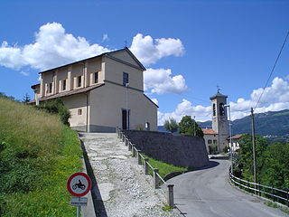
GiorcesCornaIm2.JPG

Church
Italy provincial location map 2015.svg
Red pog.svg
Corna Imagna
Location of Corna Imagna in Italy
Coordinates: 45°50′N9°33′E / 45.833°N 9.550°E / 45.833; 9.550 Coordinates: 45°50′N9°33′E / 45.833°N 9.550°E / 45.833; 9.550
Country Italy
Region Lombardy
Province Province of Bergamo (BG)
Area
  Total 4.5 km2 (1.7 sq mi)
Elevation 736 m (2,415 ft)
Population (Dec. 2004)
  Total 968
  Density 220/km2 (560/sq mi)
Demonym(s) Cornesi
Time zone CET (UTC+1)
  Summer (DST) CEST (UTC+2)
Postal code24030
Dialing code 035

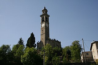
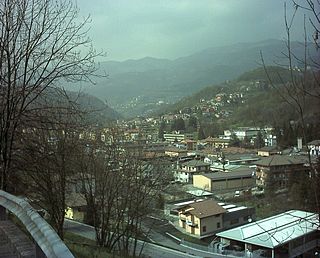
Corna Imagna is a comune (municipality) in the Province of Bergamo in the Italian region of Lombardy, located about 50 kilometres (31 mi) northeast of Milan and about 15 kilometres (9 mi) northwest of Bergamo. As of 31 December 2004, it had a population of 968 and an area of 4.5 square kilometres (1.7 sq mi). [1]

<i>Comune</i> third-level administrative divisions of the Italian Republic

The comune is a basic administrative division in Italy, roughly equivalent to a township or municipality.

Province of Bergamo Province of Italy

The Province of Bergamo is a province in the Lombardy region of Italy. It has a population of 1,112,187 (2017), an area of 2,754.91 square kilometers (1,063.68 sq mi), and contains 243 comuni. Its capital is the city of Bergamo.

Italy republic in Southern Europe

Italy, officially the Italian Republic, is a country in Southern and Western Europe. Located in the middle of the Mediterranean Sea, Italy shares open land borders with France, Switzerland, Austria, Slovenia and the enclaved microstates San Marino and Vatican City. Italy covers an area of 301,340 km2 (116,350 sq mi) and has a largely temperate seasonal and Mediterranean climate. With around 61 million inhabitants, it is the fourth-most populous EU member state and the most populous country in Southern Europe.

Corna Imagna borders the following municipalities: Blello, Brembilla, Fuipiano Valle Imagna, Gerosa, Locatello, Rota d'Imagna, Sant'Omobono Imagna.

Blello Comune in Lombardy, Italy

Blello is a comune (municipality) in the Province of Bergamo in the Italian region of Lombardy, located about 50 kilometres (31 mi) northeast of Milan and about 15 kilometres (9 mi) northwest of Bergamo. As of 31 December 2004, it had a population of 91 and an area of 2.2 square kilometres (0.85 sq mi).

Brembilla Comune in Lombardy, Italy

Brembilla was a comune in the province of Bergamo, in Lombardy, Italy. It was situated 15 km northwest of Bergamo. In 2014, the municipality of Gerosa was merged with Brembilla to create a new municipality, named Val Brembilla.

Fuipiano Valle Imagna Comune in Lombardy, Italy

Fuipiano Valle Imagna is a comune (municipality) in the Province of Bergamo in the Italian region of Lombardy, located about 50 kilometres (31 mi) northeast of Milan and about 20 kilometres (12 mi) northwest of Bergamo. As of 31 December 2004, it had a population of 238 and an area of 4.2 square kilometres (1.6 sq mi).

Demographic evolution

Corna Imagna

Related Research Articles

Bedulita Comune in Lombardy, Italy

Bedulita is a comune (municipality) in the Province of Bergamo in the Italian region of Lombardy, located about 45 kilometres (28 mi) northeast of Milan and about 13 kilometres (8 mi) northwest of Bergamo.

Brumano Comune in Lombardy, Italy

Brumano is a comune (municipality) in the Province of Bergamo in the Italian region of Lombardy, located about 50 kilometres (31 mi) northeast of Milan and about 20 kilometres (12 mi) northwest of Bergamo. As of 31 December 2004, it had a population of 96 and an area of 8.1 square kilometres (3.1 sq mi).

Fontanella, Lombardy Comune in Lombardy, Italy

Fontanella is a comune (municipality) in the Province of Bergamo in the Italian region of Lombardy, located about 50 kilometres (31 mi) east of Milan and about 30 kilometres (19 mi) southeast of Bergamo. As of 31 December 2004, it had a population of 3,773 and an area of 17.9 square kilometres (6.9 sq mi).

Gerosa Comune in Lombardy, Italy

Gerosa was a comune (municipality) in the Province of Bergamo in the Italian region of Lombardy, located about 50 kilometres (31 mi) northeast of Milan and about 20 kilometres (12 mi) northwest of Bergamo. As of 31 December 2004, it had a population of 381 and an area of 10.1 square kilometres (3.9 sq mi).

Ghisalba Comune in Lombardy, Italy

Ghisalba is a comune (municipality) in the Province of Bergamo in the Italian region of Lombardy, located about 50 kilometres (31 mi) northeast of Milan and about 13 kilometres (8 mi) southeast of Bergamo. As of 31 December 2010, it had a population of 5,967 and an area of 10.2 square kilometres (3.9 sq mi).

Locatello Comune in Lombardy, Italy

Locatello is a comune (municipality) in the Province of Bergamo in the Italian region of Lombardy, located about 50 kilometres (31 mi) northeast of Milan and about 20 kilometres (12 mi) northwest of Bergamo. As of 31 December 2004, it had a population of 785 and an area of 3.8 square kilometres (1.5 sq mi).

Mornico al Serio Comune in Lombardy, Italy

Mornico al Serio is a comune (municipality) in the Province of Bergamo in the Italian region of Lombardy, located about 50 kilometres (31 mi) northeast of Milan and about 14 kilometres (9 mi) southeast of Bergamo. As of 31 December 2004, it had a population of 2,632 and an area of 7.0 square kilometres (2.7 sq mi).

Pedrengo Comune in Lombardy, Italy

Pedrengo is a comune (municipality) in the Province of Bergamo in the Italian region of Lombardy, located about 50 kilometres (31 mi) northeast of Milan and about 5 kilometres (3 mi) east of Bergamo. As of 31 December 2004, it had a population of 5,321 and an area of 3.6 square kilometres (1.4 sq mi).

Pumenengo Comune in Lombardy, Italy

Pumenengo is a comune (municipality) in the Province of Bergamo in the Italian region of Lombardy, located about 50 kilometres (31 mi) east of Milan and about 30 kilometres (19 mi) southeast of Bergamo. As of 31 December 2004, it had a population of 1,512 and an area of 10.1 square kilometres (3.9 sq mi).

Roncola Comune in Lombardy, Italy

Roncola is a comune (municipality) in the Province of Bergamo in the Italian region of Lombardy, located about 45 kilometres (28 mi) northeast of Milan and about 12 kilometres (7 mi) northwest of Bergamo.

Rota dImagna Comune in Lombardy, Italy

Rota d'Imagna is a comune (municipality) in the Province of Bergamo in the Italian region of Lombardy, located about 50 kilometres (31 mi) northeast of Milan and about 20 kilometres (12 mi) northwest of Bergamo. As of 31 December 2004, it had a population of 857 and an area of 6.0 square kilometres (2.3 sq mi).

SantOmobono Terme Comune in Lombardy, Italy

Sant'Omobono Terme is a comune (municipality) in the Province of Bergamo in the Italian region of Lombardy, located about 50 kilometres (31 mi) northeast of Milan and about 15 kilometres (9 mi) northwest of Bergamo.

Taleggio, Lombardy Comune in Lombardy, Italy

Taleggio is a comune (municipality) in the Province of Bergamo in the Italian region of Lombardy, located about 60 kilometres (37 mi) northeast of Milan and about 25 kilometres (16 mi) northwest of Bergamo. As of 31 December 2004, it had a population of 583 and an area of 46.6 square kilometres (18.0 sq mi).

Torre de Roveri Comune in Lombardy, Italy

Torre de' Roveri is a comune (municipality) in the Province of Bergamo in the Italian region of Lombardy, located about 50 kilometres (31 mi) northeast of Milan and about 9 kilometres (6 mi) east of Bergamo. As of 31 December 2004, it had a population of 2,134 and an area of 2.7 square kilometres (1.0 sq mi).

Ubiale Clanezzo Comune in Lombardy, Italy

Ubiale Clanezzo is a comune (municipality) in the Province of Bergamo in the Italian region of Lombardy, located about 50 kilometres (31 mi) northeast of Milan and about 10 kilometres (6 mi) northwest of Bergamo.

Vedeseta Comune in Lombardy, Italy

Vedeseta is a comune (municipality) in the Province of Bergamo in the Italian region of Lombardy, located about 50 kilometres (31 mi) northeast of Milan and about 25 kilometres (16 mi) northwest of Bergamo. As of 31 December 2004, it had a population of 244 and an area of 19.8 square kilometres (7.6 sq mi).

Villa di Serio Comune in Lombardy, Italy

Villa di Serio is a comune (municipality) in the Province of Bergamo in the Italian region of Lombardy, located about 50 kilometres (31 mi) northeast of Milan and about 6 kilometres (4 mi) northeast of Bergamo. As of 31 December 2004, it had a population of 6,118 and an area of 4.6 square kilometres (1.8 sq mi).

References

  1. All demographics and other statistics: Italian statistical institute Istat.