Arcene is a comune (municipality) in the Province of Bergamo in the Italian region of Lombardy, located about 35 kilometres (22 mi) northeast of Milan and about 14 kilometres (9 mi) southwest of Bergamo. As of 31 December 2004, it had a population of 4,529 and an area of 4.2 square kilometres (1.6 sq mi).

Bonate Sotto is a comune (municipality) in the Province of Bergamo in the Italian region of Lombardy, located about 40 kilometres (25 mi) northeast of Milan and about 9 kilometres (6 mi) southwest of Bergamo in the Isola bergamasca.

Cerete is a comune (municipality) in the Province of Bergamo in the Italian region of Lombardy, located about 80 kilometres (50 mi) northeast of Milan and about 35 kilometres (22 mi) northeast of Bergamo.
Cusio is a comune (municipality) in the Province of Bergamo in the Italian region of Lombardy, and is located about 70 kilometres (43 mi) northeast of Milan and about 30 kilometres (19 mi) north of Bergamo. As of 31 December 2004, it had a population of 286 and an area of 9.3 square kilometres (3.6 sq mi).
Dalmine is a comune (municipality) in the Province of Bergamo in the Italian region of Lombardy, located about 40 kilometres (25 mi) northeast of Milan and about 8 kilometres (5 mi) southwest of Bergamo. As of 31 December 2004, it had a population of 22,326 and an area of 11.6 square kilometres (4.5 sq mi).

Fara Olivana con Sola is a comune (municipality) in the Province of Bergamo in the Italian region of Lombardy, located about 45 kilometres (28 mi) east of Milan and about 25 kilometres (16 mi) southeast of Bergamo.

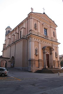
Fornovo San Giovanni is a comune (municipality) in the Province of Bergamo in the Italian region of Lombardy, located in the Gera d'Adda, about 40 kilometres (25 mi) east of Milan and about 20 kilometres (12 mi) south of Bergamo.

Martinengo is a comune (municipality) in the Province of Bergamo in the Italian region of Lombardy, located about 50 kilometres (31 mi) east of Milan and about 15 kilometres (9 mi) southeast of Bergamo. As of 31 December 2004, it had a population of 9,138 and an area of 21.7 square kilometres (8.4 sq mi).

Morengo is a comune (municipality) in the Province of Bergamo in the Italian region of Lombardy, located about 40 kilometres (25 mi) east of Milan and about 20 kilometres (12 mi) south of Bergamo.

Mozzo is a comune (municipality) in the Province of Bergamo in the Italian region of Lombardy, located about 45 kilometres (28 mi) northeast of Milan and about 5 kilometres (3 mi) west of Bergamo. As of 31 December 2004, it had a population of 7,202 and an area of 3.6 square kilometres (1.4 sq mi).

Piario is a comune (municipality) in the Province of Bergamo in the Italian region of Lombardy, located about 80 kilometres (50 mi) northeast of Milan and about 30 kilometres (19 mi) northeast of Bergamo. As of 31 December 2004, it had a population of 990 and an area of 1.5 square kilometres (0.58 sq mi).
Ponteranica is a comune (municipality) in the Province of Bergamo in the Italian region of Lombardy, located about 50 kilometres (31 mi) northeast of Milan and about 4 kilometres (2 mi) northwest of Bergamo. As of 31 December 2004, it had a population of 6,866 and an area of 8.4 square kilometres (3.2 sq mi).
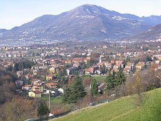
Selvino is a comune (municipality) in the Province of Bergamo in the Italian region of Lombardy, located about 60 kilometres (37 mi) northeast of Milan and about 11 kilometres (7 mi) northeast of Bergamo. As of 31 December 2004, it had a population of 2,045 and an area of 6.4 square kilometres (2.5 sq mi).

Seriate is a comune (municipality) in the Province of Bergamo in the Italian region of Lombardy, located about 50 kilometres (31 mi) northeast of Milan and about 4 kilometres (2 mi) southeast of Bergamo. As of 31 December 2010, it had a population of 24,297 and an area of 12.4 square kilometres (4.8 sq mi).

Telgate is a comune (municipality) in the Province of Bergamo in the Italian region of Lombardy, located about 60 kilometres (37 mi) northeast of Milan and about 15 kilometres (9 mi) southeast of Bergamo. As of 31 December 2004, it had a population of 4,598 and an area of 8.1 square kilometres (3.1 sq mi).

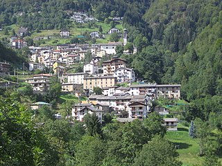
Ubiale Clanezzo is a comune (municipality) in the Province of Bergamo in the Italian region of Lombardy, located about 50 kilometres (31 mi) northeast of Milan and about 10 kilometres (6 mi) northwest of Bergamo.

Valleve is a comune (municipality) in the Province of Bergamo in the Italian region of Lombardy, located about 80 kilometres (50 mi) northeast of Milan and about 40 kilometres (25 mi) north of Bergamo. As of 31 December 2004, it had a population of 145 and an area of 14.9 square kilometres (5.8 sq mi).

Valnegra is a comune (municipality) in the Province of Bergamo in the Italian region of Lombardy, located about 70 kilometres (43 mi) northeast of Milan and about 30 kilometres (19 mi) north of Bergamo. As of 31 December 2004, it had a population of 233 and an area of 2.1 square kilometres (0.81 sq mi).
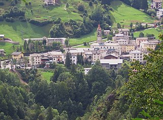
Valtorta is a comune (municipality) in the Province of Bergamo in the Italian region of Lombardy, located about 60 kilometres (37 mi) northeast of Milan and about 35 kilometres (22 mi) northwest of Bergamo.


