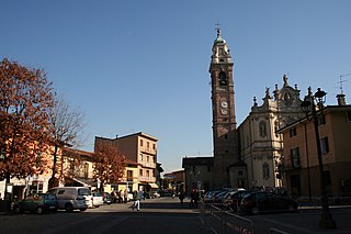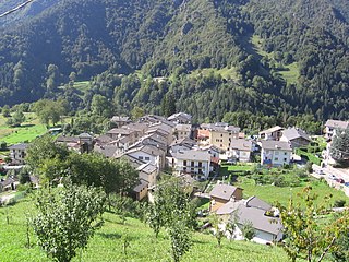
Brembate is a comune (municipality) in the Province of Bergamo in the Italian region of Lombardy, located about 35 kilometres (22 mi) northeast of Milan and about 14 kilometres (9 mi) southwest of Bergamo. As of 31 December 2010, it had a population of 8,234 and an area of 5.5 square kilometres (2.1 sq mi).

Brembate di Sopra is a comune (municipality) in the Province of Bergamo in the Italian region of Lombardy, located about 45 kilometres northeast of Milan and about 7 km (4 mi) northwest of Bergamo. As of 31 December 2004, it had a population of 7,190 and an area of 4.3 square kilometres.

Cassiglio is a comune (municipality) in the Province of Bergamo in the northern Italian region of Lombardy, located about 100 kilometres (62 mi) northeast of Milan and about 45 kilometres (28 mi) north of Bergamo.

Filago is a comune (municipality) in the Province of Bergamo in the Italian region of Lombardy, located about 35 kilometres (22 mi) northeast of Milan and about 12 kilometres (7 mi) southwest of Bergamo.

Lallio is a comune (municipality) in the Province of Bergamo in the Italian region of Lombardy, located about 45 kilometres (28 mi) northeast of Milan and about 5 kilometres (3.1 mi) southwest of Bergamo. As of 31 December 2004, it had a population of 4,050 and an area of 2.1 square kilometres (0.81 sq mi).

Levate is a comune (municipality) in the Province of Bergamo in the Italian region of Lombardy, located about 40 kilometres (25 mi) northeast of Milan and about 8 kilometres (5 mi) southwest of Bergamo.

Martinengo is a comune (municipality) in the Province of Bergamo in the Italian region of Lombardy, located about 50 kilometres (31 mi) east of Milan and about 15 kilometres (9 mi) southeast of Bergamo. As of 31 December 2004, it had a population of 9,138 and an area of 21.7 square kilometres (8.4 sq mi).

Mezzoldo is a comune (municipality) in the Province of Bergamo in the Italian region of Lombardy, located about 70 kilometres (43 mi) northeast of Milan and about 35 kilometres (22 mi) north of Bergamo. As of 31 December 2004, it had a population of 225 and an area of 18.8 square kilometres (7.3 sq mi).

Olmo al Brembo is a comune (municipality) in the Province of Bergamo in the Italian region of Lombardy, located about 70 kilometres (43 mi) northeast of Milan and about 45 kilometres (28 mi) north of Bergamo.

Osio Sotto is a comune (municipality) in the Province of Bergamo in the Italian region of Lombardy, located about 40 kilometres (25 mi) northeast of Milan and about 11 kilometres (7 mi) southwest of Bergamo. As of 31 December 2004, it had a population of 11,097 and an area of 7.5 square kilometres (2.9 sq mi).

Piazza Brembana is a comune (municipality) in the Province of Bergamo in the Italian region of Lombardy, located about 70 kilometres (43 mi) northeast of Milan and about 30 kilometres (19 mi) north of Bergamo.

Piazzatorre is a comune (municipality) in the Province of Bergamo in the Italian region of Lombardy, located about 70 kilometres (43 mi) northeast of Milan and about 35 kilometres (22 mi) north of Bergamo. As of 31 December 2004, it had a population of 475 and an area of 23.6 square kilometres (9.1 sq mi).

Piazzolo is a comune (municipality) in the Province of Bergamo in the Italian region of Lombardy, located about 70 kilometres (43 mi) northeast of Milan and about 30 kilometres (19 mi) north of Bergamo. As of 31 December 2004, it had a population of 92 and an area of 4.2 square kilometres (1.6 sq mi).

Presezzo is a comune (municipality) in the Province of Bergamo in the Italian region of Lombardy, located about 40 kilometres (25 mi) northeast of Milan and about 8 kilometres (5 mi) west of Bergamo. As of 31 December 2004, it had a population of 4,657 and an area of 2.1 square kilometres (0.81 sq mi).

Ranica is a comune (municipality) in the Province of Bergamo in the Italian region of Lombardy, located about 50 kilometres (31 mi) northeast of Milan and about 5 kilometres (3 mi) northeast of Bergamo. As of 31 December 2004, it had a population of 5,984 and an area of 4.2 square kilometres (1.6 sq mi).

Santa Brigida is a comune (municipality) in the Province of Bergamo in the Italian region of Lombardy, located about 70 kilometres (43 mi) northeast of Milan and about 30 kilometres (19 mi) north of Bergamo. As of 31 December 2004, it had a population of 623 and an area of 14.2 square kilometres (5.5 sq mi).

Treviolo is a comune (municipality) in the Province of Bergamo in the Italian region of Lombardy, located about 40 kilometres (25 mi) northeast of Milan and about 7 kilometres (4 mi) southwest of Bergamo. As of 1 January 2011, it had a population of 10,363 and an area of 8.7 square kilometres (3.4 sq mi).

Urgnano is a comune (municipality) in the Province of Bergamo in the Italian region of Lombardy, located about 45 kilometres (28 mi) northeast of Milan and about 11 kilometres (7 mi) south of Bergamo. As of 31 December 2004, it had a population of 8,704 and an area of 14.0 square kilometres (5.4 sq mi).

Verdellino is a comune (municipality) in the Province of Bergamo in the Italian region of Lombardy, located about 40 kilometres (25 mi) northeast of Milan and about 12 kilometres (7 mi) southwest of Bergamo. The town is easily reachable by train, the station of Verdello-Dalmine is in fact located on Verdellino's soil and the stop is one of several on the railroad line that connects the two cities of Bergamo and Milan. As of 31 December 2004, it had a population of 7,186 and an area of 3.8 square kilometres (1.5 sq mi).
Villongo is a comune (municipality) in the Province of Bergamo in the Italian region of Lombardy, located about 60 kilometres (37 mi) northeast of Milan and about 20 kilometres (12 mi) east of Bergamo. As of January 2017, it had a population of 8,052 and an area of 5.93 square kilometres (2.29 sq mi).


