Vigano San Martino

Last updated
Vigano San Martino
Comune
Comune di Vigano San Martino
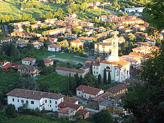
Vigano Vista 03.jpg
Vigano San Martino
Italy provincial location map 2015.svg
Red pog.svg
Vigano San Martino
Location of Vigano San Martino in Italy
Coordinates: 45°43′N9°54′E / 45.717°N 9.900°E / 45.717; 9.900 Coordinates: 45°43′N9°54′E / 45.717°N 9.900°E / 45.717; 9.900
Country Italy
Region Lombardy
Province Bergamo (BG)
Government
  Mayor Massimo Armati
Area
  Total 3.76 km2 (1.45 sq mi)
Elevation 363 m (1,191 ft)
Population (30 November 2016) [1]
  Total 1,336
  Density 360/km2 (920/sq mi)
Demonym(s) Viganesi
Time zone UTC+1 (CET)
  Summer (DST) UTC+2 (CEST)
Postal code24060
Dialing code 035
Website Official website

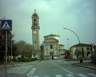
Vigano San Martino (Bergamasque: Igà) is a comune (municipality) in the Province of Bergamo in the Italian region of Lombardy, located about 60 kilometres (37 mi) northeast of Milan and about 20 kilometres (12 mi) east of Bergamo.

<i>Comune</i> third-level administrative divisions of the Italian Republic

The comune is a basic administrative division in Italy, roughly equivalent to a township or municipality.

Province of Bergamo Province of Italy

The Province of Bergamo is a province in the Lombardy region of Italy. It has a population of 1,112,187 (2017), an area of 2,754.91 square kilometers (1,063.68 sq mi), and contains 243 comuni. Its capital is the city of Bergamo.

Italy republic in Southern Europe

Italy, officially the Italian Republic, is a country in Southern Europe. Located in the middle of the Mediterranean Sea, Italy shares open land borders with France, Switzerland, Austria, Slovenia and the enclaved microstates San Marino and Vatican City. Italy covers an area of 301,340 km2 (116,350 sq mi) and has a largely temperate seasonal and Mediterranean climate. With around 61 million inhabitants, it is the fourth-most populous EU member state and the most populous country in Southern Europe.

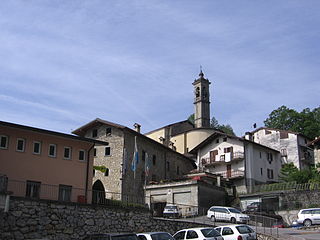
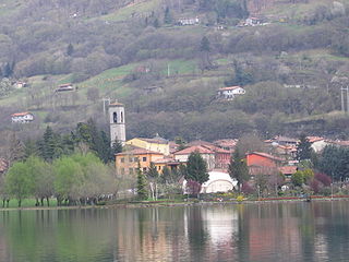
Vigano San Martino borders the following municipalities: Albino, Berzo San Fermo, Borgo di Terzo, Casazza, Grone.

Berzo San Fermo Comune in Lombardy, Italy

Berzo San Fermo is a comune in the province of Bergamo, in Lombardy.

Borgo di Terzo Comune in Lombardy, Italy

Borgo di Terzo is a comune in the province of Bergamo, Lombardy, in northern Italy.

Casazza Comune in Lombardy, Italy

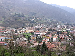
Casazza is a comune (municipality) in the Province of Bergamo in the Italian region of Lombardy, located about 70 kilometres (43 mi) northeast of Milan and about 20 kilometres (12 mi) northeast of Bergamo. As of 31 December 2004, it had a population of 3,649 and an area of 7.1 square kilometres (2.7 sq mi).

Related Research Articles

Almè Comune in Lombardy, Italy

Almè is a comune (municipality) in the Province of Bergamo in the Italian region Lombardy, located about 45 kilometres (28 mi) northeast of Milan and about 5 kilometres (3 mi) northwest of Bergamo.

Almenno San Bartolomeo Comune in Lombardy, Italy

Almenno San Bartolomeo is a comune (municipality) in the Province of Bergamo in the Italian region Lombardy, located about 45 kilometres (28 mi) northeast of Milan and about 9 kilometres (6 mi) northwest of Bergamo.

Barzana Comune in Lombardy, Italy

Barzana is a comune (municipality) in the Province of Bergamo in the Italian region of Lombardy, located about 45 kilometres (28 mi) northeast of Milan and about 9 kilometres (6 mi) northwest of Bergamo. As of 31 December 2004, it had a population of 1,645 and an area of 2.1 square kilometres (0.81 sq mi).

Bracca Comune in Lombardy, Italy

Bracca is a comune (municipality) in the Province of Bergamo in the Italian region of Lombardy, located about 60 kilometres (37 mi) northeast of Milan and about 14 kilometres (9 mi) northeast of Bergamo. As of 31 December 2004, it had a population of 827 and an area of 5.5 square kilometres (2.1 sq mi).

Foresto Sparso Comune in Lombardy, Italy

Foresto Sparso is a comune (municipality) in the Province of Bergamo in the Italian region of Lombardy, located about 60 kilometres (37 mi) northeast of Milan and about 20 kilometres (12 mi) east of Bergamo. As of 31 December 2004, it had a population of 2,983 and an area of 7.7 square kilometres (3.0 sq mi).

Grone, Lombardy Comune in Lombardy, Italy

Grone is a comune (municipality) in the Province of Bergamo in the Italian region of Lombardy, located about 70 kilometres (43 mi) northeast of Milan and about 20 kilometres (12 mi) east of Bergamo. As of 31 December 2004, it had a population of 817 and an area of 7.8 square kilometres (3.0 sq mi).

Monasterolo del Castello Comune in Lombardy, Italy

Monasterolo del Castello is a comune (municipality) in the Province of Bergamo in the Italian region of Lombardy, located about 70 kilometres (43 mi) northeast of Milan and about 20 kilometres (12 mi) northeast of Bergamo.

Nembro Comune in Lombardy, Italy

Nembro is a comune (municipality) in the Province of Bergamo in the Italian region of Lombardy, located about 60 kilometres (37 mi) northeast of Milan and about 10 kilometres (6 mi) northeast of Bergamo, on the right bank of the Serio River.

Paladina Comune in Lombardy, Italy

Paladina is a comune (municipality) in the Province of Bergamo in the Italian region of Lombardy, located about 45 kilometres (28 mi) northeast of Milan and about 5 kilometres (3 mi) northwest of Bergamo.

San Giovanni Bianco Comune in Lombardy, Italy

San Giovanni Bianco is a comune (municipality) in the Province of Bergamo in the Italian region Lombardy, located about 60 kilometres (37 mi) northeast of Milan and about 20 kilometres (12 mi) north of Bergamo, located in the Val Brembana.

Sarnico Comune in Lombardy, Italy

Sarnico is a comune (municipality) in the Province of Bergamo in the Italian region of Lombardy, about 70 kilometres (43 mi) northeast of Milan and about 20 kilometres (12 mi) east of Bergamo at the southern end of Lake Iseo.

Scanzorosciate Comune in Lombardy, Italy

Scanzorosciate is a comune (municipality) in the Province of Bergamo in the Italian region of Lombardy, located about 50 kilometres (31 mi) northeast of Milan and about 6 kilometres (4 mi) northeast of Bergamo. As of 30 April 2013, it had a population of 10,018 and an area of 10.8 square kilometres (4.2 sq mi).

Viadanica Comune in Lombardy, Italy

Viadanica is a comune (municipality) in the Province of Bergamo in the Italian region of Lombardy, located about 70 kilometres (43 mi) northeast of Milan and about 25 kilometres (16 mi) east of Bergamo. As of 31 December 2004, it had a population of 1,093 and an area of 5.4 square kilometres (2.1 sq mi).

Vigolo Comune in Lombardy, Italy

Vigolo is a comune (municipality) in the Province of Bergamo in the Italian region of Lombardy, located about 70 kilometres (43 mi) northeast of Milan and about 25 kilometres (16 mi) east of Bergamo. As of 31 December 2004, it had a population of 641 and an area of 12.2 square kilometres (4.7 sq mi).

Villa dAlmè Comune in Lombardy, Italy

Villa d'Almè is a comune (municipality) in the Province of Bergamo in the Italian region of Lombardy, located about 45 kilometres (28 mi) northeast of Milan and about 7 kilometres (4 mi) northwest of Bergamo.

Villongo Comune in Lombardy, Italy

Villongo is a comune (municipality) in the Province of Bergamo in the Italian region of Lombardy, located about 60 kilometres (37 mi) northeast of Milan and about 20 kilometres (12 mi) east of Bergamo. As of January 2017, it had a population of 8,052 and an area of 5.93 square kilometres (2.29 sq mi).

Algua Comune in Lombardy, Italy

Algua is a comune (municipality) in the Province of Bergamo in the Italian region Lombardy, located about 60 kilometres (37 mi) northeast of Milan and about 15 kilometres (9 mi) north of Bergamo.

References

  1. All demographics and other statistics: Italian statistical institute Istat.