| Gorlago | |
|---|---|
| Comune | |
| Comune di Gorlago | |
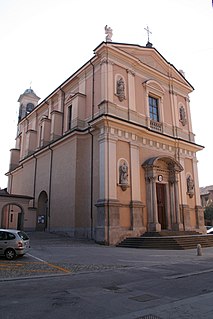
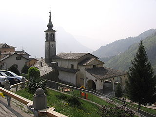
 Church | |
 Gorlago Location of Gorlago in Italy | |
| Coordinates: 45°40′N9°49′E / 45.667°N 9.817°E Coordinates: 45°40′N9°49′E / 45.667°N 9.817°E | |
| Country | Italy |
| Region | Lombardy |
| Province | Province of Bergamo (BG) |
| Government | |
| • Mayor | Gianluigi Marcassoli |
| Area | |
| • Total | 5.6 km2 (2.2 sq mi) |
| Elevation | 233 m (764 ft) |
| Population (31 December 2014) [1] | |
| • Total | 5,186 |
| • Density | 930/km2 (2,400/sq mi) |
| Demonym(s) | Gorlaghesi |
| Time zone | CET (UTC+1) |
| • Summer (DST) | CEST (UTC+2) |
| Postal code | 24060 |
| Dialing code | 035 |
| Website | Official website |
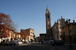
Gorlago (Bergamasque: Gorlàgh) is a comune (municipality) in the Province of Bergamo in the Italian region of Lombardy, located about 60 kilometres (37 mi) northeast of Milan and about 12 kilometres (7 mi) southeast of Bergamo.

The comune is a basic administrative division in Italy, roughly equivalent to a township or municipality.

The Province of Bergamo is a province in the Lombardy region of Italy. It has a population of 1,112,187 (2017), an area of 2,754.91 square kilometers (1,063.68 sq mi), and contains 243 comuni. Its capital is the city of Bergamo.

Italy, officially the Italian Republic, is a country in Southern Europe. Located in the middle of the Mediterranean Sea, Italy shares open land borders with France, Switzerland, Austria, Slovenia and the enclaved microstates San Marino and Vatican City. Italy covers an area of 301,340 km2 (116,350 sq mi) and has a largely temperate seasonal and Mediterranean climate. With around 61 million inhabitants, it is the fourth-most populous EU member state and the most populous country in Southern Europe.
Gorlago borders the following municipalities: Bolgare, Carobbio degli Angeli, Costa di Mezzate, Montello, San Paolo d'Argon, Trescore Balneario.

Bolgare is a comune in the province of Bergamo, in Lombardy, Italy. It is situated in the plain between the rivers Serio and Oglio, 13 km southeast of Bergamo.

Carobbio degli Angeli is a comune (municipality) in the Province of Bergamo in the Italian region of Lombardy, located about 60 kilometres (37 mi) northeast of Milan and about 13 kilometres (8 mi) southeast of Bergamo.

Costa di Mezzate is a comune in the province of Bergamo, in Lombardy, Italy. Neighbouring communes are Albano Sant'Alessandro, Bagnatica, Bolgare, Calcinate, Gorlago and Montello.
The opera singer Luigi Bolis owned a villa and farm estate on the banks of the Cherio River in Gorlago in the late 19th century and died there in 1905.
Luigi Bolis was an Italian tenor. After his triumphant debut in 1864, he became an important opera singer in major theaters in Italy and in Europe in the 1870s. His name is engraved at the Italian Hospital of Buenos Aires.

The Cherio River is a river of the Province of Bergamo in Lombardy in Italy. The river runs for 32 kilometers (20 mi) and has a basin area of 161 square kilometers (62 sq mi). Its source is at 1,276 meters (4,186 ft) above sea level at Monte Torrezzo near Lake Endine. From there, it flows into the Oglio at Palosco. The main tributary is the Tadone River on its right bank.