| Oneta | |
|---|---|
| Comune | |
| Comune di Oneta | |
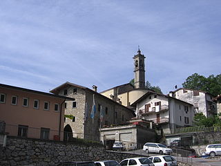
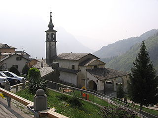
Oneta | |
 Oneta Location of Oneta in Italy | |
| Coordinates: 45°52′N9°49′E / 45.867°N 9.817°E Coordinates: 45°52′N9°49′E / 45.867°N 9.817°E | |
| Country | Italy |
| Region | Lombardy |
| Province | Province of Bergamo (BG) |
| Frazioni | Scullera, Cantoni, Case Fanfani, Molino, Case Belotti |
| Area | |
| • Total | 18.3 km2 (7.1 sq mi) |
| Elevation | 740 m (2,430 ft) |
| Population (Dec. 2004) | |
| • Total | 731 |
| • Density | 40/km2 (100/sq mi) |
| Demonym(s) | Onetesi |
| Time zone | CET (UTC+1) |
| • Summer (DST) | CEST (UTC+2) |
| Postal code | 24020 |
| Dialing code | 035 |


Oneta is a comune (municipality) in the Province of Bergamo in the Italian region of Lombardy, located about 70 kilometres (43 mi) northeast of Milan and about 20 kilometres (12 mi) northeast of Bergamo. As of 31 December 2004, it had a population of 731 and an area of 18.3 square kilometres (7.1 sq mi). [1]

The comune is a basic administrative division in Italy, roughly equivalent to a township or municipality.

The Province of Bergamo is a province in the Lombardy region of Italy. It has a population of 1,112,187 (2017), an area of 2,754.91 square kilometers (1,063.68 sq mi), and contains 243 comuni. Its capital is the city of Bergamo.

Italy, officially the Italian Republic, is a European country consisting of a peninsula delimited by the Italian Alps and sorrounded by several islands. Located in the middle of the Mediterranean sea and traversed along its lenght by the Apennines, Italy has a largely temperate seasonal climate. The country covers an area of 301,340 km2 (116,350 sq mi) and shares open land borders with France, Slovenia, Austria, Switzerland and the enclaved microstates of Vatican City and San Marino. Italy has a territorial exclave in Switzerland (Campione) and a maritime exclave in the Tunisian sea (Lampedusa). With around 60 million inhabitants, Italy is the fourth-most populous member state of the European Union.
The municipality of Oneta contains the frazioni (subdivisions, mainly villages and hamlets) Scullera, Cantoni, Case Fanfani, Molino, and Case Belotti.
"Frazione" is the Italian name given in administrative law to a type of territorial subdivision of a comune; for other administrative divisions, see municipio, circoscrizione, quartiere. It is cognate to the English word fraction, but in practice is roughly equivalent to "parishes" or "wards" in other countries.
Oneta borders the following municipalities: Colzate, Cornalba, Gorno, Oltre il Colle, Premolo, Vertova.

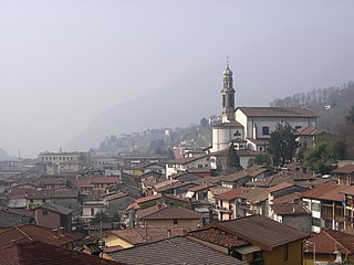
Colzate is a comune (municipality) in the Province of Bergamo in the Italian region of Lombardy, located about 70 kilometres (43 mi) northeast of Milan and about 20 kilometres (12 mi) northeast of Bergamo. As of 31 December 2004, it had a population of 1,638 and an area of 6.7 square kilometres (2.6 sq mi).

Cornalba is a comune (municipality) in the Province of Bergamo in the Italian region of Lombardy, located about 60 kilometres (37 mi) northeast of Milan and about 20 kilometres (12 mi) northeast of Bergamo. As of 31 December 2010, it had a population of 310 and an area of 9.4 square kilometres (3.6 sq mi).

Gorno is a comune (municipality) in the Province of Bergamo in the Italian region of Lombardy, located about 70 km (43 mi) northeast of Milan and about 25 km (16 mi) northeast of Bergamo. As of 31 December 2004, it had a population of 1,760 and an area of 9.9 km2 (3.8 sq mi).