
Bottanuco is a comune (municipality) in the Province of Bergamo in the Italian region of Lombardy, located about 35 kilometres (22 mi) northeast of Milan and about 14 kilometres (9 mi) southwest of Bergamo. As of 31 December 2004, it had a population of 4,874 and an area of 5.7 square kilometres (2.2 sq mi).
Bracca is a comune (municipality) in the Province of Bergamo in the Italian region of Lombardy, located about 60 kilometres (37 mi) northeast of Milan and about 14 kilometres (9 mi) northeast of Bergamo. As of 31 December 2004, it had a population of 827 and an area of 5.5 square kilometres (2.1 sq mi).

Brembate is a comune (municipality) in the Province of Bergamo in the Italian region of Lombardy, located about 35 kilometres (22 mi) northeast of Milan and about 14 kilometres (9 mi) southwest of Bergamo. As of 31 December 2010, it had a population of 8,234 and an area of 5.5 square kilometres (2.1 sq mi).

Calvenzano is a comune (municipality) in the Province of Bergamo in the Italian region of Lombardy, located about 35 kilometres (22 mi) east of Milan and about 25 kilometres (16 mi) south of Bergamo. As of 31 December 2004, it had a population of 3,618 and an area of 6.5 square kilometres (2.5 sq mi).

Cenate Sopra is a comune (municipality) in the Province of Bergamo in the Italian region of Lombardy, located about 60 kilometres (37 mi) northeast of Milan and about 12 kilometres (7.5 mi) east of Bergamo. As of 31 December 2004, it had a population of 2,248 and an area of 6.9 square kilometres (2.7 sq mi).

Ciserano is a comune (municipality) in the Province of Bergamo in the Italian region of Lombardy, located about 35 kilometres (22 mi) northeast of Milan and about 14 kilometres (9 mi) southwest of Bergamo. As of 31 December 2004, it had a population of 5,270 and an area of 5.2 square kilometres (2.0 sq mi).

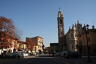
Ghisalba is a comune (municipality) in the Province of Bergamo in the Italian region of Lombardy, located about 50 kilometres (31 mi) northeast of Milan and about 13 kilometres (8 mi) southeast of Bergamo. As of 31 December 2010, it had a population of 5,967 and an area of 10.2 square kilometres (3.9 sq mi).

Gorle is a comune (municipality) in the Province of Bergamo in the Italian region of Lombardy, located about 50 kilometres (31 mi) northeast of Milan and about 4 kilometres (2 mi) east of Bergamo. As of 31 December 2004, it had a population of 5,506 and an area of 2.4 square kilometres (0.93 sq mi).
Lurano is a comune (municipality) in the Province of Bergamo in the Italian region of Lombardy, located about 40 kilometres (25 mi) northeast of Milan and about 15 kilometres (9 mi) south of Bergamo. As of 31 December 2004, it had a population of 2,201 and an area of 4.0 square kilometres (1.5 sq mi).
Osio Sotto is a comune (municipality) in the Province of Bergamo in the Italian region of Lombardy, located about 40 kilometres (25 mi) northeast of Milan and about 11 kilometres (7 mi) southwest of Bergamo. As of 31 December 2004, it had a population of 11,097 and an area of 7.5 square kilometres (2.9 sq mi).

Parre is a comune (municipality) in the Province of Bergamo in the Italian region of Lombardy, located about 70 kilometres (43 mi) northeast of Milan and about 25 kilometres (16 mi) northeast of Bergamo. As of 31 December 2004, it had a population of 2,821 and an area of 22.5 square kilometres (8.7 sq mi).

Ponte Nossa is a comune (municipality) in the Province of Bergamo in the Italian region of Lombardy, located about 70 kilometres (43 mi) northeast of Milan and about 25 kilometres (16 mi) northeast of Bergamo. As of 31 December 2004, it had a population of 2,048 and an area of 5.6 square kilometres (2.2 sq mi).

Ranica is a comune (municipality) in the Province of Bergamo in the Italian region of Lombardy, located about 50 kilometres (31 mi) northeast of Milan and about 5 kilometres (3 mi) northeast of Bergamo. As of 31 December 2004, it had a population of 5,984 and an area of 4.2 square kilometres (1.6 sq mi).

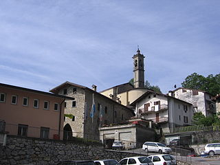
Santa Brigida is a comune (municipality) in the Province of Bergamo in the Italian region of Lombardy, located about 70 kilometres (43 mi) northeast of Milan and about 30 kilometres (19 mi) north of Bergamo. As of 31 December 2004, it had a population of 623 and an area of 14.2 square kilometres (5.5 sq mi).

Selvino is a comune (municipality) in the Province of Bergamo in the Italian region of Lombardy, located about 60 kilometres (37 mi) northeast of Milan and about 11 kilometres (7 mi) northeast of Bergamo. As of 31 December 2004, it had a population of 2,045 and an area of 6.4 square kilometres (2.5 sq mi).

Viadanica is a comune (municipality) in the Province of Bergamo in the Italian region of Lombardy, located about 70 kilometres (43 mi) northeast of Milan and about 25 kilometres (16 mi) east of Bergamo. As of 31 December 2004, it had a population of 1,093 and an area of 5.4 square kilometres (2.1 sq mi).

Villa d'Ogna is a comune (municipality) in the Province of Bergamo in the Italian region of Lombardy, located about 80 kilometres (50 mi) northeast of Milan and about 30 kilometres (19 mi) northeast of Bergamo. As of 31 December 2004, it had a population of 1,891 and an area of 5.2 square kilometres (2.0 sq mi).
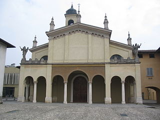
Villongo is a comune (municipality) in the Province of Bergamo in the Italian region of Lombardy, located about 60 kilometres (37 mi) northeast of Milan and about 20 kilometres (12 mi) east of Bergamo. As of January 2017, it had a population of 8,052 and an area of 5.93 square kilometres (2.29 sq mi).


