Algua | ||
---|---|---|
Comune | ||
Comune di Algua | ||
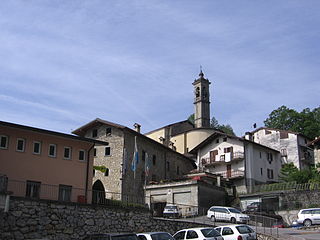
frazione Sambusita | ||
| ||
Coordinates: 45°50′N9°43′E / 45.833°N 9.717°E Coordinates: 45°50′N9°43′E / 45.833°N 9.717°E | ||
Country | Italy | |
Region | Lombardy | |
Province | Province of Bergamo (BG) | |
Frazioni | Frerola, Pagliaro, Rigosa, Sambusita | |
Government | ||
• Mayor | Pier Angelo Acerbis | |
Area | ||
• Total | 8.1 km2 (3.1 sq mi) | |
Elevation | 432 m (1,417 ft) | |
Population (28 February 2017) [1] | ||
• Total | 670 | |
• Density | 83/km2 (210/sq mi) | |
Demonym(s) | Alguesi | |
Time zone | CET (UTC+1) | |
• Summer (DST) | CEST (UTC+2) | |
Postal code | 24010 | |
Dialing code | 0345 | |
Website | Official website |
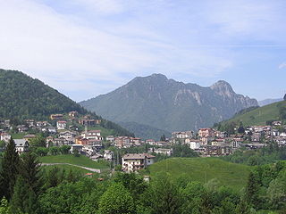
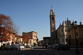
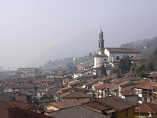
Algua is a comune (municipality) in the Province of Bergamo in the Italian region Lombardy, located about 60 kilometres (37 mi) northeast of Milan and about 15 kilometres (9 mi) north of Bergamo.
The comune is a basic administrative division in Italy, roughly equivalent to a township or municipality.
The Province of Bergamo is a province in the Lombardy region of Italy. It has a population of 1,112,187 (2017), an area of 2,754.91 square kilometers (1,063.68 sq mi), and contains 243 comuni. Its capital is the city of Bergamo.
Italy, officially the Italian Republic, is a country in Southern and Western Europe. Located in the middle of the Mediterranean Sea, Italy shares open land borders with France, Switzerland, Austria, Slovenia and the enclaved microstates San Marino and Vatican City. Italy covers an area of 301,340 km2 (116,350 sq mi) and has a largely temperate seasonal and Mediterranean climate. With around 61 million inhabitants, it is the fourth-most populous EU member state and the most populous country in Southern Europe.
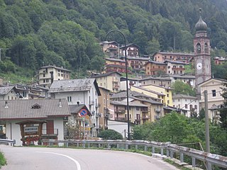
The municipality of Algua contains the frazioni (subdivisions, mainly villages and hamlets) Frerola, Pagliaro, Sambusita and Rigosa.
"Frazione" is the Italian name given in administrative law to a type of territorial subdivision of a comune; for other administrative divisions, see municipio, circoscrizione, quartiere. It is cognate to the English word fraction, but in practice is roughly equivalent to "parishes" or "wards" in other countries.
Algua borders the following municipalities: Aviatico, Bracca, Costa di Serina, Nembro, San Pellegrino Terme, Selvino, Serina, and Zogno.
Aviatico is a comune (municipality) in the Province of Bergamo in the Italian region of Lombardy, located about 60 kilometres (37 mi) northeast of Milan and about 12 kilometres (7 mi) northeast of Bergamo. As of 31 December 2007, it had a population of 515 and an area of 8.4 square kilometres (3.2 sq mi).
Bracca is a comune (municipality) in the Province of Bergamo in the Italian region of Lombardy, located about 60 kilometres (37 mi) northeast of Milan and about 14 kilometres (9 mi) northeast of Bergamo. As of 31 December 2004, it had a population of 827 and an area of 5.5 square kilometres (2.1 sq mi).
Nembro is a comune (municipality) in the Province of Bergamo in the Italian region of Lombardy, located about 60 kilometres (37 mi) northeast of Milan and about 10 kilometres (6 mi) northeast of Bergamo, on the right bank of the Serio River.
Costa Serina is a comune in the province of Bergamo, in Lombardy, northern Italy. Neighbouring communes are Algua, Aviatico, Bracca, Cornalba, Gazzaniga, Serina, Vertova and Zogno.
Curno is a comune (municipality) in the Province of Bergamo in the Italian region of Lombardy, located about 40 kilometres (25 mi) northeast of Milan and about 6 kilometres (4 mi) southwest of Bergamo. As of 31 December 2006, it had a population of 7,590 and an area of 4.62 square kilometres (1.78 sq mi).
Dossena is a comune (municipality) in the Province of Bergamo in the Italian region of Lombardy, located about 60 kilometres (37 mi) northeast of Milan and about 20 kilometres (12 mi) north of Bergamo.
Gazzaniga is a comune (municipality) in the Province of Bergamo in the Italian region of Lombardy, located about 60 kilometres (37 mi) northeast of Milan and 18 kilometres (11 mi) northeast of Bergamo.
Gorle is a comune (municipality) in the Province of Bergamo in the Italian region of Lombardy, located about 50 kilometres (31 mi) northeast of Milan and about 4 kilometres (2 mi) east of Bergamo. As of 31 December 2004, it had a population of 5,506 and an area of 2.4 square kilometres (0.93 sq mi).
Mozzo is a comune (municipality) in the Province of Bergamo in the Italian region of Lombardy, located about 45 kilometres (28 mi) northeast of Milan and about 5 kilometres (3 mi) west of Bergamo. As of 31 December 2004, it had a population of 7,202 and an area of 3.6 square kilometres (1.4 sq mi).
Oltre il Colle is a comune (municipality) in the Province of Bergamo in the Italian region of Lombardy, located about 70 kilometres (43 mi) northeast of Milan and about 20 kilometres (12 mi) northeast of Bergamo. As of 31 December 2004, it had a population of 1,114 and an area of 32.4 square kilometres (12.5 sq mi).
Osio Sotto is a comune (municipality) in the Province of Bergamo in the Italian region of Lombardy, located about 40 kilometres (25 mi) northeast of Milan and about 11 kilometres (7 mi) southwest of Bergamo. As of 31 December 2004, it had a population of 11,097 and an area of 7.5 square kilometres (2.9 sq mi).
Paladina is a comune (municipality) in the Province of Bergamo in the Italian region of Lombardy, located about 45 kilometres (28 mi) northeast of Milan and about 5 kilometres (3 mi) northwest of Bergamo.
Roncobello is a comune (municipality) in the Province of Bergamo in the Italian region of Lombardy, located about 70 kilometres (43 mi) northeast of Milan and about 30 kilometres (19 mi) north of Bergamo.
Selvino is a comune (municipality) in the Province of Bergamo in the Italian region of Lombardy, located about 60 kilometres (37 mi) northeast of Milan and about 11 kilometres (7 mi) northeast of Bergamo. As of 31 December 2004, it had a population of 2,045 and an area of 6.4 square kilometres (2.5 sq mi).
Serina is a comune (municipality) in the Province of Bergamo in the Italian region of Lombardy, located about 60 kilometres (37 mi) northeast of Milan and about 31 kilometres (19 mi) northeast of Bergamo. As of 31 December 2004, it had a population of 2,214 and an area of 27.6 square kilometres (10.7 sq mi).
Sorisole is a comune (municipality) in the Province of Bergamo in the Italian region of Lombardy, located about 50 kilometres (31 mi) northeast of Milan and about 4 kilometres (2 mi) north of Bergamo. As of 31 December 2004, it had a population of 8,507 and an area of 12.3 square kilometres (4.7 sq mi).
Valbrembo is a comune (municipality) in the Province of Bergamo in the Italian region of Lombardy, located about 45 kilometres (28 mi) northeast of Milan and about 4 kilometres (2 mi) northwest of Bergamo. As of 31 December 2004, it had a population of 3,584 and an area of 3.7 square kilometres (1.4 sq mi).
Vertova is a comune (municipality) in the Province of Bergamo in the Italian region of Lombardy, located about 70 kilometres (43 mi) northeast of Milan and about 20 kilometres (12 mi) northeast of Bergamo. As of 31 December 2004, it had a population of 4,793 and an area of 15.8 square kilometres (6.1 sq mi).
Zogno is a comune (municipality) in the Province of Bergamo in the Italian region of Lombardy, located about 50 kilometres (31 mi) northeast of Milan and about 11 kilometres (7 mi) north of Bergamo.
Cornalba is a comune (municipality) in the Province of Bergamo in the Italian region of Lombardy, located about 60 kilometres (37 mi) northeast of Milan and about 20 kilometres (12 mi) northeast of Bergamo. As of 31 December 2010, it had a population of 310 and an area of 9.4 square kilometres (3.6 sq mi).
This article on a location in the Province of Bergamo is a stub. You can help Wikipedia by expanding it. |