Torre Pallavicina

Last updated
Torre Pallavicina
Comune
Comune di Torre Pallavicina
GiorgesTorreplvc1.JPG
Barbó Palace
Italy provincial location map 2015.svg
Red pog.svg
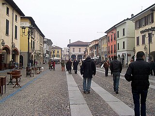
Torre Pallavicina
Location of Torre Pallavicina in Italy
Coordinates: 45°27′N9°52′E / 45.450°N 9.867°E / 45.450; 9.867 Coordinates: 45°27′N9°52′E / 45.450°N 9.867°E / 45.450; 9.867
Country Italy
Region Lombardy
Province Province of Bergamo (BG)
Frazioni Villanuova, Torre, S.Maria in Campagna
Area
  Total 10.3 km2 (4.0 sq mi)
Elevation 95 m (312 ft)
Population (Dec. 2004)
  Total 1,093
  Density 110/km2 (270/sq mi)
Demonym(s) Torrepallavicinesi
Time zone CET (UTC+1)
  Summer (DST) CEST (UTC+2)
Postal code24050
Dialing code 0363

Torre Pallavicina (Bergamasque: Tór Palaisina) is a comune (municipality) in the Province of Bergamo in the Italian region of Lombardy, located about 50 kilometres (31 mi) east of Milan and about 30 kilometres (19 mi) southeast of Bergamo. As of 31 December 2004, it had a population of 1,093 and an area of 10.3 square kilometres (4.0 sq mi). [1]

<i>Comune</i> third-level administrative divisions of the Italian Republic

The comune is a basic administrative division in Italy, roughly equivalent to a township or municipality.

Province of Bergamo Province of Italy

The Province of Bergamo is a province in the Lombardy region of Italy. It has a population of 1,112,187 (2017), an area of 2,754.91 square kilometers (1,063.68 sq mi), and contains 243 comuni. Its capital is the city of Bergamo.

Italy republic in Southern Europe

Italy, officially the Italian Republic, is a country in Southern and Western Europe. Located in the middle of the Mediterranean Sea, Italy shares open land borders with France, Switzerland, Austria, Slovenia and the enclaved microstates San Marino and Vatican City. Italy covers an area of 301,340 km2 (116,350 sq mi) and has a largely temperate seasonal and Mediterranean climate. With around 61 million inhabitants, it is the fourth-most populous EU member state and the most populous country in Southern Europe.

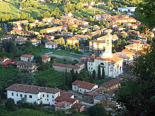
The municipality of Torre Pallavicina contains the frazioni (subdivisions, mainly villages and hamlets) Villanuova, Torre, and S.Maria in Campagna. The church of Santa Maria in Campagna, Torre Pallavicina is under restoration.

"Frazione" is the Italian name given in administrative law to a type of territorial subdivision of a comune; for other administrative divisions, see municipio, circoscrizione, quartiere. It is cognate to the English word fraction, but in practice is roughly equivalent to "parishes" or "wards" in other countries.

Santa Maria in Campagna is a renaissance-style, Roman Catholic parish church located in the town of Torre Pallavicina, province of Bergamo, region of Lombardy, Italy.

Torre Pallavicina borders the following municipalities: Fontanella, Orzinuovi, Pumenengo, Roccafranca, Soncino.

Orzinuovi Comune in Lombardy, Italy

Orzinuovi is a town and comune in the province of Brescia, in Lombardy, Italy.

Pumenengo Comune in Lombardy, Italy

Pumenengo is a comune (municipality) in the Province of Bergamo in the Italian region of Lombardy, located about 50 kilometres (31 mi) east of Milan and about 30 kilometres (19 mi) southeast of Bergamo. As of 31 December 2004, it had a population of 1,512 and an area of 10.1 square kilometres (3.9 sq mi).

Roccafranca Comune in Lombardy, Italy

Roccafranca is a comune in the province of Brescia, in Lombardy.

Demographic evolution

Torre Pallavicina

Related Research Articles

Soncino, Lombardy Comune in Lombardy, Italy

Soncino is a comune (municipality) in the Province of Cremona in the Italian region Lombardy, located about 60 kilometres (37 mi) east of Milan and about 30 kilometres (19 mi) northwest of Cremona.

Torre di Santa Maria Comune in Lombardy, Italy

Torre di Santa Maria is a comune (municipality) in the Province of Sondrio in the Italian region Lombardy, located about 100 kilometres (62 mi) northeast of Milan and about 8 kilometres (5 mi) north of Sondrio. As of 31 December 2004, it had a population of 884 and an area of 45.5 square kilometres (17.6 sq mi).

Azzone Comune in Lombardy, Italy

Azzone is a comune (municipality) in the Province of Bergamo in the Italian region of Lombardy, located about 90 kilometres (56 mi) northeast of Milan and about 45 kilometres (28 mi) northeast of Bergamo. As of 31 December 2004, it had a population of 458 and an area of 16.8 square kilometres (6.5 sq mi).

Caprino Bergamasco Comune in Lombardy, Italy

Caprino Bergamasco is a comune (municipality) in the Province of Bergamo in the Italian region of Lombardy, located about 40 kilometres (25 mi) northeast of Milan and about 15 kilometres (9 mi) northwest of Bergamo. As of 31 December 2004, it had a population of 2,908 and an area of 8.6 square kilometres (3.3 sq mi).

Dalmine Comune in Lombardy, Italy

Dalmine is a comune (municipality) in the Province of Bergamo in the Italian region of Lombardy, located about 40 kilometres (25 mi) northeast of Milan and about 8 kilometres (5 mi) southwest of Bergamo. As of 31 December 2004, it had a population of 22,326 and an area of 11.6 square kilometres (4.5 sq mi).

Fontanella, Lombardy Comune in Lombardy, Italy

Fontanella is a comune (municipality) in the Province of Bergamo in the Italian region of Lombardy, located about 50 kilometres (31 mi) east of Milan and about 30 kilometres (19 mi) southeast of Bergamo. As of 31 December 2004, it had a population of 3,773 and an area of 17.9 square kilometres (6.9 sq mi).

Gorle Comune in Lombardy, Italy

Gorle is a comune (municipality) in the Province of Bergamo in the Italian region of Lombardy, located about 50 kilometres (31 mi) northeast of Milan and about 4 kilometres (2 mi) east of Bergamo. As of 31 December 2004, it had a population of 5,506 and an area of 2.4 square kilometres (0.93 sq mi).

Osio Sotto Comune in Lombardy, Italy

Osio Sotto is a comune (municipality) in the Province of Bergamo in the Italian region of Lombardy, located about 40 kilometres (25 mi) northeast of Milan and about 11 kilometres (7 mi) southwest of Bergamo. As of 31 December 2004, it had a population of 11,097 and an area of 7.5 square kilometres (2.9 sq mi).

Pedrengo Comune in Lombardy, Italy

Pedrengo is a comune (municipality) in the Province of Bergamo in the Italian region of Lombardy, located about 50 kilometres (31 mi) northeast of Milan and about 5 kilometres (3 mi) east of Bergamo. As of 31 December 2004, it had a population of 5,321 and an area of 3.6 square kilometres (1.4 sq mi).

Ponteranica Comune in Lombardy, Italy

Ponteranica is a comune (municipality) in the Province of Bergamo in the Italian region of Lombardy, located about 50 kilometres (31 mi) northeast of Milan and about 4 kilometres (2 mi) northwest of Bergamo. As of 31 December 2004, it had a population of 6,866 and an area of 8.4 square kilometres (3.2 sq mi).

Ranica Comune in Lombardy, Italy

Ranica is a comune (municipality) in the Province of Bergamo in the Italian region of Lombardy, located about 50 kilometres (31 mi) northeast of Milan and about 5 kilometres (3 mi) northeast of Bergamo. As of 31 December 2004, it had a population of 5,984 and an area of 4.2 square kilometres (1.6 sq mi).

Roncola Comune in Lombardy, Italy

Roncola is a comune (municipality) in the Province of Bergamo in the Italian region of Lombardy, located about 45 kilometres (28 mi) northeast of Milan and about 12 kilometres (7 mi) northwest of Bergamo.

Scanzorosciate Comune in Lombardy, Italy

Scanzorosciate is a comune (municipality) in the Province of Bergamo in the Italian region of Lombardy, located about 50 kilometres (31 mi) northeast of Milan and about 6 kilometres (4 mi) northeast of Bergamo. As of 30 April 2013, it had a population of 10,018 and an area of 10.8 square kilometres (4.2 sq mi).

Torre Boldone Comune in Lombardy, Italy

Torre Boldone is a comune (municipality) in the Province of Bergamo in the Italian region of Lombardy, located about 50 kilometres (31 mi) northeast of Milan and about 3 kilometres (2 mi) northeast of Bergamo, at the entrance of the Valle Seriana. Part of Torre Boldone's territory is part of Parco dei Colli di Bergamo

Torre de Roveri Comune in Lombardy, Italy

Torre de' Roveri is a comune (municipality) in the Province of Bergamo in the Italian region of Lombardy, located about 50 kilometres (31 mi) northeast of Milan and about 9 kilometres (6 mi) east of Bergamo. As of 31 December 2004, it had a population of 2,134 and an area of 2.7 square kilometres (1.0 sq mi).

Vertova Comune in Lombardy, Italy

Vertova is a comune (municipality) in the Province of Bergamo in the Italian region of Lombardy, located about 70 kilometres (43 mi) northeast of Milan and about 20 kilometres (12 mi) northeast of Bergamo. As of 31 December 2004, it had a population of 4,793 and an area of 15.8 square kilometres (6.1 sq mi).

Zogno Comune in Lombardy, Italy

Zogno is a comune (municipality) in the Province of Bergamo in the Italian region of Lombardy, located about 50 kilometres (31 mi) northeast of Milan and about 11 kilometres (7 mi) north of Bergamo.

Torre de Busi Comune in Lombardy, Italy

Torre de' Busi is a comune (municipality) in the Province of Bergamo in the Italian region Lombardy, located about 40 kilometres (25 mi) northeast of Milan and about 27 kilometres (17 mi) northwest of Bergamo.

References

  1. All demographics and other statistics: Italian statistical institute Istat.