
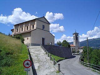
Brembilla was a comune in the province of Bergamo, in Lombardy, Italy. It was situated 15 km northwest of Bergamo. In 2014, the municipality of Gerosa was merged with Brembilla to create a new municipality, named Val Brembilla.
Bedulita is a comune (municipality) in the Province of Bergamo in the Italian region of Lombardy, located about 45 kilometres (28 mi) northeast of Milan and about 13 kilometres (8 mi) northwest of Bergamo.

Berbenno is a comune (municipality) in the Province of Bergamo in the Italian region of Lombardy, located about 50 kilometres (31 mi) northeast of Milan and about 15 kilometres (9 mi) northwest of Bergamo.

Blello is a comune (municipality) in the Province of Bergamo in the Italian region of Lombardy, located about 50 kilometres (31 mi) northeast of Milan and about 15 kilometres (9 mi) northwest of Bergamo. As of 31 December 2004, it had a population of 91 and an area of 2.2 square kilometres (0.85 sq mi).

Brumano is a comune (municipality) in the Province of Bergamo in the Italian region of Lombardy, located about 50 kilometres (31 mi) northeast of Milan and about 20 kilometres (12 mi) northwest of Bergamo. As of 31 December 2004, it had a population of 96 and an area of 8.1 square kilometres (3.1 sq mi).

Capizzone is a comune (municipality) in the Province of Bergamo in the Italian region of Lombardy, located about 45 kilometres (28 mi) northeast of Milan and about 12 kilometres (7 mi) northwest of Bergamo.

Corna Imagna is a comune (municipality) in the Province of Bergamo in the Italian region of Lombardy, located about 50 kilometres (31 mi) northeast of Milan and about 15 kilometres (9 mi) northwest of Bergamo. As of 31 December 2004, it had a population of 968 and an area of 4.5 square kilometres (1.7 sq mi).
Fuipiano Valle Imagna is a comune (municipality) in the Province of Bergamo in the Italian region of Lombardy, located about 50 kilometres (31 mi) northeast of Milan and about 20 kilometres (12 mi) northwest of Bergamo. As of 31 December 2004, it had a population of 238 and an area of 4.2 square kilometres (1.6 sq mi).

Locatello is a comune (municipality) in the Province of Bergamo in the Italian region of Lombardy, located about 50 kilometres (31 mi) northeast of Milan and about 20 kilometres (12 mi) northwest of Bergamo. As of 31 December 2004, it had a population of 785 and an area of 3.8 square kilometres (1.5 sq mi).

Roncola is a comune (municipality) in the Province of Bergamo in the Italian region of Lombardy, located about 45 kilometres (28 mi) northeast of Milan and about 12 kilometres (7 mi) northwest of Bergamo.
Rota d'Imagna is a comune (municipality) in the Province of Bergamo in the Italian region of Lombardy, located about 50 kilometres (31 mi) northeast of Milan and about 20 kilometres (12 mi) northwest of Bergamo. As of 31 December 2004, it had a population of 857 and an area of 6.0 square kilometres (2.3 sq mi).
Sant'Omobono Terme is a comune (municipality) in the Province of Bergamo in the Italian region of Lombardy, located about 50 kilometres (31 mi) northeast of Milan and about 15 kilometres (9 mi) northwest of Bergamo.
Sedrina is a comune (municipality) in the Province of Bergamo in the Italian region of Lombardy, located about 50 kilometres (31 mi) northeast of Milan and about 10 kilometres (6 mi) northwest of Bergamo. As of 31 December 2010, it had a population of 2,559 and an area of 6.0 square kilometres (2.3 sq mi).

Taleggio is a comune (municipality) in the Province of Bergamo in the Italian region of Lombardy, located about 60 kilometres (37 mi) northeast of Milan and about 25 kilometres (16 mi) northwest of Bergamo. As of 31 December 2004, it had a population of 583 and an area of 46.6 square kilometres (18.0 sq mi).

Ubiale Clanezzo is a comune (municipality) in the Province of Bergamo in the Italian region of Lombardy, located about 50 kilometres (31 mi) northeast of Milan and about 10 kilometres (6 mi) northwest of Bergamo.

Valbrembo is a comune (municipality) in the Province of Bergamo in the Italian region of Lombardy, located about 45 kilometres (28 mi) northeast of Milan and about 4 kilometres (2 mi) northwest of Bergamo. As of 31 December 2004, it had a population of 3,584 and an area of 3.7 square kilometres (1.4 sq mi).

Vedeseta is a comune (municipality) in the Province of Bergamo in the Italian region of Lombardy, located about 50 kilometres (31 mi) northeast of Milan and about 25 kilometres (16 mi) northwest of Bergamo. As of 31 December 2004, it had a population of 244 and an area of 19.8 square kilometres (7.6 sq mi).

Zogno is a comune (municipality) in the Province of Bergamo in the Italian region of Lombardy, located about 50 kilometres (31 mi) northeast of Milan and about 11 kilometres (7 mi) north of Bergamo.
Torre de' Busi is a comune (municipality) in the Province of Bergamo in the Italian region Lombardy, located about 40 kilometres (25 mi) northeast of Milan and about 27 kilometres (17 mi) northwest of Bergamo.


