Boroughs of Amsterdam

Last updated
Boroughs of Amsterdam
Amsterdamse stadsdelen 2010.png
Category Urban district
Location Amsterdam, Netherlands
Created
  • December 1981
Number7 (and 1 urban area) (as of 2022)
Populations86,862–157,964 (excluding Westpoort) [1]
Government
  • District committee (7)

The boroughs of Amsterdam (Dutch : stadsdelen; lit. "city parts") are the seven principal subdivisions of the municipality of Amsterdam, Netherlands. [2] Each borough is governed by a directly elected district committee (bestuurscommissie). The first Amsterdam boroughs were created in 1981, with other boroughs created in later years. The last area to be granted the status of borough was Amsterdam-Centrum (2002). The existing system of seven boroughs, covering most parts of Amsterdam, is the result of a major borough reform in 2010. The current boroughs have populations of around 80,000 to 150,000, which is the equivalent to an average-sized municipality in the Netherlands. Since 2022, there is also the urban area (Dutch : stadsgebied) Weesp. [2]

Contents

Borough government

Stadsdeelkantoor (district office) of the borough of Amsterdam-Zuidoost Anton de Komplein 150.jpg
Stadsdeelkantoor (district office) of the borough of Amsterdam-Zuidoost
Residual waste collection by the borough of Amsterdam-Centrum Spijkstaal Gemeente Amsterdam Stadsdeel Centrum.jpg
Residual waste collection by the borough of Amsterdam-Centrum

Until 2014, the Amsterdam boroughs had the status of submunicipalities (deelgemeenten), a form of government which existed only in Amsterdam and Rotterdam. Westpoort, however, was governed by the central municipal authorities and therefore not a submunicipality. The submunicipalities were recognised under the Dutch Municipalities Act and enjoyed far-going autonomy, with the central municipal authorities abiding to the "submunicipalities decide, unless" principle. [3] The submunicipalities were governed by a directly elected district council (deelraad) as well as a separate district executive board, the members of which were appointed and controlled by the council. The central municipal authorities retained some power, especially in the areas of public order (police), budget, public transport and social security.

In 2013, the States General of the Netherlands adopted a revision of the Municipalities Act abolishing submunicipalities as a form of government. [4] Since the 2014 municipal elections, therefore, the Amsterdam district councils have ceased to exist. Under a municipal ordinance, however, they were replaced by smaller, but still directly elected district committees (bestuurscommissies). [5] All Dutch nationals, all EU nationals, as well as non-EU nationals who have lived in the Netherlands for at least three consecutive years, are eligible to vote for the district committee of the Amsterdam borough in which they live according to the city's civil register. [6] Each district committee elects three of its members to form an executive committee (dagelijks bestuur).

The district committees' jurisdiction is determined by the central municipal council. Responsibilities delegated to the 2018-2022 district committees include parks and recreation, streets and squares, refuse collection, permits and events, preparation of zoning plans, passports and drivers licenses, and welfare work. [7] As the new district committees depend on powers being delegated by the central municipal council, their position is far less autonomous than their predecessors. Instead, the district committees are considered to be the local 'eyes and ears' of the central municipal authorities, carrying out their delegated powers within the frameworks determined by the municipal council and the college van burgemeester en wethouders . [8]

List of boroughs

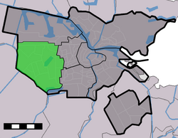
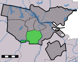
Since 2010, there are 7 boroughs (stadsdelen). [2] [9] Westpoort (West Gateway) is not a borough, because it has a low population and it is directly governed by the municipality.

BoroughAreaPopulationPopulation densityLocation (in green)Neighbourhoods
Centrum
(Centre)
8.04 km2
86,422
13,748/km²
Map NL - Amsterdam - Stadsdeel Binnenstad.png Binnenstad, Grachtengordel, Haarlemmerbuurt, Jodenbuurt, Jordaan, Kadijken, Lastage, Oosterdokseiland, Oostelijke Eilanden, Plantage, Rapenburg, Uilenburg, Westelijke Eilanden, Weteringschans
Nieuw-West
(New West)
32.38 km2
151,677
4,478/km²
Amsterdam - Stadsdeel Nieuw-West.PNG Geuzenveld, Nieuw Sloten, Oostoever, Osdorp, Overtoomse Veld, Sloten, Slotermeer, Slotervaart
Noord
(North)
49.01 km2
94,766
2,269/km²
Map NL - Amsterdam - Stadsdeel Noord.png Banne Buiksloot, Buiksloot, Buikslotermeer, Floradorp, Kadoelen, Molenwijk, Nieuwendam, Nieuwendammerdijk en Buiksloterdijk, Oostzanerwerf, Overhoeks, Tuindorp Nieuwendam, Tuindorp Oostzaan
Oost
(East)
30.56 km2
135,767
7,635/km²
Amsterdam - Stadsdeel Oost.PNG IJburg, Indische Buurt, Eastern Docklands, Oud-Oost, Watergraafsmeer
9.89 km2
143,842
15,252/km²
Amsterdam - Stadsdeel West.PNG Frederik Hendrikbuurt, Houthaven, Spaarndammerbuurt, Staatsliedenbuurt, Zeeheldenbuurt, Westerpark, Kinkerbuurt, Overtoombuurt, De Baarsjes, Bos en Lommer, Kolenkitbuurt, Landlust, Sloterdijk
Zuid
(South)
17.41 km2
144,432
9,349/km²
Amsterdam - Stadsdeel Zuid.PNG Apollobuurt, Buitenveldert, Hoofddorppleinbuurt, Museumkwartier, De Pijp, Prinses Irenebuurt, Rivierenbuurt, Schinkelbuurt, Stadionbuurt, Vondelpark, Willemspark, Zuidas
Zuidoost
(Southeast)
22.08 km2
87,854
4,391/km²
Map NL - Amsterdam - Stadsdeel Zuidoost.png Bijlmermeer, Venserpolder, Gaasperdam, Driemond, Weesp

Urban area

There is 1 urban area (stadsgebied) Weesp. [2] Weesp merged with Amsterdam in 2022. [10] It is located to the east of Zuidoost.

Urban areaAreaPopulationPopulation densityLocation (in green)Villages
24.16 km2
20,445
897/km²
Gem-Weesp-OpenTopo.jpg Driemond

Related Research Articles

<span class="mw-page-title-main">Amsterdam</span> Capital and most populous city of the Netherlands

Amsterdam is the capital and most populated city of the Netherlands. It has a population of 921,402 within the city proper, 1,457,018 in the urban area and 2,480,394 in the metropolitan area. Located in the Dutch province of North Holland, Amsterdam is colloquially referred to as the "Venice of the North", for its large number of canals, now a UNESCO World Heritage Site.

<span class="mw-page-title-main">Almere</span> City and municipality in Flevoland, Netherlands

Almere is a planned city and municipality in the province of Flevoland, Netherlands across the IJmeer from Amsterdam.

<span class="mw-page-title-main">Municipalities of the Netherlands</span> Second-level administrative divisions of the Netherlands

Since 1 January 2023, there have been 342 regular municipalities and three special municipalities in the Netherlands. The latter is the status of three of the six island territories that make up the Dutch Caribbean. Municipalities are the second-level administrative division, or public bodies, in the Netherlands and are subdivisions of their respective provinces. Their duties are delegated to them by the central government and they are ruled by a municipal council that is elected every four years. Municipal mergers have reduced the total number of municipalities by two-thirds since the first official boundaries were created in the mid 19th century. Municipalities themselves are informally subdivided into districts and neighbourhoods for administrative and statistical purposes.

The Government of Amsterdam consists of several territorial and functional forms of local and regional government. The principal form of government is the municipality of Amsterdam, Netherlands. The municipality's territory covers the city of Amsterdam as well as a number of small towns. The city of Amsterdam is also part of several functional forms of regional government. These include the Waterschap of Amstel, Gooi en Vecht, which is responsible for water management, and the Stadsregio of Amsterdam, which has responsibilities in the areas of spatial planning and public transport.

<span class="mw-page-title-main">Amsterdam-Zuidoost</span> Borough of Amsterdam in North Holland, Netherlands

Amsterdam-Zuidoost is a borough (stadsdeel) of Amsterdam, Netherlands. It consists of four residential neighborhoods—Bijlmermeer, Venserpolder, Gaasperdam and Driemond—as well as the Amstel III/Bullewijk Business Park and the Amsterdam Arena entertainment and shopping district.

A deelgemeente, or section, is a subdivision of a municipality in Belgium and, until March 2014, in the Netherlands as well.

A stadsdeel is the name used for urban or municipality districts in some of the larger municipalities of the Netherlands.

<span class="mw-page-title-main">Amsterdam-Noord</span> Borough of Amsterdam in North Holland, Netherlands

Amsterdam-Noord is a borough of Amsterdam, Netherlands with a population of about 90,000. The IJ, the body of water which separates it from Amsterdam-Centrum and the rest of the city, is situated southwest of Amsterdam-Noord. The borough, which has an area of 49.01 km2, borders the municipalities of Zaanstad, Oostzaan, Landsmeer and Waterland to the north, all part of the province of North Holland like Amsterdam. It borders the Markermeer to the east.

<span class="mw-page-title-main">Municipal executive</span>

In the Netherlands, the municipal executive is the executive board of a municipality. It plays a central role in municipal politics in the Netherlands, similar to the communal college in Belgium. It consists of the mayor and the members of the municipal executive (aldermen).

<span class="mw-page-title-main">Westpoort</span> Borough of Amsterdam in North Holland, Netherlands

Westpoort is an area of Amsterdam, Netherlands. The area covers the Port of Amsterdam, the main harbour and industrial area of the city, and is located in the north-western part of Amsterdam. It is divided in the industrial areas of Teleport, Sloterdijk areas I, II and II, De Heining and the harbour area (Havengebied).

<span class="mw-page-title-main">Amsterdam-Oost</span> Borough of Amsterdam in North Holland, Netherlands

Amsterdam-Oost is a borough of Amsterdam, Netherlands, established in May 2010 after a merger of the former boroughs of Zeeburg and Oost-Watergraafsmeer. In 2013, the borough had almost 123,000 inhabitants.

<span class="mw-page-title-main">Amsterdam-West</span> Borough of Amsterdam in North Holland, Netherlands

Amsterdam-West is a borough of Amsterdam, Netherlands, to the west of the centre of the city. This borough was formed in 2010 through the merging of four former boroughs Oud West, Westerpark, De Baarsjes and Bos en Lommer.

<span class="mw-page-title-main">Amsterdam-Zuid</span> Borough of Amsterdam in North Holland, Netherlands

Amsterdam-Zuid is a borough (stadsdeel) of Amsterdam, Netherlands. The borough was formed in 2010 as a merger of the former boroughs Oud-Zuid and Zuideramstel. The borough has almost 138,000 inhabitants (2013). With 8,500 homes per square kilometer, it is one of the most densely populated boroughs of Amsterdam. It has the highest income per household of all boroughs in Amsterdam.

<span class="mw-page-title-main">Amsterdam Nieuw-West</span> Borough of Amsterdam in North Holland, Netherlands

Amsterdam Nieuw-West is a borough comprising the westernmost neighbourhoods of the city of Amsterdam, Netherlands. It was created in 2010 after a merger of the former boroughs Osdorp, Geuzenveld-Slotermeer and Slotervaart. In 2017, the borough had almost 150,000 inhabitants.

<span class="mw-page-title-main">Omval</span> Neighbourhood of Amsterdam in North Holland, Netherlands

Omval is a neighbourhood situated on a peninsula on the eastern shore of the Amstel river in Amsterdam, Netherlands. It is situated south of the Weesperzijde neighbourhood and next to the Amsterdam Amstel railway station in the borough of Amsterdam-Oost. In the 1990s, it became the site of a major business district featuring the Rembrandt Tower, the tallest skyscraper in Amsterdam.

<span class="mw-page-title-main">Government of Rotterdam</span>

The Government of Rotterdam is the government of the municipality and city of Rotterdam in the Netherlands. Most of the inhabitants live in the city of Rotterdam, but the municipality also covers a number of small villages, and other parts of the local government, such as Rozenburg, cover an even larger area.

<span class="mw-page-title-main">Amsterdam-Centrum</span> Borough of Amsterdam in North Holland, Netherlands

Amsterdam-Centrum is the inner-most borough and historical city centre of Amsterdam, Netherlands, containing the majority of the city's landmarks. Established in 2002, Amsterdam-Centrum was the last area in the city to be granted the status of self-governing borough. The borough is 8.04 km2 and covers the UNESCO-listed Amsterdam canal belt. In 2013, the borough had approximately 85,000 inhabitants, who on average had the second-highest income per household in the city and one of the highest in the country.

<span class="mw-page-title-main">Weesp City Hall</span> Seat of local government in Weesp

The Weesp City Hall is the former city hall of Weesp, Netherlands. The main body of the municipality, the municipal council, convened in the Raadzaal until 24 March 2022 when Weesp became part of the municipality of Amsterdam. The administrative offices have moved, but the former Vierschaar and Burgerzaal are still used for weddings and other official proceedings. The rest of the building is in use as the local museum of Weesp.

<span class="mw-page-title-main">Alexander Hammelburg</span> Member of the Dutch House of Representatives

Alexander Robert Hammelburg is a Dutch politician of the Democrats 66 (D66). He has been a member of the House of Representatives since the 2021 general election. He previously worked as a lobbyist for COC Nederland and held a seat in the municipal council of Amsterdam.

<span class="mw-page-title-main">Thijs Reuten</span> Dutch politician

M.J.A. "Thijs" Reuten is a Dutch politician of the Labour Party (PvdA). He began his career as a policy advisor of the party's parliamentary group in the House of Representatives and was a member of the Amsterdam municipal council in the years 2002–07. He then served for two terms as a district alderman in Amsterdam-Oost with a focus on housing and the economy. Starting in 2018, Reuten worked as an independent consultant and as head of policy at the Global Reporting Initiative (GRI). He was appointed to the European Parliament in April 2021 after the resignation of Kati Piri.

References

  1. "Data en informatie".
  2. 1 2 3 4 "Stadsdelen". Gemeente Amsterdam. Archived from the original on 27 March 2023. Retrieved 20 July 2024.
  3. "District Councils". Iamsterdam.com. Archived from the original on 2014-08-12. Retrieved 2014-08-10.
  4. Vermeulen, Floris (2013-12-16). "Goodbye, city district councils. You will be missed for at least one unexpected reason" . Retrieved 2014-08-10.
  5. "Verordening op de bestuurscommissies 2013" (PDF). City of Amsterdam. Retrieved 2014-08-11.[ permanent dead link ]
  6. "Amsterdam Local Elections". Iamsterdam.com. Archived from the original on 2014-08-09. Retrieved 2014-08-08.
  7. "Bestuurlijk stelsel: stadsdelen en bestuurscommissies" (in Dutch). City of Amsterdam. Retrieved 2014-08-08.
  8. "Bestuurlijk stelsel: Stadsdelen en Bestuurscommissies". City of Amsterdam. Retrieved 2014-08-10.
  9. "1.2.1 Standgegevens, 1 januari 2017". Gemeente Amsterdam (in Dutch). Archived from the original on 2018-09-15. Retrieved 15 September 2018.
  10. "Wet van 9 juni 2021 tot herindeling van de gemeenten Amsterdam en Weesp". www.officielebekendmakingen.nl/ (in Dutch). Archived from the original on 2021-10-16. Retrieved 2021-08-25.