Tourist attractions
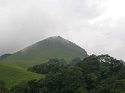
Thirunelli Temple, dedicated to Lord Vishnu, lies on the Kerala side of Brahmagiri. This temple is known as Dakshina Kasi or the Kasi of the South. The temple was constructed in an ancient style and includes 30 granite pillars. According to legend, the temple was constructed by Lord Brahma himself.
Pakshipathalam at an altitude of 1740 m is another attraction on the Kerala side. Pakshipathalam has a cave that is said to have been used by rishis in ancient times. On the Karnataka side it is also known by the name of Munikal cave.
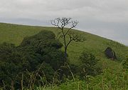
Iruppu (or Irpu or Lakshmana Tirtha) Falls of the Lakshmana Tirtha River lies on the Karnataka side of Brahmagiri. According to legend, when Rama and Lakshmana were searching for Sita, they became thirsty. Lakshmana shot an arrow into the Brahmagiri from which the river sprang. Rama is said to have dedicated a Shiva Kshethra known as Rajeshwara Temple on the banks of river Lakshmana Tirtha. The Lakshmana Tirtha river eventually flows into the Kaveri River. One Jain Temple is also present here built by Kadamba dynasty. Nishani Motte is a peak in Brahmagiri range of hills.
Transportation
Brahmagiri can be reached by a trek from Mananthavady (29 km east) or from Kutta. From Karnataka side, trek to Brahmagiri from Irupu Falls is 9 km and to Munikal Caves (Pakshipathalam) is 7 km. Trekkers need to seek the permission of Range Forest Officer at Srimangala. Brahmagiri is about 11 km from Tirunelli.
The Periya ghat road connects Mananthavady to Kannur and Thalassery. The Thamarassery mountain road connects Calicut with Kalpetta. The Kuttiady mountain road connects Vatakara with Kalpetta and Mananthavady. The Palchuram mountain road connects Kannur and Iritty with Mananthavady. The road from Nilambur to Ooty is also connected to Wayanad through the village of Meppadi.
The nearest railway station is at Mysore and the nearest airports are Kozhikode International Airport-120 km, Bengaluru International Airport-290 km, and Kannur International Airport, 58 km.

Thirunelli Temple is an ancient temple dedicated to Lord Maha Vishnu on the side of Brahmagiri hill in Kerala, near the border with Karnataka state. The temple is at an altitude of about 900m in north Wayanad in a valley surrounded by mountains and beautiful forests. It is 32 km away from Manathavady.

Valliyoorkkavu is an ancient Bhagavathy temple located near Mananthavady in Wayanad district. The temple is for Goddess Durga as its presiding deity in three forms namely: Vana Durga, Bhadrakali, and Jala Durga.

Mazhuvannur is where the axe of Shiva is believed to have fallen )

The Irupu Fallsಇರ್ಪು ಜಲಪಾತ are located in the Brahmagiri Range in the Kodagu district of Karnataka, India, bordering the Wayanad district of Kerala. It is a fresh water cascade and is situated at a distance of 48 km from Virajpet on the highway to Nagarhole. The Falls are also known as the Lakshmana Tirtha Falls, derived from the name of the tributary of Cauvery which starts from these falls, the Lakshmana Tirtha River.

Kabanigiri is a place near Pulpally, Wayanad district. It is One of the nearest places of Kabani River. So it named as Kabanigiri.

Kaniyambetta or Pachilakkad is a village in the Wayanad district of Kerala state, southern India. This places are mainly known as Kaniambetta office. kamblakkad is main town situated here.It is about 8 km from the district capital Kalpetta.

Kottathara or Venniyode is a gram panchayat of Wayanad district, Kerala State, India.
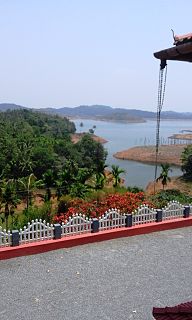
Padinharathara , padinharathara is a small town and important junction in Wayanad district in the state of Kerala, India.

Panamaram is a village in Wayanad district in the state of Kerala, India.

Payyampally is a village in Wayanad district in the state of Kerala, India.

Thirunelly is a village in Wayanad district in the state of Kerala, India.

Thrissilery is a village in Wayanad district in the state of Kerala, India.
Thovarimala Ezhuthupara is a remotely located rock shelter in the Wayanad district of Kerala in India. Pre-historic stone age petroglyphs dating from around 1000 BC and after had been discovered here at a height of 500 m on Thovarimala. One can see the stone age rock engravings on the walls of these natural caves from top of Thovarimala. The rare historic treasure at Thovarimala throwing light into human habitation in the Wayanad area since ancient times, is yet to receive the protection of agencies like Archaeology Department, which preserves the Edakkal Caves just five kilometers away. The carvings, found on the upper side of the cave, depict few geometrical figures, an arrow, and one carving closely resembles a female genital organ. Recently more writings were located in this cave. The name Ezhuthupara means "writings on the stone."
Karingari is a small serene village near Tharuvana in Vellamunda panchayath, Mananthavady area, Wayanad, Kerala, India.

The district capital of Wayanad is Kalpetta town. Kalpetta has very good road connectivity with the rest of Kerala and neighboring South Indian cities. National Highway 766 (India) NH766 connects Kalpetta with Kozhikode and Mysore. State Highways connect Kalpetta with Ooty in Tamil Nadu and Madikeri in Karnataka.

Kattikkulam(Kartikulam) is a small town near Mananthavady in Wayanad district, Kerala, India.The office of the Thirunelly Gramapanchayath is located at Kartikulam.

Neervaram Dasanakara is a village near Panamaram in Wayanad district of Kerala province, India.
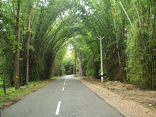
The Wayanad District of Kerala, India has a wide variety of tourist attractions ranging from religious sites to natural, and historical sites. This district is divided into three towns, Kalpetta, Sultan Bathery and Mananthavady. All Major Tourism destinations in the district are maintained by the District Tourism Promotion Council.
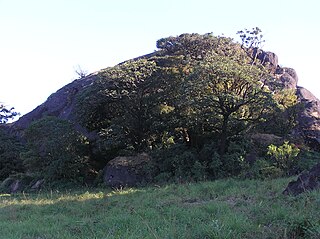
Pakshi Pathalam is a Bird Sanctuary and a tourist location in Wayanad district of Kerala state, India.

Kayakkunnu is a village near Nadavayal, Mananthavady in the Wayanad District of Kerala, India. The village is part of the Panamaram Panchayath, and the assembly constituency is Mananthavady. It is an agricultural area and its main crops include rice, coffee, pepper, ginger, cardamom, vanilla, rubber, areca nut, and coconut. The nearest towns are Nadavayal and Panamaram. Kayakkunn is situated midway along the Mananthavady–Gudalur interstate road.
This page is based on this
Wikipedia article Text is available under the
CC BY-SA 4.0 license; additional terms may apply.
Images, videos and audio are available under their respective licenses.


