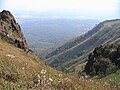
The Green Mountains are a mountain range in the U.S. state of Vermont. The range runs primarily south to north and extends approximately 250 miles (400 km) from the border with Massachusetts to the border with Quebec, Canada. The part of the same range that is in Massachusetts and Connecticut is known as The Berkshires or the Berkshire Hills and the Quebec portion is called the Sutton Mountains, or Monts Sutton in French.
Peak bagging or hill bagging is an activity in which hikers, climbers, and mountaineers attempt to reach a collection of summits, published in the form of a list. This activity has been popularized around the world, with lists such as 100 Famous Japanese Mountains, the Sacred Mountains of China, the Seven Summits, and the eight-thousanders becoming the subject of mass public interest.

Mount Hua is a mountain located near the city of Huayin in Shaanxi Province, about 120 kilometres (75 mi) east of Xi'an. It is the "Western Mountain" of the Five Great Mountains of China and has a long history of religious significance. Originally classified as having three peaks, in modern times the mountain is classified as five main peaks, the highest of which is the South Peak at 2,154.9 metres (7,070 ft).

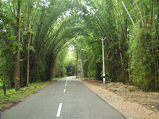
Kodachadri is a mountain peak with dense forests in the Western Ghats in South India, 78 km from Shimoga. It is declared as natural heritage site by the Karnataka Government. and it is 13th highest peak of Karnataka.

Brahmagiri, is a mountain range in the Western Ghats of south India. It is situated on the border between Kodagu district in Karnataka state in the north and Wayanad district of Kerala state on the south. Brahmagiri Hill, at 1608 m height, is a scenic tourist attraction. The top of Brahmagiri Hill is well forested and has much wildlife.
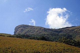
Kudremukha(ಕುದುರೆ ಮುಖ) is a mountain range and name of a peak located in Chikkamagaluru district, in Karnataka, India. It is also the name of a small hill station cum mining town situated near the mountain, about 20 kilometres from Kalasa. The name Kuduremukha literally means 'horse-faced (Kannada) and refers to a particular picturesque view of a side of the mountain that resembles a horse's face. It was also referred to as 'Samseparvata', historically since it was approached from Samse village. Kuduremukha is Karnataka's 2nd highest peak after Mullayanagiri. The nearest International Airport is at Mangalore which is at a distance of 99 kilometres.

The Garo Hills are part of the Garo-Khasi range in Meghalaya, India. They are inhabited mainly by tribal dwellers, the majority of whom are Garo people. It is one of the wettest places in the world. The range is part of the Meghalaya subtropical forests ecoregion.

Baba Budan Giri also known as Dattatray Peeta is a mountain in range of the Western Ghats of India. Located in the Chikmagaluru taluk, Chikmagaluru District of Karnataka, Dattatreya peeta is known for its shrine to a pilgrimage site for Hindus .Sangh parivar organizations started "Datta Jayanti" celebrations in the late 2000s as part of their fight to claim "Sri Guru Dattatreya Swami Dattapit". People go to have a darshan of the Samadhi. The main peaks in this range are the Mullayanagiri and Baba Budangiri. Collectively, these peaks are known as Chandradrona Parvatha Shreni as they naturally form the shape of a crescent moon.

Nandi Hills is an ancient hill fortress built by Ganga Dynasty and later enlarged and strengthened by Tipu Sultan in southern India, in the Chikkaballapur district of Karnataka state. It is 10 km from Chickballapur town and approximately 60 km from Bengaluru. The hills are near the town Nandi. In traditional belief, the hills are the origin of the Arkavathy river, Ponnaiyar River, Palar River, Papagni and Penna River. Watching the sunrise at Nandi Hills is popular with tourists. The first ever SAARC summit hosted by India was held at Nandi Hills in 1986.

Kaiwara is a small town in the Chickballapur district of Karnataka state, located northeast of Bangalore, India. Kaiwara is a popular place to visit, as it is very close to Bangalore, the capital of Karnataka. Free boarding (prasada) and well-maintained, low-cost accommodation is available at the ashram. Chintamani Town is the nearest Taluk Centre and a business hub of this part of Karnataka.

Bhandardara is a dam built by British during their regime in the western ghats of India. The village is located in the Akole tehsil, Ahmednagar district of the state of Maharashtra, about 185 kilometers (115 mi) from Mumbai and 155 kilometers (96 mi) from Ahmednagar.

Gajendragad is a town and a sub-district place in Gadag District, Karnataka, India. This place is known for its hill station and hill strip. Highest populated city after Gadag in the district. It is about 55 kilometers from the district head quarter Gadag, 110 kilometers from Hubballi and 450 kilometers from state capital Bengaluru.

Bhadra Wildlife Sanctuary is a protected area and tiger reserve as part of the Project Tiger, situated in Chikkamagaluru district, 23 km (14 mi) south of Bhadravathi city, 38 km (24 mi) 20 km from Tarikere town, northwest of Chikkamagaluru and 283 km from Bengaluru city in Karnataka state, India. Bhadra sanctuary has a wide range of flora and fauna and is a popular place for day outings. The 1,875 m (6,152 ft) above MSL Hebbe Giri is the highest peak in the sanctuary.

Pushpagiri, at 1,712 metres (5,617 ft), is the highest peak in Pushpagiri Wildlife Sanctuary in the Western Ghats of Karnataka. It is located in the Somwarpet Taluk, 20 kilometres (12 mi) from Somwarpet in the northern part of Kodagu district on the border between Dakshina Kannada and Kodagu district and hassan districts. It is 4th highest peak of Karnataka. The Sanskrit name of the mountain is Puṣpagiri while its Prakrit form is Puphagiri, which is mentioned in the Nagarjunakond Second Apsidal Temple inscription, although this may refer to a different mountain to the north of Cuddapah, in Andhra Pradesh.
Karnataka, the sixth largest state in India, has been ranked as the third most popular state in the country for tourism in 2014. It is home to 507 of the 3600 centrally protected monuments in India, the largest number after Uttar Pradesh. The State Directorate of Archaeology and Museums protects an additional 752 monuments and another 25,000 monuments are yet to receive protection. Tourism centres on the ancient sculptured temples, modern cities, the hill ranges, forests and beaches. Broadly, tourism in Karnataka can be divided into four geographical regions: North Karnataka, the Hill Stations, Coastal Karnataka and South Karnataka.

Eldon Hill is a hill in the Peak District National Park in the county of Derbyshire, England, 4 kilometres (2.5 mi) southwest of the village of Castleton. It is a 470-metre (1,540 ft) limestone hill whose pastureland is used for rough grazing, although a large proportion has been lost to limestone quarrying. It lies within the Castleton Site of Special Scientific Interest. Eldon Hill was formed when a bed of pure limestone was squeezed and upfolded by geological forces to form a dome; it is the highest limestone hill north of the River Wye.

Bettadapura is a town located in Mysore district, in the Indian state of Karnataka. The name is derived from two Kannada words, "Betta" and "pura". Betta means "hill" and pura means "town".

Dhosi Hill is an extinct volcano, standing alone at the north-west end of the Aravalli mountain range, of which it is a part, with height varying from about 345 to 470 meters from the surrounding land and 740 meters from the sea level. It has temple, pond, fort and caves on the top and forest around it. The Aravalli range is a Precambrian Malani igneous suite of rocks that have been dated at 732 Ma BP.

Shivagange is a mountain peak with a height of 1300 metres and Hindu pilgrimage center located near Dobbaspet, in Bengaluru Rural district India. It is situated 19 km from the town of Tumakuru and 54 km from Bengaluru. The sacred mountain is shaped as a shivalinga and a spring flows near locally called "Ganga", thereby giving the place its name. It is also known as Dakshina Kashi and has various temples such as Gangadhareshwara temple, Sri Honnammadevi Temple, Olakal Teertha, Nandi Statue, Patalagang Sharadambe temple and several theerthas such as Agasthya theertha, Kanva theertha, Kapila theertha, Pathala Gange
The Wayanad District of Kerala, India has a wide variety of tourist attractions ranging from religious sites to natural, and historical sites. This district is divided into three towns, Kalpetta, Sultan Bathery and Mananthavady. All Major Tourism destinations in the district are maintained by the District Tourism Promotion Council.