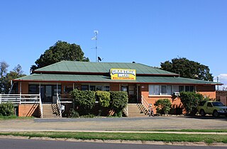
Grantham is a rural town and locality in the Lockyer Valley Region, Queensland, Australia. The town is located 100 kilometres (62 mi) west of the state capital, Brisbane. In the 2021 census, the locality of Grantham had a population of 796 people.
Flagstone Creek is a rural locality in the Lockyer Valley Region, Queensland, Australia. In the 2021 census, Flagstone Creek had a population of 256 people.
Upper Flagstone is a rural locality in the Lockyer Valley Region, Queensland, Australia. In the 2021 census, Upper Flagstone had a population of 191 people.

Lower Tenthill is a rural locality in the Lockyer Valley Region, Queensland, Australia. In the 2021 census, Lower Tenthill had a population of 236 people.

Winwill is a rural locality in the Lockyer Valley Region, Queensland, Australia. In the 2021 census, Winwill had a population of 144 people.

Fordsdale is a rural locality in the Lockyer Valley Region, Queensland, Australia. In the 2021 census, Fordsdale had a population of 50 people.
Lockyer is a rural locality in the Lockyer Valley Region, Queensland, Australia. In the 2021 census, Lockyer had a population of 89 people.
Glen Cairn is a rural locality in the Lockyer Valley Region, Queensland, Australia. In the 2021 census, Glen Cairn had a population of 141 people.

Caffey is a rural locality in the Lockyer Valley Region, Queensland, Australia. In the 2021 census, Caffey had a population of 45 people.
Iredale is a rural locality in the Lockyer Valley Region, Queensland, Australia. In the 2021 census, Iredale had a population of 177 people.

Mount Berryman is a rural locality in the Lockyer Valley Region, Queensland, Australia. In the 2021 census, Mount Berryman had a population of 96 people.
Rockmount is a rural locality in the Lockyer Valley Region, Queensland, Australia. In the 2021 census, Rockmount had a population of 82 people.
Summerholm is a rural locality in the Lockyer Valley Region, Queensland, Australia. In the 2021 census, Summerholm had a population of 646 people.

Brightview is a locality split between the Lockyer Valley Region and Somerset Region, Queensland, Australia. In the 2021 census, Brightview had a population of 911 people.
Crowley Vale is a rural locality in the Lockyer Valley Region, Queensland, Australia. In the 2021 census, Crowley Vale had a population of 106 people.
Laidley South is a rural locality in the Lockyer Valley Region, Queensland, Australia. In the 2021 census, Laidley South had a population of 293 people.
Lilydale is a rural locality in the Lockyer Valley Region, Queensland, Australia. In the 2021 census, Lilydale had a population of 77 people.
Placid Hills is a mixed-use locality on the western outskirts of the town of Gatton in the Lockyer Valley Region, Queensland, Australia. In the 2021 census, Placid Hills had a population of 796 people.
Seventeen Mile is a rural locality in the Lockyer Valley Region, Queensland, Australia. In the 2021 census, Seventeen Mile had a population of 22 people.
Veradilla is a rural locality in the Lockyer Valley Region, Queensland, Australia. In the 2021 census, Veradilla had a population of 125 people.
