Charles V Wall

Last updated

Charles V Wall
Part of Fortifications of Gibraltar
Gibraltar
Upper Charles V Wall.jpg
Upper section of Charles V Wall in the Upper Rock Nature Reserve, Gibraltar
Charles V Wall, 1608.png
1608 plan of the lower portion of the wall, showing lines of fire from the South Bastion, by Cristóbal de Rojas
Gibraltar location map.svg
Red pog.svg
Charles V Wall
Coordinates 36°07′56″N5°20′54″W / 36.132143°N 5.348293°W / 36.132143; -5.348293 Coordinates: 36°07′56″N5°20′54″W / 36.132143°N 5.348293°W / 36.132143; -5.348293
Site information
Owner Government of Gibraltar
Open to
the public
Yes
Site history
Built1540 (1540)
Built by Emperor Charles V

The Charles V Wall is a 16th-century defensive curtain wall that forms part of the fortifications of the British Overseas Territory of Gibraltar. Originally called Muralla de San Benito (English: St. Benedict's Wall), it was built in 1540 and strengthened in 1552 by Holy Roman Emperor Charles V. The wall remains largely intact and extends from South Bastion, which was once at the water's edge in the harbour, to the top ridge of the Rock of Gibraltar.

Contents

Description

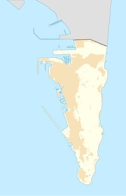
The lower section of the wall runs up from the South Bastion which was once at the water's edge in the harbour, to Prince Edward's Gate at the base of a steep cliff. It is pierced by the Puerta de África (English: Gate of Africa), which is defended from above by the Flat Bastion. [1]

The upper section of Charles V Wall, somewhat further south, runs from the top of a cliff up to the crest of The Rock. It zigzags up the slope of The Rock in four stages in a configuration that lets the defenders give flanking fire to each face. [2] The Hacho (later the Signal Station) at the top of the wall was once equipped with a small tower. [3]

Another wall continues from the lower section of Charles V Wall almost all the way up to the top of The Rock and known as the Moorish Wall. It was once thought to be an ancient wall from the Moorish period. However, the Muralla de San Reymondo (English: St. Raymond's Wall), also known as the Philip II Wall, was built during the 16th century by King Philip II of Spain as a fallback defensive line. [1] [4]

Construction

At the time the Charles V Wall was built, the Barbary pirates posed the main threat to the city. [5] In September 1540 Gibraltar was attacked by a corsair force led by Piali Hamet, one of Barbarossa's captains. The town was plundered and many of the leading citizens were taken captive. [6] [lower-alpha 1] The wall, originally called the Muralla de San Benito (English: St. Benedict's Wall), was built in 1540 to help defend The Rock against further attacks from the south. [2]

Starting around 1552 the Italian military engineer Giovanni Battista Calvi made improvements to the wall. [2] Calvi designed a wall that ran west–east in a straight line from the coast for about 280 metres (920 ft) until it reached a precipice. A traverse ran north–south along the top of the cliff, and then a zigzag wall ran up to the crest of the Rock of Gibraltar. [8]

Philip II succeeded Charles V in 1558, and commissioned the Genovese engineer Giovan Giacomo Paleari Fratino to continue the improvements. El Fratino decided that the traverse should be abandoned, and what had been done on Calvi's zigzag wall should be demolished. Instead, an upper wall should continue the line of the lower wall from the top of the cliff to the crest of the rock. [lower-alpha 2] Work was stopped on the traverse, but Philip II's chief engineer Tibúrcio Spanucchi refused to stop work on the zigzag wall, which was eventually finished in 1599, and forms the upper portion of the Charles V Wall. The traverse wall along the top of the cliff was never built. [8]

A 1565 sketch of the wall by Anton van den Wyngaerde shows that it did not then have bastions, but depicted a gatehouse projecting from the wall to the African Gate. The Baluarte de Nuestra Señora del Rosario (now South Bastion) and the Bastión de Santiago (now Flat Bastion) in the lower section of the wall had both been built by 1627. [2] Fratino built the South Bastion, which was possibly improved by Alsatian engineer Daniel Specklin, and built the Flat Bastion. [4]

In 1627 the Spaniard Luis Bravo de Acuña wrote a treatise on the fortifications of Gibraltar for King Philip IV of Spain. [9] He noted the use of strategically placed boulders that a single man could roll down on attackers, and of hoardings above the city gates holding large rocks that could also be dropped down on attackers. [10]

History

In July 1704 combined forces from the United Kingdom and the Dutch Republic led by Sir George Rooke, captured Gibraltar during the War of the Spanish Succession. The Spanish attempted to recapture The Rock in October 1704 during its Twelfth Siege. A force of five hundred volunteers led by Spanish Gibraltar-born goatherd Simón Susarte managed to scale Charles V's Wall, and massacred the guard at Middle Hill, but were attacked by a party of grenadiers and were all either killed or captured. [11]

The Southport Gates were built in place of the old Puerta de África in the lower section of the wall. [10] Deadman's Cemetery used to be located on the inner (north) side of the wall, above the Southport Gates with some of the headstones dating back to 1738. In 1798 Southport Ditch Cemetery (later renamed Trafalgar Cemetery in honour of the Battle of Trafalgar) was consecrated, a small graveyard on the other side of the wall from Deadman's Cemetery. [12] Many of the tombstones are those of victims of the 1804, 1813 and 1814 yellow fever epidemics. Trafalgar Cemetery fell into disuse after 1814. [13] In 1929 Deadman's Cemetery became part of St. Jago's Barracks and was turned into a ball alley and rifle range, with the headstones relocated to Trafalgar Cemetery in 1932 and embedded into one of the walls. [12] [13]

The upper section of Charles V Wall has recently been restored by the Bonita Trust, together with the Government of Gibraltar. [14] The wall is in good condition and is fitted with a handrail and it is possible to walk along it from the foot to the top of The Rock. [4] The upper section of Charles V Wall lies within the Upper Rock Nature Reserve which was established in 1993 and covers about 40% of Gibraltar's total land area. [15] Inglis Way, one of the walks within the reserve begins at Queen's Gate near the foot of the upper section of the wall at Prince Ferdinand's Battery. It leads through a region of esparto grass, white asparagus, common asphodel and germander. [16]

Notes

  1. The captives in the 1540 raid on Gibraltar regained their freedom when a Spanish fleet led by Bernardino de Mendoza intercepted the corsairs on their return to Algiers and defeated them in the Battle of Alborán, a major victory for the Spanish. [7]
  2. El Fratino's upper wall was completed by 1575, running parallel but to the north of Calvi's upper wall. Fratino's wall today is called the Philip II Wall. [8]

Citations

  1. 1 2 Finlayson & Fa 2006, p. 21.
  2. 1 2 3 4 Finlayson & Fa 2006, p. 19.
  3. Gilbard 1888, p. 66.
  4. 1 2 3 Gibraltar – Fortified Places.
  5. Cano 2012.
  6. Drinkwater 1786, p. 8.
  7. Fernández Duro 1895, p. 251-253.
  8. 1 2 3 Chipulina 2012.
  9. Finlayson & Fa 2006, p. 20.
  10. 1 2 Finlayson & Fa 2006, p. 22.
  11. The New and complete American encyclopedia.
  12. 1 2 Trafalgar Cemetery.
  13. 1 2 Trafalgar Cemetery and Nelson Gibraltar.
  14. Gibraltar Projects ... Bonita Trust.
  15. Perez & Bensusan 2005, p. 3.
  16. Perez & Bensusan 2005, p. 20.

Sources

Related Research Articles

<span class="mw-page-title-main">Trafalgar Cemetery</span> Cemetery in Gibraltar

The Trafalgar Cemetery is a cemetery in the British Overseas Territory of Gibraltar. Formerly known as the Southport Ditch Cemetery, it occupies a small area of land just to the south of the city walls, in what had been a defensive ditch during the period of Spanish rule of Gibraltar. Although it is named for the Battle of Trafalgar of 21 October 1805, only two victims of the battle are buried there. The remainder of the interments are mostly of those killed in other sea battles or casualties of the yellow fever epidemics that swept Gibraltar between 1804 and 1814. In addition, tombstones were transferred to the Trafalgar Cemetery from St. Jago's Cemetery and Alameda Gardens.

Giovanni Battista Calvi was an Italian military engineer at the service of the Spanish Monarchy during the 16th century.

<span class="mw-page-title-main">Flat Bastion Road</span> Road in Gibraltar

Flat Bastion Road is a road in Gibraltar, the British Overseas Territory at the southern end of the Iberian Peninsula. The road runs north–south, providing views of the city and Bay of Gibraltar. Previously known in Spanish as Senda del Moro, the traditional Llanito name for the road is Cuesta de Mr. Bourne.

<span class="mw-page-title-main">Line Wall Curtain</span>

The Line Wall Curtain is a defensive curtain wall that forms part of the fortifications of the British Overseas Territory of Gibraltar.

<span class="mw-page-title-main">Flat Bastion</span> Bastion in Gibraltar

Flat Bastion is a bastion which projects southward from the Charles V Wall in the British Overseas Territory of Gibraltar. Once known as the St. Jago's Bastion or the Baluarte de Santiago in Spanish, the fortification was built by the Spanish in the mid 16th century and formed part of the southern defences of the city of Gibraltar, together with Charles V Wall, Southport Gates, Southport Ditch, and South Bastion. In 1859, six guns, four 12-pounders and two 12-pound carronades, were installed on the bastion, and four years later, five 32-pounders were mounted on the fortification.

<span class="mw-page-title-main">Prince Edward's Gate</span>

Prince Edward's Gate is a city gate at the entrance to Prince Edward's Road in the British Overseas Territory of Gibraltar. It cuts through Charles V Wall, one of the 16th century fortifications of Gibraltar at the former southern limit of the city. The gate is adjacent to the west wall of the Flat Bastion, another 16th-century fortification. The gate was named after Prince Edward, the future Duke of Kent, and was opened in 1790, the same year the prince arrived at Gibraltar as commander of the 7th Regiment of Foot. While the gate now has a limited role in the defence of Gibraltar, it continues to provide vehicular and pedestrian access through Charles V Wall. Prince Edward's Gate is listed with the Gibraltar Heritage Trust.

<span class="mw-page-title-main">Orillon</span>

An orillon, also known as an orillion, is an architectural element of a military fortification. The ear-shaped projection of masonry provided defense for guns and soldiers at the flank of a bastion. However, an orillon could also shield a city gate.

<span class="mw-page-title-main">Southport Gates</span>

The Southport Gates are three city gates in the British Overseas Territory of Gibraltar. They are located in the Charles V Wall, one of the 16th century fortifications of Gibraltar. The gates are clustered together, with the South Bastion to the west, and the Trafalgar Cemetery to the east. The first and second Southport Gates were constructed at present day Trafalgar Road in 1552 and 1883, respectively. The third gate, Referendum Gate, is the widest of the three and was constructed in 1967 at Main Street, immediately west of the first two gates. The Southport Gates are listed with the Gibraltar Heritage Trust.

<span class="mw-page-title-main">Grand Casemates Gates</span>

Grand Casemates Gates, formerly Waterport Gate, provide an entrance from the northwest to the old, fortified portion of the city of the British Overseas Territory of Gibraltar, at Grand Casemates Square.

<span class="mw-page-title-main">South Bastion, Gibraltar</span> Bastion in Gibraltar

The South Bastion was part of the fortifications of Gibraltar, protecting the western base of the Charles V Wall. It was originally built by Spanish military engineers, later improved by the British. The South Bastion stands at the south end of the Line Wall Curtain which defends the town from attack from the Bay of Gibraltar. Another curtain wall runs east from the bastion to the base of a precipice. This wall is pierced by the Southport Gates, guarded by the South Bastion and the Flat Bastion on either side.

Giovan Giacomo Paleari Fratino (1520–1586), known as El Fratin or Il Fratino, was a military engineer who served the Spanish Emperor Charles V, and then his son Philip II of Spain. He is known for having designed the first Martello tower as well as many other fortifications.

<span class="mw-page-title-main">Moorish Wall</span> Defensive wall in Gibraltar

The Moorish Wall, also known as the Philip II Wall and formerly the Muralla de San Reymondo is a defensive curtain wall built in the 16th century that formed part of the southern fortifications of the British Overseas Territory of Gibraltar. It was completed by 1575. The wall ran from the top of a steep cliff above the lower section of the Charles V Wall up the slope of the Rock of Gibraltar to its crest, north of the upper section of the Charles V Wall and is now within the Upper Rock Nature Reserve.

<span class="mw-page-title-main">North Bastion, Gibraltar</span>

The North Bastion, formerly the Baluarte San Pablo was part of the fortifications of Gibraltar, in the north of the peninsula, protecting the town against attack from the mainland of Spain. The bastion was based on the older Giralda tower, built in 1309. The bastion, with a mole that extended into the Bay of Gibraltar to the west and a curtain wall stretching to the Rock of Gibraltar on its east, was a key element in the defenses of the peninsula. After the British took Gibraltar in 1704 they further strengthened these fortifications, flooding the land in front and turning the curtain wall into the Grand Battery.

<span class="mw-page-title-main">Wellington Front</span>

Wellington Front is a fortification in the British Overseas Territory of Gibraltar. It was built in 1840 on a site established by the Spanish in 1618.

<span class="mw-page-title-main">Europa Batteries</span>

The Europa Batteries are a group of artillery batteries in the British Overseas Territory of Gibraltar. Facing the North African coast, they are the most southerly batteries in Gibraltar and were built to cover ships approaching from the Mediterranean Sea. They run along the fortified clifftops of Europa Point from Camp Bay on the west side of the Rock of Gibraltar to the Europa Advance Batteries on the east side.

<span class="mw-page-title-main">Grand Battery, Gibraltar</span>

Grand Battery is an artillery battery in the British Overseas Territory of Gibraltar. To the west of the grand battery was a very formidable flank which was considered to have been a "great annoyance to the besiegers."

<span class="mw-page-title-main">Fortifications of Gibraltar</span> Defensive military constructions at the Rock of Gibraltar

The Gibraltar peninsula, located at the far southern end of Iberia, has great strategic importance as a result of its position by the Strait of Gibraltar where the Mediterranean Sea meets the Atlantic Ocean. It has repeatedly been contested between European and North African powers and has endured fourteen sieges since it was first settled in the 11th century. The peninsula's occupants – Moors, Spanish, and British – have built successive layers of fortifications and defences including walls, bastions, casemates, gun batteries, magazines, tunnels and galleries. At their peak in 1865, the fortifications housed around 681 guns mounted in 110 batteries and positions, guarding all land and sea approaches to Gibraltar. The fortifications continued to be in military use until as late as the 1970s and by the time tunnelling ceased in the late 1960s, over 34 miles (55 km) of galleries had been dug in an area of only 2.6 square miles (6.7 km2).

<span class="mw-page-title-main">King's Lines</span>

The King's Lines are a walled rock-cut trench on the lower slopes of the north-west face of the Rock of Gibraltar. Forming part of the Northern Defences of the fortifications of Gibraltar, they were originally created some time during the periods when Gibraltar was under the control of the Moors or Spanish. They are depicted in a 1627 map by Don Luis Bravo de Acuña, which shows their parapet following a tenaille trace. The lines seem to have been altered subsequently, as maps from the start of the 18th century show a more erratic course leading from the Landport, Gibraltar's main land entrance, to the Round Tower, a fortification at their western end. A 1704 map by Johannes Kip calls the Lines the "Communication Line of the Round Tower".

The footpaths of Gibraltar provide access to key areas of the Upper Rock Nature Reserve, a refuge for hundreds of species of flora and fauna which in some cases are found nowhere else in Europe. The reserve occupies the upper part of the Rock of Gibraltar, a long and narrow mountain that rises to a maximum height of 424 metres (1,391 ft) above sea level, and constitutes around 40 per cent of Gibraltar's total land area. The unusual geology of the Rock of Gibraltar – a limestone peak adjoining a sandstone hinterland – provides a habitat for plants and animals, such as the Gibraltar candytuft and Barbary partridge, which are found nowhere else in mainland Europe. For many years, the Upper Rock was reserved exclusively for military use; it was fenced off for military purposes, but was decommissioned and converted into a nature reserve in 1993.