North Bastion, Gibraltar

Last updated

North Bastion
Part of Fortifications of Gibraltar
Gibraltar
North Bastion, Gibraltar.jpg
Western façade of the North Bastion
Other end North Bastion.jpg
Northern facade of the North Bastion showing its older Spanish and Moorish construction at its base
Gibraltar location map.svg
Red pog.svg
North Bastion
Coordinates 36°08′45″N5°21′10″W / 36.145904°N 5.352799°W / 36.145904; -5.352799 Coordinates: 36°08′45″N5°21′10″W / 36.145904°N 5.352799°W / 36.145904; -5.352799
Site information
Owner Government of Gibraltar
Open to
the public
Yes
Site history
Built by Philip II of Spain

The North Bastion, formerly the Baluarte San Pablo (St. Paul's Bastion) was part of the fortifications of Gibraltar, in the north of the peninsula, protecting the town against attack from the mainland of Spain. The bastion was based on the older Giralda tower, built in 1309. The bastion, with a mole that extended into the Bay of Gibraltar to the west and a curtain wall stretching to the Rock of Gibraltar on its east, was a key element in the defenses of the peninsula. After the British took Gibraltar in 1704 they further strengthened these fortifications, flooding the land in front and turning the curtain wall into the Grand Battery.

Contents

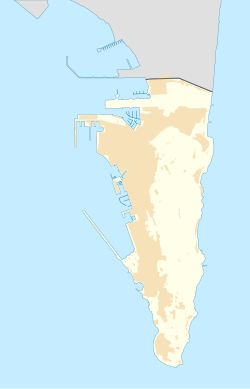
Today, the bastion is surrounded by reclaimed land to the west and north. Glacis Road runs along the base of the bastion's former glacis. Smith Dorrien Avenue separates the bastion from the curtain wall, which is still largely intact. The bastion is occupied by the Giralda Gardens and a pétanque club. The Government of Gibraltar has plans to rehabilitate the site as part of a plan to develop the old fortifications as tourist attractions.

Background

Gibraltar is accessible by land only along a narrow isthmus overlooked by the Rock, which is too steep to be climbed on its east and north sides. The only entrance to Gibraltar is via the west side of the Rock. A Moorish town occupied the strip of land along the west of the peninsula between the sea and the Rock. The northern approaches to the town were defended by a castle on the slopes of the rock, from which walls built in the Middle Ages ran down to the shore of the Bay of Gibraltar. [1]

A tower was built at the end of the wall by the Spanish after Ferdinand IV of Castile took Gibraltar from the Moors in 1309. The Spanish built an arsenal where the Grand Casemates barracks now stand, and the Giralda tower where the North Bastion would later stand. [2] The tower was built on Ferdinand's orders to protect the dockyard, although improvements to other defenses were neglected. [3] In 1333 the Moors retook Gibraltar after a lengthy siege, and the Spanish under Alfonso XI of Castile were unable to recapture it. Portillo describes the Giralda tower as "a redoubt of very great strength and capable of containing sufficient numbers to defend the place, as was seen in the year 1333 when besieged by King Alfonso." [4] The Spanish finally took Gibraltar in August 1462. [5]

A mole extending into the bay from a location just south of the tower provided shelter for trading vessels. [6] The Moors built a wall along the bay south from the tower, which the Spanish later improved and the British further fortified. [7] The Moors built their galleys in a building behind the tower, and launched them through a large arch in the sea wall, later closed. [7] Later the Grand Casemates Gates, formerly called the Waterport Gate, provided access to the town through the wall that ran along the bay. Vessels landing at the wharves by the old mole could gain entry through these fortified gates just south of the North Bastion.

Construction

The Italian Engineer Giovan Giacomo Paleari Fratino was commissioned by Philip II of Spain to improve the defenses of Gibraltar in the 1560s. [8] Among other works he converted the tower into a bastion. [1] The foot of the glacis in front of the north bastion, and part of the curtain wall leading towards the Rock, was washed by the water of the bay. [9] Further improvements to the northern defenses were made by the British after they took Gibraltar in 1704. They mounted guns along the land front curtain wall, calling this the Grand Battery, and mounted more guns on the old mole, which extended into the sea near the North Bastion. [1] Between 1731 and 1734 the area in front of the land wall, which had been a marsh, was excavated to a depth of 2 feet (0.61 m) lower than lower-water level in the bay. [9]

An account of the Great Siege of Gibraltar (1779–83) described the fortifications at that time. Entrance by land was then along a narrow causeway that could be raked by fire from artillery on the old mole and in the Grand Battery. The sea line south of the Grand Battery was defended by the "line wall", a curtain wall that linked five bastions: North Bastion, Montagu Bastion, Orange Bastion, King's Bastion and South Bastion. Montague's, Prince of Orange's and Kings had recently been erected by the British. [10] Around that time the North Bastion was described as "...anciently a square Moorish tower: it still retains the same form, except the parapet in front, which is made of tapia, with four embrasures mounted in the face towards the enemy, three towards the sea, three in the flank next the ditch, and three on the flank next Water port." [9]

History

Gibraltar from the North Bastion in 1828. The bastion jutted out from the curtain wall defending the town, which is to the right of the picture behind the ditch. Gibraltar from the North Bastion coloured.jpg
Gibraltar from the North Bastion in 1828. The bastion jutted out from the curtain wall defending the town, which is to the right of the picture behind the ditch.
Fortifications of Gibraltar in 1597. The old mole, extending into the bay, is in the lower left. The bastion is the square structure above the base of the mole at the angle between the bay wall and the northern land defenses (north is to the left in this map). 1597 - Unknown - Map and Fortifications of Gibraltar.jpg
Fortifications of Gibraltar in 1597. The old mole, extending into the bay, is in the lower left. The bastion is the square structure above the base of the mole at the angle between the bay wall and the northern land defenses (north is to the left in this map).

A combined British and Dutch force under the British Admiral Sir George Rooke and Prince George of Hesse-Darmstadt attacked the Rock on 1 August 1704, and the outnumbered and outgunned garrison surrendered on 4 August 1704. [11] A Franco-Spanish army reached the Rock in early September 1704 and began a siege in October. [12] Governor Henry Nugent was mortally wounded on 9 November 1704 at San Pablo Battery (North Bastion). [13] The English received reinforcements, and in March 1705 the siege was lifted. [14]

The bastion was an important position during the Siege of Gibraltar of 1727. During this siege the attack was directed only against the Rock's north front and defenses. [15] These defenses consisted of the Land Port curtain wall defended by Willis' Battery, the Castle Battery, North Bastion and guns on the old mole. Most of the British artillery was old and in poor condition: more deaths were caused to the British by their own guns bursting than by fire from the Spanish. [16]

By the end of February the Spanish had brought forward siege works, but were exposed to fire from the British defenses and also from above, since small mines exploded at the top of the Rock sent showers of stone into the Spanish trenches. [17] By mid-March the North Bastion was suffering from heavy fire from a 12-gun position close to the Rock. [18] At the end of April the bastion was still subject to heavy fire from the Spanish batteries, with three guns dismounted on the 30th. [19] In the end, it proved impossible for the Spanish to break through the fortifications. On 23 June 1727 a truce was agreed, and a peace treaty was signed in 1729 after long negotiations. [20]

At the start of the Great Siege of Gibraltar (June 1779 – 7 February 1783), engineers built a "cavalier" (elevated firing platform) for five guns within the north bastion, by then considered a part of the Grand Battery. [10]

Today

Before 1999, the site of the Giralda Tower was partly an unkept garden, and is now used by the Gibraltar Petanque Association. [21]

The association has about 80 members. Its premises at the Giralda Gardens on the city wall have four floodlit pistes. [22]

The Government of Gibraltar had plans to improve access to the Northern Defences as part of an effort to better exploit the tourist potential of the historical defence work. [23] The plan included making the gardens more attractive and accessible and providing historical interpretation of the site. The Giralda Tower site, across the road from the Grand Battery, would link tours of the northern and western defences. [21]

Related Research Articles

Fort Ricasoli Historic fort on Malta

Fort Ricasoli is a bastioned fort in Kalkara, Malta, which was built by the Order of Saint John between 1670 and 1698. The fort occupies a promontory known as Gallows' Point and the north shore of Rinella Bay, commanding the entrance to the Grand Harbour along with Fort Saint Elmo. It is not only the largest fort in Malta but also the largest in Europe, and it has been on the tentative list of UNESCO World Heritage Sites since 1998, as part of the Knights' Fortifications around the Harbours of Malta.

Thirteenth siege of Gibraltar

The siege of Gibraltar of 1727 saw Spanish forces besiege the British garrison of Gibraltar as part of the Anglo-Spanish War. Depending on the sources, Spanish troops numbered between 12,000 and 25,000. British defenders were 1,500 at the beginning of the siege, increasing up to about 5,000. After a five-month siege with several unsuccessful and costly assaults, Spanish troops gave up and withdrew. Following the failure the war drew to a close, opening the way for the 1728 Treaty of El Pardo and the Treaty of Seville signed in 1729.

Line Wall Curtain

The Line Wall Curtain is a defensive curtain wall that forms part of the fortifications of the British Overseas Territory of Gibraltar.

Streets in Gibraltar

Streets in the British Overseas Territory of Gibraltar are represented by road signs as in the United Kingdom. As of 2007, Gibraltar has a network of 29 kilometres (18 mi) of roads.

Charles V Wall

The Charles V Wall is a 16th-century defensive curtain wall that forms part of the fortifications of the British Overseas Territory of Gibraltar. Originally called Muralla de San Benito, it was built in 1540 and strengthened in 1552 by Holy Roman Emperor Charles V. The wall remains largely intact and extends from South Bastion, which was once at the water's edge in the harbour, to the top ridge of the Rock of Gibraltar.

Grand Casemates Gates

Grand Casemates Gates, formerly Waterport Gate, provide an entrance from the northwest to the old, fortified portion of the city of the British Overseas Territory of Gibraltar, at Grand Casemates Square.

South Bastion, Gibraltar Bastion in Gibraltar

The South Bastion was part of the fortifications of Gibraltar, protecting the western base of the Charles V Wall. It was originally built by Spanish military engineers, later improved by the British. The South Bastion stands at the south end of the Line Wall Curtain which defends the town from attack from the Bay of Gibraltar. Another curtain wall runs east from the bastion to the base of a precipice. This wall is pierced by the Southport Gates, guarded by the South Bastion and the Flat Bastion on either side.

Twelfth siege of Gibraltar Siege of War of the Spanish Succession

The twelfth siege of Gibraltar was fought between September 1704 and May 1705 during the War of the Spanish Succession. It followed the capture in August 1704 of the fortified town of Gibraltar, at the southern tip of Spain, by an Anglo–Dutch naval force led by Sir George Rooke and Prince George of Hesse-Darmstadt. The members of the Grand Alliance, Holy Roman Empire, England, the Netherlands, Pro-Habsburg Spain, Portugal and the Savoy, had allied to prevent the unification of the French and Spanish thrones by supporting the claim of the Habsburg pretender Archduke Charles VI of Austria as Charles III of Spain. They were opposed by the rival claimant, the Bourbon Philip, Duke of Anjou, ruling as Philip V of Spain, and his patron and ally, Louis XIV of France. The war began in northern Europe and was largely contained there until 1703, when Portugal joined the confederate powers. From then, English naval attentions were focused on mounting a campaign in the Mediterranean to distract the French navy and disrupt French and Bourbon Spanish shipping or capture a port for use as a naval base. The capture of Gibraltar was the outcome of that initial stage of the Mediterranean campaign.

Orange Bastion

The Orange Bastion is one of the many bastions in the British Overseas Territory of Gibraltar, which served to protect it against its many sieges. It is located along the Line Wall Curtain and was built to protect the Gibraltar Harbour against enemy attack.

Kings Bastion

King's Bastion is a coastal bastion on the western front of the fortifications of the British overseas territory of Gibraltar, protruding from the Line Wall Curtain. It is located between Line Wall Road and Queensway and overlooks the Bay of Gibraltar. It played a crucial role in defending The Rock during the Great Siege of Gibraltar. In more recent history the bastion was converted into a generating station which powered Gibraltar's electricity needs. Today it continues to serve the community as Gibraltar's leisure centre.

Wellington Front

Wellington Front is a fortification in the British Overseas Territory of Gibraltar. It was built in 1840 on a site established by the Spanish in 1618.

Hesses Demi Bastion

Hesse's Demi Bastion is a demi-bastion in the British Overseas Territory of Gibraltar. It is part of the Northern Defences of Gibraltar. The bastion forms a link in a chain of fortifications which ascend the lower north-west slopes of the Rock of Gibraltar, below the King's Lines Battery and Bombproof Battery. The Moorish Castle's Tower of Homage is at the top of the same incline.

Jumpers Bastion

Jumper's Bastion may refer to one of two adjacent bastions in the British Overseas Territory of Gibraltar. They were both created in 1785 on the sites of previous constructions and named for a British Captain who was one on the first on shore during the Capture of Gibraltar in 1704.

Zoca Flank Battery

Zoca Flank Battery is an artillery battery on the west side of the British Overseas Territory of Gibraltar.

Fortifications of Gibraltar Defensive military constructions at the Rock of Gibraltar

The Gibraltar peninsula, located at the far southern end of Iberia, has great strategic importance as a result of its position by the Strait of Gibraltar where the Mediterranean Sea meets the Atlantic Ocean. It has repeatedly been contested between European and North African powers and has endured fourteen sieges since it was first settled in the 11th century. The peninsula's occupants – Moors, Spanish, and British – have built successive layers of fortifications and defences including walls, bastions, casemates, gun batteries, magazines, tunnels and galleries. At their peak in 1865, the fortifications housed around 681 guns mounted in 110 batteries and positions, guarding all land and sea approaches to Gibraltar. The fortifications continued to be in military use until as late as the 1970s and by the time tunnelling ceased in the late 1960s, over 34 miles (55 km) of galleries had been dug in an area of only 2.6 square miles (6.7 km2).

Lines of Contravallation of Gibraltar

The Lines of Contravallation of Gibraltar, known in English as the "Spanish Lines", were a set of fortifications built by the Spanish across the northern part of the isthmus linking Spain with Gibraltar. They later gave their name to the Spanish town of La Línea de la Concepción. The Lines were constructed after 1730 to establish a defensive barrier across the peninsula, with the aim of preventing any British incursions, and to serve as a base for fresh Spanish attempts to retake Gibraltar. They played an important role in the Great Siege of Gibraltar between 1779 and 1783 when they supported the unsuccessful French and Spanish assault on the British-held fortress. The siege was ended after the lines of contravallation were attacked by British and Dutch forces under the command of the Governor of Gibraltar, General Augustus Eliot. The attack caused the Spanish forces to retreat and abandon the fortifications and the combined British led forces virtually destroyed all the Spanish gun batteries and the enemy cannon and munitions either captured or destroyed. This attack is still commemorated to this day and is known as 'Sortie Day'.

Kings Lines

The King's Lines are a walled rock-cut trench on the lower slopes of the north-west face of the Rock of Gibraltar. Forming part of the Northern Defences of the fortifications of Gibraltar, they were originally created some time during the periods when Gibraltar was under the control of the Moors or Spanish. They are depicted in a 1627 map by Don Luis Bravo de Acuña, which shows their parapet following a tenaille trace. The lines seem to have been altered subsequently, as maps from the start of the 18th century show a more erratic course leading from the Landport, Gibraltar's main land entrance, to the Round Tower, a fortification at their western end. A 1704 map by Johannes Kip calls the Lines the "Communication Line of the Round Tower".

Queens Lines

The Queen's Lines are a set of fortified lines, part of the fortifications of Gibraltar, situated on the lower slopes of the north-west face of the Rock of Gibraltar. They occupy a natural ledge which overlooks the landward entrance to Gibraltar and were an extension to the north-east of the King's Lines. They run from a natural fault called the Orillon to a cliff above the modern Laguna Estate, which stands on the site of the Inundation, an artificial lake created to obstruct landward access to Gibraltar. The Prince's Lines run immediately behind and above them on a higher ledge. All three of the Lines were constructed to enfilade attackers approaching Gibraltar's Landport Front from the landward direction.

Princes Lines

The Prince's Lines are part of the fortifications of Gibraltar, situated on the lower slopes of the north-west face of the Rock of Gibraltar. They are located at a height of about 70 feet (21 m) on a natural ledge above the Queen's Lines, overlooking the landward entrance to Gibraltar, and run from a natural fault called the Orillon to a cliff at the southern end of the isthmus linking Gibraltar with Spain. The lines face out across the modern Laguna Estate, which stands on the site of the Inundation, an artificial lake created to obstruct landward access to Gibraltar. They were constructed to enfilade attackers approaching Gibraltar's Landport Front from the landward direction.

References

Citations

  1. 1 2 3 Gibraltar.
  2. Kenyon 1938, p. 9-11.
  3. Harvey 1996, p. 37.
  4. Royal Engineers Journal 1910, p. 171.
  5. Fothergill Jackson 1987, p. 57-58.
  6. Drinkwater 1786, p. 29.
  7. 1 2 James 1771, p. 403.
  8. Fa & Finlayson 2006, p. 19.
  9. 1 2 3 James 1771, p. 304.
  10. 1 2 Drinkwater 1786, p. 27.
  11. Fothergill Jackson 1987, p. 96-98.
  12. Fothergill Jackson 1987, p. 106.
  13. Parnell 1905, p. 83.
  14. Fothergill Jackson 1987, p. 111.
  15. Sayer 1865, p. 194.
  16. Sayer 1865, p. 195.
  17. Sayer 1865, p. 196.
  18. Sayer 1865, p. 198.
  19. James 1771, p. 266.
  20. Sayer 1865, p. 215.
  21. 1 2 Town Planning Division 2009, p. 19.
  22. Gibraltar Petanque Association.
  23. Town Planning Division 2009, p. 18.

Sources