South Mole, Gibraltar Harbour

Last updated

View of the South Mole at Gibraltar Harbour, from the Rock of Gibraltar Gibraltar Dockyard.JPG
View of the South Mole at Gibraltar Harbour, from the Rock of Gibraltar

The South Mole is a breakwater located in the southern section of Gibraltar Harbour, in the British Overseas Territory of Gibraltar, at the southern end of the Iberian Peninsula. Previously known as the New Mole and New Mole Extension, the South Mole, with the rest of harbour, is just north of the east entrance to the Strait of Gibraltar.

Contents

History

Gibraltar Harbour with North Mole, Detached Mole, and South Mole Gibraltar map-en-edit2.svg
Gibraltar Harbour with North Mole, Detached Mole, and South Mole
Bay of Gibraltar c1750 includes Gibraltar Harbour with Old Mole and short New Mole. Gibraltar and Bay map 1750.jpg
Bay of Gibraltar c1750 includes Gibraltar Harbour with Old Mole and short New Mole.
The "New" Mole in the 1890s. 1890s - GWashington Wilson - New Mole.jpg
The "New" Mole in the 1890s.
Photograph taken from the "New" Mole looking south along its length in the 1890s . 1890s G Washington Wilson View from New Mole.jpg
Photograph taken from the "New" Mole looking south along its length in the 1890s .

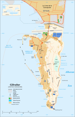
The South Mole at Gibraltar Harbour is one of a trio of breakwaters that provides protection to the harbour, in addition to that which results from the presence of the Rock of Gibraltar on its east side. The South Mole is positioned at the southwestern aspect of the harbour, and is 1,100 feet (340 m) in length. The Gibdock shipyard and Royal Naval base are also in the southern section of the harbour, [1] the wharfage of the shipyard including 435 metres (1,427 ft) of the South Mole. Repair berths along the breakwater can accommodate vessels up to 150,000 deadweight tonnage (dwt). [2] During construction in the 1880s, a railway and two new tunnels were created to take large quantities of quarried stone to assist in the Mole's creation. One of these tunnels was by Camp Bay and the other was under the Parson's Lodge Battery. [3]

The north end of the South Mole, its "A" Head, is the site of the Gibraltar South Mole Lighthouse. The location gives the tower its alternate name of the Gibraltar "A" Head Lighthouse. Its light characteristic is a quick, flashing white light, with a range of fifteen nautical miles. The black, cast-iron, skeletal tower continues to be active as an aid to navigation and is operated by the Gibraltar Port Authority. [4] [5]

The south entrance to Gibraltar Harbour, between the "A" Head of the South Mole and the "B" Head of the Detached Mole, is controlled by the Queen's Harbourmaster. Berths utilised by U.S. Navy ships on the South Mole include Piers 48, 49, and 50. [6]

The South Mole was formerly known as the New Mole and New Mole Extension, to distinguish it from the Old Mole at the northeastern corner of the harbour. Construction of the New Mole was begun by the Spanish in 1620. [7] It underwent extension a variety of times, eventually reaching a length of 1,400 feet (430 m). It was built of rubble stone. The New Mole Extension was added about the turn of the twentieth century. The 2,700 feet (820 m) extension, together with the New Mole length of 1,400 feet (430 m), resulted in a total length of 4,100 feet (1,200 m) for the New Mole and New Mole Extension together, by 1911. [7] This is more than the length indicated by the Gibraltar Port Authority one hundred years later, in 2011. [1] [7] In 1916, the length of the south entrance to the harbour was reported to be 600 feet (180 m). At that time, coal stores lined almost the entire length of the South Mole. [8]

SS Rosslyn

In January 1916, the SS Rosslyn, a more than 3,600 ton steamship commanded by Captain William Fishey, departed from Liverpool, England. The ship was 340 feet long and built in 1902. [9] After the ship's cargo was unloaded at Muros, Spain, the captain was directed to set a course for Gibraltar, where he was instructed to anchor off the South Mole, outside the harbour. After an uneventful week at anchor, the weather changed for the worse on 27 February 1916. The following day, gale-force winds repeatedly dashed the ship against the recently completed South Mole. Despite the efforts of tugs provided by the Royal Navy and the Gibraltar Harbour authority, the ship sank off the South Mole. [10] [11] The Gibraltar Chronicle of 1 March 1916 reported: [12]

The Cardiff steamer Rosslyn, of 3,679 tons gross, in ballast, dragged her anchor on Monday afternoon and was driven by the South-West gale on to the new Mole Breakwater. The dangerous plight of the vessel was at once seen and two Government Tugs immediately went to her assistance and made several attempts to tow her off, but as the gale was increasing every moment, after taking off the crew, they gave up their efforts and brought the men safely to harbour. Owing to the battering received by the high seas, the Rosslyn foundered yesterday morning, only part of her masts being now visible above water.

The SS Rosslyn was the largest wreck in Gibraltar and is now a popular site with divers. [11]

Map of Gibraltar from EB1911. EB1911 Gibraltar.jpg
Map of Gibraltar from EB1911.

Related Research Articles

Plymouth Sound

Plymouth Sound, or locally just The Sound, is a deep Inlet or sound in the English Channel near Plymouth in England.

Apra Harbor

Apra Harbor, also called Port Apra, is a deep-water port on the western side of the United States territory of Guam. It is considered one of the best natural ports in the Pacific Ocean. The harbor is bounded by Cabras Island and the Glass Breakwater to the north and the Orote Peninsula in the south. Naval Base Guam and the Port of Guam are the two major users of the harbor. It is also a popular recreation area for boaters, surfers, scuba divers, and other recreationalists.

Saint Peter Port Harbour Port Harbour located in Guernsey

Saint Peter Port Harbour is located in Saint Peter Port, Guernsey. It was a natural anchorage used by the Romans which has been changed into an artificial harbour that is now the island's main port for passengers. Loose cargo, liquids and gas are shipped to and from St Sampson's harbour.

Braye Harbour is the main harbour on the north side of the Island of Alderney, in the Channel Islands, a dependency of the British Crown. A 3,000 feet (910 m) break-water was built by the Admiralty to protect the Navy in the 19th century shelters Braye Harbour. It is an artificial harbour created by building a pier or jetty. The harbour faces out onto the Swinge, which is part of the English Channel. It is here that most of the island's freight comes in. It is more or less a suburb of St Anne, which is a large settlement in Alderney that juts out on a rocky promontory on the west side, approximately 1 mile from the harbour.

Toronto Harbour Commission

The Toronto Harbour Commission (THC) was a joint federal-municipal government agency based in Toronto, Ontario, Canada. The agency managed Toronto Harbour as well as being responsible for major works along the Toronto waterfront. It built the Toronto Island Airport in 1939. The agency was founded in 1911 and operated until 1999 when the port operations were transferred to the new Toronto Port Authority (TPA), now PortsToronto.

Fremantle Harbour Port in Fremantle, Perth, Western Australia

Fremantle Harbour is Western Australia's largest and busiest general cargo port and an important historical site. The inner harbour handles a large volume of sea containers, vehicle imports and livestock exports, cruise shipping and naval visits, and operates 24 hours a day. It is located adjacent to the city of Fremantle, in the Perth metropolitan region.

Port of Livorno Port in Italy

The Port of Livorno is one of the largest Italian seaports and one of the largest seaports in the Mediterranean Sea, with an annual traffic capacity of around 30 million tonnes of cargo and 600,000 TEU's.

Douglas Harbour Port

Douglas Harbour is located near Douglas Head at the southern end of Douglas, the capital of the Isle of Man. It is the island's main commercial shipping port. The Port of Douglas was the first in the world to be equipped with radar.

Gibraltar North Mole Lighthouse Lighthouse

The Gibraltar North Mole Lighthouse is one of several lighthouses in Gibraltar, the British Overseas Territory at the southern end of the Iberian Peninsula. Also referred to as the Gibraltar "D" Head Lighthouse, its cast-iron tower is painted black. The active lighthouse west of the Rock of Gibraltar is positioned on the Western Arm of the North Mole at Gibraltar Harbour, and is operated by the Gibraltar Port Authority.

Gibraltar South Mole Lighthouse Lighthouse

The Gibraltar South Mole Lighthouse is one of several lighthouses in Gibraltar, a British Overseas Territory at the south end of the Iberian Peninsula. Also known as the Gibraltar "A" Head Lighthouse, it has a cast-iron, skeletal tower which is painted black and features two galleries. The lighthouse remains operational and is positioned west of the Rock of Gibraltar, on the South Mole at Gibraltar Harbour. It is operated by the Gibraltar Port Authority.

The Gibraltar North Mole Elbow Lighthouse is one of several lighthouses in Gibraltar, a British Overseas Territory at the south end of the peninsula of Iberia. Also known as the Gibraltar "E" Head Lighthouse, its tower is painted grey. The active lighthouse is west of the Rock of Gibraltar and positioned at the elbow of the North Mole at Gibraltar Harbour. The lighthouse is operated by the Gibraltar Port Authority.

Detached Mole, Gibraltar Harbour

The Detached Mole is a breakwater located at the western aspect of the middle section of Gibraltar Harbour, in the British Overseas Territory of Gibraltar, at the southern end of the Iberian Peninsula. The Detached Mole, with the rest of harbour, is just north of the east entrance to the Strait of Gibraltar and was the site of the Detached Mole Battery. In addition to the role the breakwater plays in the defence of and access to the harbour, the Detached Mole provides berths for ships. The area adjacent to the mole is also a source of recreational and research opportunities, with dive sites at the wrecks of sunken ships.

Gibraltar Detached Mole ("B" Head) Lighthouse Lighthouse

The Gibraltar Detached Mole Lighthouse is one of several lighthouses in Gibraltar, a British Overseas Territory at the south end of the Iberian Peninsula. The lighthouse is positioned west of the Rock of Gibraltar, on the Detached Mole at the south entrance to Gibraltar Harbour.

The Gibraltar Detached Mole Lighthouse is one of several lighthouses in Gibraltar, a British Overseas Territory at the south end of the Iberian Peninsula. The lighthouse is positioned west of the Rock of Gibraltar, on the Detached Mole at the north entrance to Gibraltar Harbour.

North Mole, Gibraltar Harbour

The North Mole is a breakwater located in the northern section of Gibraltar Harbour, in the British Overseas Territory of Gibraltar, at the southern end of the Iberian Peninsula. The North Mole, with the rest of harbour, is just north of the east entrance to the Strait of Gibraltar. The breakwater was formerly known as the Commercial Mole, and is the site of the commercial port in the harbour. It was the consequence of a late nineteenth century plan by the British Admiralty to create a modern dockyard and large defensive harbour in Gibraltar.

Queensway Quay Marina, Gibraltar Port in Gibraltar

The Queensway Quay Marina is one of three marinas in the British Overseas Territory of Gibraltar, at the southern end of the Iberian Peninsula. The yachting facility is located at the eastern aspect of the middle section of Gibraltar Harbour. It is the site of what may be the oldest wharf in Gibraltar, Ragged Staff Wharf.

Gibraltar Cruise Terminal

The Gibraltar Cruise Terminal is located at the northern end of the Western Arm of the North Mole at Gibraltar Harbour. Construction of the facility in the British Overseas Territory of Gibraltar was completed in 1997. In the fifteen years since its opening, the terminal handled approximately three million cruise passengers. In May 2011, the explosion of a sullage tank on the Western Arm, while a cruise ship was berthed nearby, ultimately resulted in the loss of life of a dock worker. In October 2011, the Government of Gibraltar announced plans for expansion and renovation of the cruise terminal.

Port Kembla harbour Port in Australia

Port Kembla is a man-made cargo port or artificial harbour, with an outer harbour protected by breakwaters and an inner harbour constructed by dredging, located in the Illawarra region of New South Wales, Australia.

Wollongong Harbour Precinct Harbour precinct in Wollongong, New South Wales

Wollongong Harbour Precinct is a heritage-listed shipping harbour at Cliff Road and Endeavour Drive, in Wollongong, New South Wales, Australia. It was built in 1837. The historic precinct includes Belmore Basin, Government Dam, Government Basin, Stockade Point, Flagstaff Hill, Signal Hill, Brighton Beach, Boat Harbour and Fortress Hill. It was added to the New South Wales State Heritage Register on 5 May 2010.

References

  1. 1 2 "An Outline of the Port Infrastructure". Port of Gibraltar Handbook 2010-11. Gibraltar Port Authority. 2011. p. 13. Retrieved 27 July 2012.
  2. "General Description of the Port". Port of Gibraltar Handbook 2010-11. Gibraltar Port Authority. 2011. p. 63. Retrieved 27 July 2012.
  3. Bennett, Matthew R. (1998). [Issues in Environmental Geology: A British Perspective Issues in Environmental Geology: A British Perspective]. p. 438.{{cite book}}: Check |url= value (help)
  4. "Gibraltar South Mole Light". Lighthouse Explorer, from Lighthouse Digest Magazine. Retrieved 28 July 2012.
  5. Rowlett, Russ. "Lighthouses of Gibraltar". The Lighthouse Directory. University of North Carolina at Chapel Hill . Retrieved 28 July 2012.
  6. "Military - Gibraltar". globalsecurity.org. GlobalSecurity.org. Retrieved 28 July 2012.
  7. 1 2 3 Chisholm, Hugh, ed. (1911). "Gibraltar"  . Encyclopædia Britannica . Vol. 11 (11th ed.). Cambridge University Press. p. 940.
  8. United States. Hydrographic Office (1916). Mediterranean Pilot: Strait of Gibraltar, south and southeast coast of Spain, African coast from Cape Spartel to Gulf of Gabes-including the Balearic Islands. Hydrographic Office under the authority of the secretary of the Navy. p. 112. Retrieved 30 July 2012.
  9. Smith, Phil; Fa, Darren (2004). Underwater Gibraltar: A Guide to the Rock's Submerged Sites. Gibraltar: Aquila Services Ltd. p. 66. ISBN   191965508-5.
  10. "Southern Europe / The Mediterranean 678 Gibraltar". bsac.com. British Sub-Aqua Club. Retrieved 27 July 2012.
  11. 1 2 "Gibraltar - The Loss of the Rosslyn". simplyscuba.com. Simply Scuba. Retrieved 28 July 2012.
  12. "Gibraltar Chronicle". simplyscuba.com. (as reprinted on Simply Scuba). 1 March 1916. Retrieved 31 July 2012.

Commons-logo.svg Media related to South Mole, Gibraltar at Wikimedia Commons

Coordinates: 36°7′47.34″N5°21′38.15″W / 36.1298167°N 5.3605972°W / 36.1298167; -5.3605972