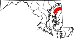
Galena, Maryland | |
---|---|
Coordinates: 39°20′30″N75°52′42″W / 39.34167°N 75.87833°W | |
Country | United States |
State | Maryland |
County | Kent |
Incorporated | 1858 [1] |
Government | |
• Mayor | John Carroll [1] |
Area | |
• Total | 0.36 sq mi (0.93 km2) |
• Land | 0.36 sq mi (0.93 km2) |
• Water | 0.00 sq mi (0.00 km2) |
Elevation | 69 ft (21 m) |
Population (2020) | |
• Total | 539 |
• Density | 1,493.07/sq mi (577.04/km2) |
Time zone | UTC-5 (Eastern (EST)) |
• Summer (DST) | UTC-4 (EDT) |
ZIP code | 21635 |
Area code | 410 |
FIPS code | 24-31225 |
GNIS feature ID | 0590270 |
Website | www |
Galena is a town in Kent County, Maryland, United States. The population was 612 at the 2010 census.
Galena is located at 39°20′30″N75°52′42″W / 39.34167°N 75.87833°W (39.341680, -75.878444). [3]
According to the United States Census Bureau, the town has a total area of 0.36 square miles (0.93 km2), all land. [4]
Galena was founded in 1763 under the name Down's Cross Roads, after William Downs, a local tavern owner. [5] The name was later changed to Georgetown Cross Roads sometime before 1813, and finally to Galena in 1858. [6] The name comes from a supposed silver mine in the vicinity of the town, which extracted the metal from the lead ore known as galena. There is, however, no geological evidence for galena deposits on Maryland's Eastern Shore, and the story is likely apocryphal. [6]
The primary means of transportation to and from Galena is by road, and several state highways serve the town. Maryland Route 213 is the most prominent of these, entering the town from the north and exiting to the west on its generally north-south route along the eastern shore of the Chesapeake Bay. Maryland Route 290 does the opposite, entering from the south and departing towards the east, with the two highways meeting at a crossroads in downtown Galena. A third highway, Maryland Route 313, runs concurrently along MD 290 from its junction with MD 213 southwards, separating from MD 290 a short distance south of town on its way towards the southern Delmarva.
Galena is home to a variety of small businesses for its size. Along with many antique shops, there is a diner, confectionery shop, convenience store and deli, organic and health foods market, pizza parlor, recording studio, and wedding videography studio.
Census | Pop. | Note | %± |
---|---|---|---|
1880 | 347 | — | |
1890 | 266 | −23.3% | |
1900 | 251 | −5.6% | |
1910 | 262 | 4.4% | |
1920 | 298 | 13.7% | |
1930 | 265 | −11.1% | |
1940 | 250 | −5.7% | |
1950 | 259 | 3.6% | |
1960 | 299 | 15.4% | |
1970 | 361 | 20.7% | |
1980 | 374 | 3.6% | |
1990 | 324 | −13.4% | |
2000 | 428 | 32.1% | |
2010 | 612 | 43.0% | |
2020 | 539 | −11.9% | |
U.S. Decennial Census [7] |
As of the census [8] of 2010, there were 612 people, 271 households, and 169 families living in the town. The population density was 1,700.0 inhabitants per square mile (656.4/km2). There were 284 housing units at an average density of 788.9 per square mile (304.6/km2). The racial makeup of the town was 91.3% White, 2.3% African American, 0.2% Native American, 0.3% Asian, 3.9% from other races, and 2.0% from two or more races. Hispanic or Latino of any race were 6.0% of the population.
There were 271 households, of which 26.2% had children under the age of 18 living with them, 52.0% were married couples living together, 7.0% had a female householder with no husband present, 3.3% had a male householder with no wife present, and 37.6% were non-families. 32.8% of all households were made up of individuals, and 14.8% had someone living alone who was 65 years of age or older. The average household size was 2.26 and the average family size was 2.88.
The median age in the town was 45.1 years. 20.1% of residents were under the age of 18; 6.5% were between the ages of 18 and 24; 23.2% were from 25 to 44; 29.4% were from 45 to 64; and 20.8% were 65 years of age or older. The gender makeup of the town was 47.5% male and 52.5% female.
As of the census [9] of 2000, there were 428 people, 190 households, and 121 families living in the town. The population density was 1,208.2 inhabitants per square mile (466.5/km2). There were 202 housing units at an average density of 570.2 per square mile (220.2/km2). The racial makeup of the town was 95.79% White, 3.50% African American, and 0.70% from two or more races. Hispanic or Latino of any race were 0.70% of the population.
There were 190 households, out of which 27.9% had children under the age of 18 living with them, 54.7% were married couples living together, 7.4% had a female householder with no husband present, and 35.8% were non-families. 33.2% of all households were made up of individuals, and 23.7% had someone living alone who was 65 years of age or older. The average household size was 2.23 and the average family size was 2.85.
In the town, the population was spread out, with 23.6% under the age of 18, 1.9% from 18 to 24, 27.6% from 25 to 44, 24.5% from 45 to 64, and 22.4% who were 65 years of age or older. The median age was 43 years. For every 100 females, there were 83.7 males. For every 100 females age 18 and over, there were 78.7 males.
The median income for a household in the town was $47,813, and the median income for a family was $53,068. Males had a median income of $35,096 versus $22,500 for females. The per capita income for the town was $18,858. About 1.6% of families and 4.7% of the population were below the poverty line, including none of those under age 18 and 6.5% of those age 65 or over.
It is in the Kent County Public Schools. Galena Elementary School is in the town. Kent County Middle School is in Chestertown, and Kent County High School is in an unincorporated area with a Worton postal address.
The former Galena High School consolidated into Kent County High in 1971, with the former Galena High becoming Galena Middle. [10] The former Galena Middle School consolidated into Kent County Middle in Chestertown in 2010. [11] The former middle school building became Galena Elementary School in 2010. [12] Before Galena Elementary existed, it was assigned to Millington Elementary. [13]
Kent County public library maintains the North County Branch. [14]
Dorchester County is a county located in the U.S. state of Maryland. At the 2020 census, the population was 32,531. Its county seat is Cambridge. The county was formed in 1669 and named for the Earl of Dorset, a family friend of the Calverts. The county is part of the Mid-Eastern Shore region of the state.
Kent County is a county located in the U.S. state of Maryland. As of the 2020 census, its population was 19,198, making it the least populous county in Maryland. Its county seat is Chestertown. The county was named for the county of Kent in England. The county is part of the Mid-Eastern Shore region of the state.
Queen Anne's County is a county located in the U.S. state of Maryland. As of the 2020 census, the population was 49,874. Its county seat and most populous municipality is Centreville. The census-designated place of Stevensville is the county's most populous place with a population of 7,442 as of 2020. The county is named for Queen Anne of Great Britain, who reigned when the county was established in 1706 during the colonial period. The county is part of the Mid-Eastern Shore region of the state.
Galena is a census-designated place (CDP) in Floyd County, Indiana, United States. The population was 1,818 at the 2010 census. The CDP includes the town of Galena as well as the nearby town of Floyds Knobs and their immediate surroundings.
Parole, a suburb of Annapolis, is a census-designated place (CDP) in Anne Arundel County, Maryland, United States. The population was 15,922 at the 2010 census. It has several major roads intersect at the western edge of the state capital, Annapolis, and it contains the Annapolis Mall, a number of other large shopping centers, and the Anne Arundel Medical Center. It is generally considered to be part of Annapolis, rather than a separate town.
Pasadena is a census-designated place (CDP) in Anne Arundel County, Maryland, United States. The population was 24,287 at the 2010 census.
Chesapeake City is a town in Cecil County, Maryland, United States. The population was 736 at the 2020 census.
Brunswick is a city in southwestern Frederick County, Maryland, United States. The city is located on the north bank of the Potomac River; Loudoun County, Virginia occupies the opposite shore. The population of Brunswick was 8,211 at the 2022 Census. There are three schools serving Brunswick: Brunswick Elementary School, Brunswick Middle School, and Brunswick High School.
Betterton is a town in Kent County, Maryland, United States. The population was 345 at the 2010 census.
Rock Hall, is a waterfront town located directly on the National Chesapeake Scenic Byway in Kent County, Maryland, United States. The population was 1,310 at the 2010 census.
Chevy Chase View is a town in Montgomery County, Maryland, United States. Established as a Special Tax District in 1924, the town was formally incorporated on October 28, 1993. The population was 1,005 at the 2020 census.
Cloverly is an unincorporated town and census-designated place in Montgomery County, Maryland, United States. Its population was 15,285 as of the 2020 census.
East Riverdale is an unincorporated area and census-designated place (CDP) in Prince George's County, Maryland, United States. The population was 18,459 at the 2020 census.
Glenarden is a city in Prince George's County, Maryland, United States. Per the 2020 census, the population was 6,402.
Morningside is an incorporated town in Prince George's County, Maryland, United States. Per the 2020 census, the population was 1,240. The town developed with the establishment of nearby Andrews Air Force Base and the federal Census Bureau. The government of the town is led by a mayor and town council. Morningside Elementary School and Benjamin Foulois Junior High School/Elementary/Creative and Performing Arts Academy (current) as well as Michael J Polley Neighborhood Park are located within the town limits. Morningside has one of the largest VFW posts (chapters) in the entire country. Morningside is also the city of license of one of Washington's most prominent radio stations, from the 1960s to the present, WJFK and WPGC-FM. Additionally, Morningside is home to one of the busiest volunteer fire departments in Prince George's County, Morningside VFD Station 827. In 2015, station 827 ran over 8,000 calls for service with 150 working fires in Morningside and the adjacent communities, and has garnered national recognition for their service to the community.
Leonardtown is a town in and the county seat of St. Mary's County, Maryland, United States. The population was 4,563 at the 2020 census.
Hampstead is a town in Carroll County in the U.S. state of Maryland. The population was 6,323 at the 2010 census.
Millington is a town in Kent and Queen Anne's counties in the U.S. state of Maryland. The population was 642 at the 2010 census. Millington is the head of navigation for the Chester River.
Calverton is an unincorporated area and census-designated place located on the boundary between Montgomery and Prince George's counties, Maryland, in the United States. as of the 2020 census, it had a population of 17,316.
Chevy Chase —formally, the Town of Chevy Chase—is an incorporated town in Montgomery County, Maryland, United States. The population was 2,904 at the 2020 census.
114 South Main Street Galena, MD 21635
111-B1 N. Main Street Galena, MD 21635