
Wells is a town in Hamilton County, New York, United States. The population was 674 at the 2010 census. The town is named after Joshua Wells, a land agent, who built the first mills in the area. It is in the Adirondack Park and on the eastern border of the county. It is northwest of Schenectady.

Black Mountain, also known as Galambary to the Ngunnawal people, is a small mountain with an elevation of 812 metres (2,664 ft) AHD that is situated to the west of the Canberra central business district on the northern shore of Lake Burley Griffin, in the Australian Capital Territory of Australia. Black Mountain is protected from development by the Canberra Nature Park and is predominantly covered in native bushland and is a haven to native wildlife.

Capital Hill is the location of Parliament House, Canberra, at the south apex of the land axis of the Parliamentary Triangle.

Black Hills National Forest is located in southwestern South Dakota and northeastern Wyoming, United States. The forest has an area of over 1.25 million acres (5,066 km²) and is managed by the Forest Service. Forest headquarters are located in Custer, South Dakota. There are local ranger district offices in Custer, Rapid City, and Spearfish in South Dakota, and in Sundance, Wyoming.
Snowy Mountain is a mountain located in Hamilton County, New York. Initially known as 'Squaw Bonnet', its summit is the highest point in the county. While most maps show the elevation as 3899 feet, some suggest that more recent surveys have it as 3904 feet or even 3908 feet.
Alander Mountain is a 2,241-foot-tall (683 m) prominent peak of the south Taconic Mountains; it is located in southwest Massachusetts and adjacent New York. Part of the summit is grassy and open and part is covered with scrub oak and shrubs; the sides of the mountain are wooded with northern hardwood tree species. Views from the top include the southern Taconic Mountains, the Hudson River Valley including the Catskills. Several trails traverse Alander Mountain, most notably the 15.7 mi (25.3 km) South Taconic Trail, which passes just beneath the summit.

The Black Hills is an isolated mountain range rising from the Great Plains of North America in western South Dakota and extending into Wyoming, United States. Black Elk Peak, which rises to 7,244 feet (2,208 m), is the range's highest summit. The Black Hills encompass the Black Hills National Forest. The name of the hills in Lakota is Pahá Sápa, meaning “the heart of everything that is." The Black Hills are considered a holy site. The hills are so called because of their dark appearance from a distance, as they are covered in evergreen trees.

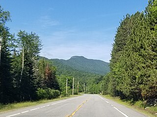
McCauley Mountain is a summit and ski resort in the Town of Webb, Herkimer County, New York. It is located just outside the hamlet of Old Forge, in the south-western area of the Adirondack Mountains.
Griffin Butte, at 8,411 feet (2,564 m) above sea level is a peak in the Smoky Mountains of Idaho. The peak is located in Sawtooth National Forest in Blaine County northwest of Ketchum. It is located in the watershed of the Big Wood River. It is about 1.75 mi (2.82 km) west of Idaho State Highway 75. No roads or trails go to the summit.

Rum Hill is a mountain located in Central New York Region of New York northwest of the Hamlet of Pierstown. Red House Hill is located southeast, Metcalf Hill is located south, Allen Lake and Mohegan Hill are located north-northwest and Otsego Lake is located east of Rum Hill.
Angel Hill is a mountain located in Central New York region of New York south of Exeter Center, New York.
Weaver Hill is a mountain located in Central New York region of New York east of South Valley, New York.
Honey Hill is a small mountain chain located in Central New York Region of New York north of South Valley, New York. It consists of two main peaks the highest being 2181 feet.
Pine Hill is a mountain in the Central New York region of New York, United States. It is located northeast of South Worcester, New York.
Algerine Hill is a mountain in the Central New York region of New York state. It is located south of Furnaceville, New York.
Lyon Mountain is a mountain located in the Catskill Mountains of New York south of Hobart. Cowan Mountain is located east of Lyon Mountain and Griffin Hill is located north.
Mount Bob is a mountain located in the Catskill Mountains of New York north of Hobart. Jaclyn Hill is north of Mount Bob and Griffin Hill is to the south.
Red Hill is a mountain located in the Catskill Mountains of New York east-south of Frost Valley. Woodhull Mountain is located northeast of Red Hill.
Griffin Island is a mountain in Barnstable County, Massachusetts. It is located on 1.7 miles (2.7 km) west-northwest of Wellfleet in the Town of Wellfleet. Great Beach Hill is located south of Griffin Island.
Washburn Mountain is a 1,496-foot-tall (456 m) mountain in New York. It is located south-southeast Copake Falls in Columbia County. From 1932 to 1964, the mountain was the location of a 60-foot-tall (18 m) steel fire lookout tower now located on Beebe Hill. Alander Mountain is located southeast of Washburn Mountain.

