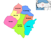
Kırşehir, historically known as Mocissus or Mokissos and Justinianopolis (Ἰουστινιανούπολις) in ancient times, is a city in Turkey. It is the seat of Kırşehir Province and Kırşehir District. Its population is 162.989 (2023).

Bayburt Province is a province of Turkey. Located in the Northeast Anatolia region of the country, the capital city is Bayburt. Its area is 3,746 km2, and its population is 84,241 (2022), making it the least-populous province in Turkey. The province was created in 1989 from part of Gümüşhane Province.

Gümüşhane Province is a province in northern Turkey, bordering Bayburt to the east, Trabzon to the north, Giresun and Erzincan to the west. Its area is 6,668 km2, and its population is 144,544 (2022). The population was 186,953 in 2000. Gümüşhane is the capital city of the province. The name Gümüşhane means silver house. The city has a rich mining history and was the source of exports for Trabzon. The current Governor is Alper Tanrısever, appointed in August 2023.

Görükle is a neighbourhood of the municipality and district of Nilüfer, Bursa Province, Turkey. Its population is 35,882 (2022). It was an independent municipality until it was merged into the municipality of Nilüfer in 2008. It is a college town, being situated near the campus of Uludağ University and home to many college students.
Kırıkkale Province is a province of Turkey. It is located on the crossroads of major highways east of Ankara leading east to the Black Sea region. Its area is 4,791 km2, and its population is 277,046 (2022). With its rapid population growth it has become an industrial center. The province was established in 1989 from part of Ankara Province. The provincial capital is Kırıkkale.

Osmaniye Province is a province in south-central Turkey. It was named Cebel-i Bereket in the early republic until 1933, when it was incorporated into Adana Province. It was made a province again in 1996. Its area is 3,320 km2, and its population is 559,405 (2022). The province is situated in Çukurova, a geographical, economical and cultural region. The capital of the province is Osmaniye. Other major towns include Kadirli and Düziçi.

Kocasinan is a municipality and district of Kayseri Province, Turkey. Its area is 1,471 km2, and its population is 409,005 (2022). It covers the northern part of the agglomeration of Kayseri and the adjacent countryside.

Kaman, formerly known as Chnamane (Khomane), and Zama, is a town in Kırşehir Province in the Central Anatolia region of Turkey. It is the seat of Kaman District. Its population is 21,340 (2022). Its elevation is 1,100 m (3,600 ft).
Kurşunlu is a neighbourhood in the municipality and district of Gemlik, Bursa Province, Turkey. Its population is 1,574 (2022). It lies on the Gulf of Gemlik, at the foot of a range of hills of about 1,000 ft (300 m). It was an independent municipality until it was merged into the municipality of Gemlik in 2008.

Darıca is a municipality and district of Kocaeli Province, Turkey. The town was previously known as Aretsou (Αρετσού) in by its native Greek population. Its area is 23 km2, and its population is 225,602 (2022). The current mayor is Muzaffer Bıyık.

Odunpazarı is a municipality and district of Eskişehir Province, Turkey. Its area is 1,120 km², and its population is 422,423 (2022), 47% of the provincial population. Odunpazarı District covers the southern part of Greater Eskişehir, including the historic center, and the adjacent countryside.

Mezitli is a municipality and district of Mersin Province, Turkey. Its area is 371 km2, and its population is 222,436 (2022). It covers the westernmost part of the city of Mersin and the adjacent countryside. The Mayor of Mezitli is Ahmet Serkan Tuncer.

Toroslar is a municipality and district of Mersin Province, Turkey. Its area is 1,075 km2, and its population is 319,711 (2022). It covers the northern part of the city of Mersin and the adjacent countryside.
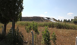
Kaman-Kalehöyük is a multi-period archaeological site in Kırşehir Province, Turkey, around 100 km south east of Ankara, 6 km east of the town center of Kaman. It is a tell or mound site that was occupied during the Bronze Age, Iron Age and Ottoman periods. Excavations in the mound have been carried out since 1986 under the direction of Sachihiro Omura, on behalf of the Middle Eastern Culture Center in Japan and the Japanese Anatolian Archeology Institute. The distance to Hattusa, the Hittite capital, is about 100 km.
Ayvalı is a neighbourhood in the municipality and district of Sarıçam, Adana Province, Turkey. Its population is 90 (2022). Before 2008, it was part of the district of Yüreğir.
Boztepe is a neighbourhood in the municipality and district of Sarıçam, Adana Province, Turkey. Its population is 588 (2022). Before 2008, it was part of the district of Yüreğir.
Karaali Merkez is a neighbourhood in the municipality and district of Gölbaşı, Ankara Province, Turkey. Its population is 251 (2022).

Aziziye is a municipality and district of Erzurum Province, Turkey. Its area is 1,529 km2, and its population is 65,553 (2022).
The geographical centre of Earth is the geometric centre of all land surfaces on Earth. Geometrically defined it is the centroid of all land surfaces within the two dimensions of the Geoid surface which approximates the Earth's outer shape. The term centre of minimum distance specifies the concept more precisely as the domain is the sphere surface without boundary and not the three-dimensional body.

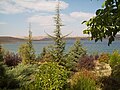
Gölyazı is a neighbourhood in the municipality and district of Nilüfer, Bursa Province in Turkey. Its population is 1,271 (2022). It lies on a small peninsula on Lake Uluabat. It was an independent municipality until it was merged into the municipality of Nilüfer in 2008.