Lawson SDA, Saskatoon

Last updated
Lawson SDA
Country Canada
Province Saskatchewan
City Saskatoon
Area
  Water0 km2 (0 sq mi)  0%
 projected 2010
Area code(s) Area code 306

Lawson Suburban Development Area (SDA) is an area in Saskatoon, Saskatchewan (Canada). It is a part of the west side community of Saskatoon. It lies (generally) south of the outskirts of the North West Industrial SDA, west of the South Saskatchewan River and the University Heights SDA, north of the Core Neighbourhoods SDA, and east of the North West Industrial SDA. [1]

Contents

Neighbourhoods

Recreation facilities

Shopping

The Mall at Lawson Heights Lawson Heights Suburban Centre LawsonHeights.jpg
The Mall at Lawson Heights Lawson Heights Suburban Centre

Education

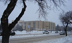
Kelsey campus of SIAST. Central Industrial SIAST.jpg
Kelsey campus of SIAST. Central Industrial

Lawson SDA is home to the following schools:

Separate education

Secondary schools

Elementary schools

Public education

Secondary schools

Secondary Schools of Saskatoon

Elementary schools

[5]

Library

Transportation

City transit

The following routes service the area, all meeting at the bus terminal at The Mall at Lawson Heights.

Related Research Articles

Marion M. Graham Collegiate Secondary school in Saskatoon, Canada

Marion M. Graham Collegiate is the only public high school in the north end of Saskatoon, Saskatchewan, Canada serving the Silverwood Heights, Lawson Heights, River Heights, Richmond Heights, and North Park neighbourhoods. Former Prime Minister Jean Chrétien visited Marion M. Graham Collegiate in 1999, Marion M. Graham Collegiate is also known as Marion Graham or Graham or MMGCI

Confederation SDA, Saskatoon Place in Saskatchewan, Canada

Confederation Suburban Development Area (SDA) is an area in Saskatoon, Saskatchewan (Canada). It is a part of the west side community of Saskatoon. It lies (generally) north of the outskirts of the City and the Rural Municipality of Corman Park No. 344, west of downtown Saskatoon, and the Core Neighbourhoods SDA, south of the North West Industrial SDA, and east of the new Blairmore SDA.

North Industrial Suburban Development Area (SDA) is located in the city of Saskatoon, Saskatchewan, Canada. Lower provincial corporate tax rates, no more provincial capital tax, and industrial lease and purchase rates which have stabilized very competitively with neighboring provinces have produced a demand for industrial property which exceeds supply. North Saskatoon Business Association (NSBA) promotes business interests in the Northern Industrial sector of Saskatoon.

Core Neighbourhoods SDA, Saskatoon Place in Saskatchewan, Canada

The Core Neighbourhoods Suburban Development Area (SDA) is an area in Saskatoon, Saskatchewan, Canada. It is a part of the west and the east side community of Saskatoon, straddling the South Saskatchewan River. It lies (generally) south of the, east of Confederation SDA, to the west of Confederation SDA Lawson SDA University Heights SDA and north of Confederation SDA and Nutana SDA. This Suburban Development Area comprises early Saskatoon origins where the first towns of Nutana, West Saskatoon, and Riversdale came together to form the city of Saskatoon in 1906.

Lakewood SDA, Saskatoon Place in Saskatchewan, Canada

Lakewood Suburban Development Area (SDA) is an area in Saskatoon, Saskatchewan, Canada. It is a part of the east side community of Saskatoon. It lies (generally) north of the outskirts of the City and the Rural Municipality of Corman Park No. 344, west of outskirts of the City and the Rural Municipality of Corman Park No. 344, south of the University Heights SDA, and east of the Nutana SDA.

University Heights SDA, Saskatoon Place in Saskatchewan, Canada

University Heights Suburban Development Area (SDA) is an area in Saskatoon, Saskatchewan (Canada). It is a part of the east side community of Saskatoon. It lies (generally) south of the outskirts of the City and the Rural Municipality of Corman Park No. 344, east of the South Saskatchewan River, and Lawson SDA, north of the Lakewood SDA, and Nutana SDA.

Nutana Suburban Development Area (SDA) is an area in Saskatoon, Saskatchewan (Canada). It is a part of the east side community of Saskatoon, and should not be confused with Nutana, one of the neighbourhoods within the Core Neighbourhoods SDA. It lies (generally) north of the outskirts of the City and the Rural Municipality of Corman Park No. 344, west of Lakewood SDA, south of the Core Neighbourhoods SDA SDA and University Heights SDA, and east of the South Saskatchewan River and Confederation SDA.

Mayfair, Saskatoon Neighbourhood in Saskatoon, Saskatchewan, Canada

Mayfair is a neighbourhood in the city of Saskatoon, Saskatchewan, Canada. Mayfair started out as a community outside of the villages of Riversdale, Nutana and Saskatoon and appears as its own place name on a map of 1907. In 1909 there were 60 residences built in Mayfair, and in 1911, the City of Saskatoon had grown large enough to encompass Mayfair. Homeownership amongst the residents is at 68.2%.

Lawson Heights, Saskatoon Neighbourhood in Saskatoon, Saskatchewan, Canada

Lawson Heights is a residential neighbourhood located in northern Saskatoon, Saskatchewan, which was developed beginning in the late 1970s.

Lawson Heights Suburban Centre, Saskatoon Neighbourhood in Saskatoon, Saskatchewan, Canada

Lawson Heights Suburban Centre is a neighbourhood that is maturing, and is located in north east Saskatoon. The neighbourhood features high density residential areas, major commercial suburban development area centre, transit mall, large green space parks which are slated for upgrade, and secondary institution. It is situated just east of the North West Industrial SDA and near the South Saskatchewan River Lawson Heights Suburban Centre combines a proximity to amenities offered by a comprehensive industrial development and the scenic river and river bank park system.

Kelsey-Woodlawn, Saskatoon Neighbourhood in Saskatoon, Saskatchewan, Canada

Kelsey-Woodlawn is a combination of industrial park nestled between the North West Industrial SDA and the Central Industrial of down town Saskatoon. It is still serviced by the CNR rail lines to both the north and east. There are two older neighbourhoods, one still survives near SIAST - Kelsey institute on Idylwyld Drive North, and the other is the McVicar Addition near the Woodlawn Cemetery.

Blairmore SDA, Saskatoon Place in Saskatchewan, Canada

Blairmore Suburban Development Area (SDA) is an area in Saskatoon, Saskatchewan (Canada). It is a part of the west side community of Saskatoon. It lies (generally) north of the outskirts of the City and the Rural Municipality of Corman Park No. 344, west of downtown Saskatoon, and the Core Neighbourhoods SDA, south of the North West Industrial SDA, and west of the Confederation SDA. Most of the Blairmore SDA consists of undeveloped land annexed by the city in the mid-2000s. A total of nine neighbourhoods, primarily residential in nature, are ultimately planned for the SDA. As of late 2019, two are in the process of development: the commercial/residential Blairmore Suburban Centre and the residential community Kensington. A third residential area, Elk Point, is also in its early stages.

History of Saskatoon

The history of Saskatoon began with the first permanent non-indigenous settlement of Saskatoon, Saskatchewan, Canada, in 1883 when Toronto Methodists, wanting to escape the liquor trade in that city, decided to set up a "dry" community in the rapidly growing prairie region. As of 1882 this area was a part of the provisional district named Saskatchewan, North-West Territories (NWT). Their organization, the Temperance Colonization Society, first examined this area in 1882 and found that it would make an excellent location to found their community based on the ideals of the temperance movement. The settlers, led by John Neilson Lake, arrived on the site of what is now Saskatoon by traveling by railway from Ontario to Moose Jaw, Assiniboia, NWT, and then completing the final leg via horse-drawn cart. The plan for the Temperance Colony soon failed as the group was unable to obtain a large block of land within the community. Nonetheless, John Lake is commonly identified as the founder of Saskatoon; a public school, a park and two streets are named after him.

North Park, Saskatoon Neighbourhood in Saskatoon, Saskatchewan, Canada

North Park is a community which is just to the north of the Meewasin Riverworks observation area and the CPR Bridge. It has access along its eastern perimeter to the scenic walking trails along the South Saskatchewan River developed by the Meewasin Valley Authority. The average home selling price in 2006 was $101,176- $139,704. Each family was approximately 2.1 residents, and 63.9% of the residents owned their own home. According to MLS data, the average sale price of a home as of 2013 was $290,594.

Richmond Heights, Saskatoon Neighbourhood in Saskatoon, Saskatchewan, Canada

Richmond Heights, adjacent to the South Saskatchewan River, features walking trails in the Meewasin Valley. G.D. Archibald Park North hosts baseball and soccer games. Luther Heights is a Luther care community for those aged 60 and over. In 2006, 73.5% of the residents owned their own home; the average home size was 2.3 residents. According to MLS data, the average sale price of a home as of 2013 was $362,063.

Hudson Bay Park, Saskatoon Neighbourhood in Saskatoon, Saskatchewan, Canada

Hudson Bay Park is geographically located in north west Saskatoon just south of Circle Drive along 33rd Street and Avenue P North. It is mainly characterized by single detached homes along with apartments that are less than five stories in height. Oliver Place and St. Joseph's Home are seniors residences located in this residential neighbourhood. This locale honours the pioneers of Saskatoon, as well as providing two very large park spaces which curve through the neighbourhood. The community was under construction mainly during the post war years between 1940 and 1960 when there was a housing shortage. The land for this neighbourhood was annexed during the City expansion around the time of 1910 to 1915. Following elementary school, students usually attend Mount Royal Collegiate in the neighboring area of Mount Royal or E.D. Feehan Catholic High School on Avenue M North a part of Westmount community. In 2006, the average family size was 2.1 residents. Statistics c2005 -

Silverwood Heights, Saskatoon Neighbourhood in Saskatoon, Saskatchewan, Canada

Silverwood Heights is a mostly residential neighbourhood located in north-central Saskatoon, Saskatchewan, Canada. It is a suburban subdivision, composed mostly of single detached dwellings and some multiple-unit apartment and semi-detached dwellings. As of 2009, the area is home to 10,786 residents. The neighbourhood is considered a middle to high-income area, with an average family income of $93,772, an average dwelling value of $324,547 and a home ownership rate of 78.8%. According to MLS data, the average sale price of a home as of 2013 was $399,760. By land area and population, Silverwood Heights is the largest subdivision in Saskatoon.

Marquis Industrial is an industrial park located in the North Industrial SDA Suburban Development Area of Saskatoon, Saskatchewan. Industrial parks are usually located close to transport facilities, especially where more than one transport modalities coincide. Sk Hwy 11, and Sk Hwy 12 are all accessed directly from Marquis Industrial. The Saskatoon John G. Diefenbaker International Airport is west of the Sk Hwy 11 Sk Hwy 12 concurrency along Idylwyld Drive.

Downtown Saskatoon bus terminal

The Downtown Saskatoon bus terminal is a bus terminal for Saskatoon Transit in the Central Business District of Saskatoon, Saskatchewan. It is located on 23rd Street between 2nd Avenue and 3rd Avenue. There is a small customer service centre, where people can buy or re-load a Go-Pass smart card, or get info on Saskatoon Transit services.

References

Coordinates: 52°10′16″N106°37′10″W / 52.17115°N 106.6195°W / 52.17115; -106.6195