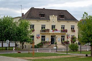
Seine-Maritime is a department of France in the Normandy region of northern France. It is situated on the northern coast of France, at the mouth of the Seine, and includes the cities of Rouen and Le Havre. Until 1955 it was named Seine-Inférieure. It had a population of 759,684 in 2019.

The 3 arrondissements of the Seine-Maritime department are:
- Arrondissement of Dieppe, with 343 communes. The population of the arrondissement was 237,203 in 2016.
- Arrondissement of Le Havre, with 149 communes. The population of the arrondissement was 387,520 in 2016.
- Arrondissement of Rouen, with 216 communes. The population of the arrondissement was 631,032 in 2016.

The arrondissement of Le Havre is an arrondissement of France in the Seine-Maritime department in the Normandy region. It has 149 communes. Its population is 387,520 (2016), and its area is 1,221.2 km2 (471.5 sq mi).

Sassetot-le-Mauconduit is a commune in the Seine-Maritime department in the Normandy region in northern France.

Veauville-lès-Quelles is a commune in the Seine-Maritime department in the Normandy region in northern France.

Hénouville is a commune in the Seine-Maritime department in the Normandy region in northern France.

Tourville-les-Ifs is a commune in the Seine-Maritime department in the Normandy region in northern France.
Le Mesnil-Durdent is a commune in the Seine-Maritime department in the Normandy region in northern France.
Le Thil-Riberpré is a commune in the Seine-Maritime department in the Normandy region in northern France.
Le Torp-Mesnil is a commune in the Seine-Maritime department in the Normandy region in northern France.

Le Trait is a commune in the Seine-Maritime department in the Normandy region in north-western France.

Les Trois-Pierres is a commune in the Seine-Maritime department in the Normandy region in northern France.

Le Mesnil-Réaume is a commune in the Seine-Maritime department in the Normandy region in northern France.
Petiville is a commune in the Seine-Maritime department in the Normandy region in northern France.
The Canton of Envermeu is a former canton situated in the Seine-Maritime département and in the Haute-Normandie region of northern France. It was disbanded following the French canton reorganisation which came into effect in March 2015. It had a total of 17,758 inhabitants (2012).
The Canton of Fécamp is a canton in the Seine-Maritime département and in the Normandy region of northern France.
The Communauté de communes Falaises du Talou is a federation of 24 municipalities located in the Seine-Maritime département of the Normandy region of north-western France. It was created on 1 January 2002, consisting of 16 communes. On 1 January 2017 it was expanded with 8 communes, and it was renamed Communauté de communes Falaises du Talou. Its seat is Envermeu. Its area is 328.5 km2, and its population was 23,598 in 2018.
The Communauté d'agglomération de Fécamp Caux Littoral is the communauté d'agglomération, an intercommunal structure, centred on the town of Fécamp. It is located in the Seine-Maritime department, in the Normandy region, northern France. It was created on 1 January 2015 from the former communauté de communes de Fécamp. It absorbed the former Communauté de communes du Canton de Valmont on 1 January 2017. Its area is 207.1 km2. Its population was 38,635 in 2015, of which 18,251 in Fécamp proper. Its seat is in Fécamp.
The canton of Dieppe-2 is an administrative division of the Seine-Maritime department, in northern France. It was created at the French canton reorganisation which came into effect in March 2015. Its seat is in Dieppe.
Les Hauts-de-Caux is a commune in the Seine-Maritime department in the Normandy region in northern France. It was established on 1 January 2019 by merger of the former communes of Autretot and Veauville-lès-Baons.


