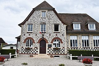
The arrondissement of Dieppe is an arrondissement of France in the Seine-Maritime department in the Normandy région. It has 343 communes. Its population is 237,203 (2016), and its area is 3,120.3 km2 (1,204.8 sq mi).

The arrondissement of Le Havre is an arrondissement of France in the Seine-Maritime department in the Normandy region. It has 149 communes. Its population is 387,520 (2016), and its area is 1,221.2 km2 (471.5 sq mi).

The Arrondissement of Rouen is an arrondissement of France in the Seine-Maritime department in the Normandy region. It has 216 communes. Its population is 631,032 (2016), and its area is 1,936.1 km2 (747.5 sq mi).
Saint-Quentin-au-Bosc is a former commune in the Seine-Maritime department in the Normandy region in northern France. On 1 January 2016, it was merged into the new commune of Petit-Caux.

Bosc-Guérard-Saint-Adrien is a commune in the Seine-Maritime department in the Normandy region in northern France.
Bosc-Hyons is a commune in the Seine-Maritime department in the Normandy region in north-western France.

Bosc-Mesnil is a commune in the Seine-Maritime department in the Normandy region in northern France.
Mathonville is a commune in the Seine-Maritime department in the Normandy region in northern France.

Sainte-Marie-au-Bosc is a commune in the Seine-Maritime department in the Normandy region in northern France.

Hodeng-au-Bosc is a commune in the Seine-Maritime department in the Normandy region of northern France.
Grugny is a commune in the Seine-Maritime department in the Normandy region in northern France.

Valmont is a commune in the Seine-Maritime department in the Normandy region in northern France.

Saint-Pierre-le-Vieux is a commune in the Seine-Maritime department in the Normandy region in north-western France.
The Canton of Blangy-sur-Bresle is a former canton situated in the Seine-Maritime département and in the Haute-Normandie region of northern France. It was disbanded following the French canton reorganisation which came into effect in March 2015. It consisted of 19 communes, which joined the canton of Eu in 2015. It had a total of 10,681 inhabitants (2012).
The Canton of Eu is a canton situated in the Seine-Maritime département and in the Normandy region of northern France.
The Canton of Gournay-en-Bray is a canton situated in the Seine-Maritime département and in the Normandy region of northern France.
The Canton of Neufchâtel-en-Bray is a canton situated in the Seine-Maritime département and in the Normandy region of north-western France.
The Canton of Criquetot-l'Esneval is a former canton situated in the Seine-Maritime département and in the Haute-Normandie region of northern France. It was disbanded following the French canton reorganisation which came into effect in March 2015. It consisted of 21 communes, which joined the canton of Octeville-sur-Mer in 2015. It had a total of 16,394 inhabitants (2012).
The Canton of Bois-Guillaume is a canton situated in the Seine-Maritime département and in the Normandy region of northern France. It covers northern suburbs of Rouen, including the town of Bois-Guillaume, and the rural area north of Rouen.

Petit-Caux is a commune in the department of Seine-Maritime, northern France. The municipality was established on 1 January 2016 by merger of the 18 former communes of Saint-Martin-en-Campagne, Assigny, Auquemesnil, Belleville-sur-Mer, Berneval-le-Grand, Biville-sur-Mer, Bracquemont, Brunville, Derchigny, Glicourt, Gouchaupre, Greny, Guilmécourt, Intraville, Penly, Saint-Quentin-au-Bosc, Tocqueville-sur-Eu and Tourville-la-Chapelle. These communes previously cooperated in the Communauté de communes du Petit Caux.


