Vattetot-sous-Beaumont

Last updated
Vattetot-sous-Beaumont
Mairie de Vattetot-sous-Beaumont 01.JPG
The town hall in Vattetot-sous-Beaumont
Blason Vattetot-sous-Beaumont1.svg
Location of Vattetot-sous-Beaumont
Vattetot-sous-Beaumont
France location map-Regions and departements-2016.svg
Red pog.svg
Vattetot-sous-Beaumont
Normandie region location map.svg
Red pog.svg
Vattetot-sous-Beaumont
Coordinates: 49°37′34″N0°26′50″E / 49.6261°N 0.4472°E / 49.6261; 0.4472 Coordinates: 49°37′34″N0°26′50″E / 49.6261°N 0.4472°E / 49.6261; 0.4472
Country France
Region Normandy
Department Seine-Maritime
Arrondissement Le Havre
Canton Saint-Romain-de-Colbosc
Intercommunality CC Campagne de Caux
Government
  Mayor (20202026) Hervé Niepceron [1]
Area
1
6.94 km2 (2.68 sq mi)
Population
 (Jan. 2019) [2]
576
  Density83/km2 (210/sq mi)
Time zone UTC+01:00 (CET)
  Summer (DST) UTC+02:00 (CEST)
INSEE/Postal code
76725 /76110
Elevation93–147 m (305–482 ft)
(avg. 140 m or 460 ft)
1 French Land Register data, which excludes lakes, ponds, glaciers > 1 km2 (0.386 sq mi or 247 acres) and river estuaries.

Vattetot-sous-Beaumont is a commune in the Seine-Maritime department in the Normandy region in northern France.

Contents

Geography

A farming village in the Pays de Caux, situated some 20 miles (32 km) northeast of Le Havre, on the D52 road.

Heraldry

Arms of Vattetot-sous-Beaumont Blason Vattetot-sous-Beaumont1.svg
Arms of Vattetot-sous-Beaumont
The arms of the commune of Vattetot-sous-Beaumont are blazoned  :
Per pale ermine and gules, a 3-peaked mount (NOT issuant from base), and in chief on an inescutcheon argent, a cross vert.


Population

Historical population
YearPop.±% p.a.
1968 345    
1975 279−2.99%
1982 361+3.75%
1990 484+3.73%
1999 490+0.14%
2007 533+1.06%
2012 577+1.60%
2017 576−0.03%
Source: INSEE [3]

Places of interest

See also

Related Research Articles

Arrondissement of Le Havre Arrondissement in Normandy, France

The arrondissement of Le Havre is an arrondissement of France in the Seine-Maritime department in the Normandy region. It has 149 communes. Its population is 387,520 (2016), and its area is 1,221.2 km2 (471.5 sq mi).

Anglesqueville-la-Bras-Long Commune in Normandy, France

Anglesqueville-la-Bras-Long is a commune in the Seine-Maritime département of the Normandy region of northern France.

Saint-Ouen-sous-Bailly is a commune in the Seine-Maritime department in the Normandy region in northern France.

<span class="mw-page-title-main">Vattetot-sur-Mer</span> Commune in Normandy, France

Vattetot-sur-Mer is a commune in the Seine-Maritime department in the Normandy region in northern France.

<span class="mw-page-title-main">Villers-sous-Foucarmont</span> Commune in Normandy, France

Villers-sous-Foucarmont is a commune in the Seine-Maritime department in the Normandy region in northern France.

Pavilly Commune in Normandy, France

Pavilly is a commune in the Seine-Maritime department in the Normandy region in northern France.

Beaumont-le-Hareng is a commune in the Seine-Maritime department in the Normandy region in northern France.

Saint-Germain-sous-Cailly is a commune in the Seine-Maritime department in the Normandy region in north-western France.

Blosseville Commune in Normandy, France

Blosseville is a commune in the Seine-Maritime department in the Normandy region in northern France.

Sotteville-sous-le-Val is a commune in the Seine-Maritime department in the Normandy region in northern France.

<span class="mw-page-title-main">Grumesnil</span> Commune in Normandy, France

Grumesnil is a commune in the Seine-Maritime department in the Normandy region in northern France.

Haucourt is a commune in the Seine-Maritime department in the Normandy region in northern France.

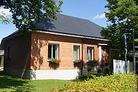
Saint-Arnoult is a commune in the Seine-Maritime department in the Normandy region in northern France.

Saint-Sylvain, Seine-Maritime Commune in Normandy, France

Saint-Sylvain is a commune in the Seine-Maritime department in the Normandy region in northern France.

<span class="mw-page-title-main">Le Mesnil-sous-Jumièges</span> Commune in Normandy, France

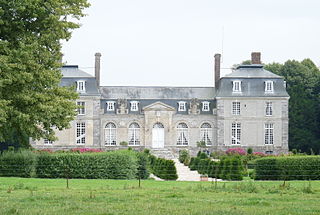
Le Mesnil-sous-Jumièges is a commune in the Seine-Maritime department in the Normandy region in north-western France.

Nolléval Commune in Normandy, France

Nolléval is a commune in the Seine-Maritime department in the Normandy region in north-western France.

The Canton of Fécamp is a canton in the Seine-Maritime département and in the Normandy region of northern France.

The Canton of Goderville is a former canton situated in the Seine-Maritime département and in the Haute-Normandie region of northern France. It was disbanded following the French canton reorganisation which came into effect in March 2015. It consisted of 22 communes, which joined the canton of Saint-Romain-de-Colbosc in 2015. It had a total of 15,022 inhabitants (2012).

The Canton of Saint-Romain-de-Colbosc is a canton situated in the Seine-Maritime département and in the Normandy region of northern France.

The communauté de communes Campagne de Caux is located in the Seine-Maritime département of the Normandy region of northern France. It was created on 31 December 1997. Its seat is Goderville. Its area is 145.3 km2, and its population was 15,059 in 2018.

References

  1. Liste des maires du département de la Seine-Maritime, 10 August 2020
  2. "Populations légales 2019". The National Institute of Statistics and Economic Studies. 29 December 2021.
  3. Population en historique depuis 1968, INSEE