Seine-Maritime is a department of France in the Normandy region of northern France. It is situated on the northern coast of France, at the mouth of the Seine, and includes the cities of Rouen and Le Havre. Until 1955 it was named Seine-Inférieure. It had a population of 1,255,633 in 2019.
Touffreville may refer to the following communes in France, in the region Normandy:

The Arrondissement of Rouen is an arrondissement of France in the Seine-Maritime department in the Normandy region. It has 216 communes. Its population is 631,032 (2016), and its area is 1,936.1 km2 (747.5 sq mi).
Saint-Nicolas-de-la-Haie is a commune in the Seine-Maritime department in the Normandy region in northern France.

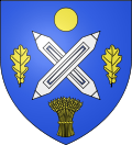
Touffreville-la-Cable is a former commune in the Seine-Maritime department in the Normandy region in northern France. On 1 January 2016, it was merged into the new commune of Port-Jérôme-sur-Seine.
Saint-Gilles-de-Crétot is a commune in the Seine-Maritime department in the Normandy region in northern France.
Saint-Jean-de-la-Neuville is a commune in the Seine-Maritime department in the Normandy region in northern France.
Saint-Denis-d'Aclon is a commune in the Seine-Maritime department in the Normandy region in north-western France.
Cropus is a commune in the Seine-Maritime department in the Normandy region in northern France.

Hénouville is a commune in the Seine-Maritime department in the Normandy region in northern France.
Heurteauville is a commune in the Seine-Maritime department in the Normandy region in north-western France.

Touffreville-sur-Eu is a commune in the Seine-Maritime department in the Normandy region in northern France.
Saint-Arnoult is a commune in the Seine-Maritime department in the Normandy region in northern France.
Petiville is a commune in the Seine-Maritime department in the Normandy region in northern France.

La Remuée is a commune in the Seine-Maritime department in the Normandy region in northern France.

La Bellière is a commune in the Seine-Maritime department in the Normandy region in northern France.
The Canton of Eu is a canton situated in the Seine-Maritime département and in the Normandy region of northern France.
The Canton of Yvetot is a canton situated in the Seine-Maritime département and in the Normandy region of northern France.
The Communauté de communes Falaises du Talou is a federation of 24 municipalities located in the Seine-Maritime département of the Normandy region of north-western France. It was created on 1 January 2002, consisting of 16 communes. On 1 January 2017 it was expanded with 8 communes, and it was renamed Communauté de communes Falaises du Talou. Its seat is Envermeu. Its area is 328.5 km2, and its population was 23,598 in 2018.
Port-Jérôme-sur-Seine is a commune in the department of Seine-Maritime, northern France. The municipality was established on 1 January 2016 by merger of the former communes of Notre-Dame-de-Gravenchon, Auberville-la-Campagne, Touffreville-la-Cable and Triquerville.