
The arrondissement of Dieppe is an arrondissement of France in the Seine-Maritime department in the Normandy région. It has 343 communes. Its population is 237,203 (2016), and its area is 3,120.3 km2 (1,204.8 sq mi).

Manéhouville is a commune in the Seine-Maritime department in the Normandy region in northern France.

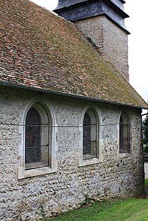
Saint-Paër is a commune in the Seine-Maritime department in the Normandy region in northern France.
Ouville-la-Rivière is a commune in the Seine-Maritime department in the Normandy region in north-western France.

Bosc-Mesnil is a commune in the Seine-Maritime department in the Normandy region in northern France.
Mesnil-Follemprise is a commune in the Seine-Maritime department in the Normandy region in northern France.
Mesnil-Mauger is a commune in the Seine-Maritime department in the Normandy region in northern France.
Mesnil-Panneville is a commune in the Seine-Maritime department in the Normandy region in northern France.

Mesnil-Raoul is a commune in the Seine-Maritime department in the Normandy region in northern France.

Le Mesnil-Esnard is a commune in the Seine-Maritime department in the Normandy region in northern France.
Le Mesnil-Durdent is a commune in the Seine-Maritime department in the Normandy region in northern France.
Le Torp-Mesnil is a commune in the Seine-Maritime department in the Normandy region in northern France.

Le Mesnil-Réaume is a commune in the Seine-Maritime department in the Normandy region in northern France.

Le Mesnil-sous-Jumièges is a commune in the Seine-Maritime department in the Normandy region in north-western France.
La Rue-Saint-Pierre is a commune in the Seine-Maritime department in the Normandy region in northern France. It belongs to the Arrondissement of Rouen and the Canton of Le Mesnil-Esnard. The inhabitants are called Bocassiens.
The Canton of Argueil is a former canton situated in the Seine-Maritime département and in the Haute-Normandie region of northern France. It was disbanded following the French canton reorganisation which came into effect in March 2015. It consisted of 14 communes, which joined the canton of Gournay-en-Bray in 2015. It had a total of 5,568 inhabitants (2012).
The Canton of Gournay-en-Bray is a canton situated in the Seine-Maritime département and in the Normandy region of northern France.
The Canton of Neufchâtel-en-Bray is a canton situated in the Seine-Maritime département and in the Normandy region of north-western France.
The Communauté de communes des Monts et de l'Andelle was located in the Seine-Maritime département of the Normandy région of north-western France. It was created in January 2003. It was merged into the new Communauté de communes des 4 rivières in January 2017.
The Communauté de communes des 4 rivières is a communauté de communes in the Seine-Maritime and Eure départements and in the Normandy région of France. It was formed on 1 January 2017 by the merger of the former Communauté de communes du Bray-Normand, Communauté de communes du Canton de Forges-les-Eaux and Communauté de communes des Monts et de l'Andelle on 1 January 2017. It consists of 53 communes, and its seat is in Gournay-en-Bray.


