
Saint-Ouen-sur-Seine is a commune in the Seine-Saint-Denis department in the Île-de-France region of France. It is located in the northern suburbs of Paris, 6.6 kilometres from the centre of Paris. The commune was officially called Saint-Ouen until 2018, when its name was changed by ministerial order.
Mesnil is derived from Latin mansionile, meaning a small mansio or dwelling, and may refer to:

The arrondissement of Dieppe is an arrondissement of France in the Seine-Maritime department in the Normandy région. It has 343 communes. Its population is 237,203 (2016), and its area is 3,120.3 km2 (1,204.8 sq mi).

Saint-Ouen-en-Brie is a commune in the Seine-et-Marne department in the Île-de-France region in north-central France.

Saint-Ouen-sur-Morin is a commune in the Seine-et-Marne department in the Île-de-France region in north-central France.
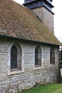
Les Authieux-sur-le-Port-Saint-Ouen is a commune in the Seine-Maritime department in the Normandy region in northern France.

Martainville-Épreville is a commune in the Seine-Maritime department in the Normandy region in north-western France.

Saint-Martin-le-Gaillard is a commune in the Seine-Maritime department in the Normandy region in northern France.
Saint-Ouen-sous-Bailly is a commune in the Seine-Maritime department in the Normandy region in northern France.

Bosc-Mesnil is a commune in the Seine-Maritime department in the Normandy region in northern France.
Mesnil-Mauger is a commune in the Seine-Maritime department in the Normandy region in northern France.
Bertreville-Saint-Ouen is a commune in the Seine-Maritime department in the Normandy region in northern France.

Morville-sur-Andelle is a commune in the Seine-Maritime department in the Normandy region in northern France.

Ermenouville is a commune in the Seine-Maritime department in the Normandy region in northern France.
The Canton of Bacqueville-en-Caux is a former canton situated in the Seine-Maritime département and in the Haute-Normandie region of northern France. It was disbanded following the French canton reorganisation which came into effect in March 2015. It consisted of 25 communes, which joined the new canton of Luneray in 2015. It had a total of 11,466 inhabitants (2012).
The Canton of Gournay-en-Bray is a canton situated in the Seine-Maritime département and in the Normandy region of northern France.
The Canton of Darnétal is a canton situated in the Seine-Maritime département and in the Normandy region of northern France.
The Communauté de communes des 4 rivières is a communauté de communes in the Seine-Maritime and Eure départements and in the Normandy région of France. It was formed on 1 January 2017 by the merger of the former Communauté de communes du Bray-Normand, Communauté de communes du Canton de Forges-les-Eaux and Communauté de communes des Monts et de l'Andelle on 1 January 2017. It consists of 53 communes, and its seat is in Gournay-en-Bray.
The canton of Luneray is an administrative division of the Seine-Maritime department, in northern France. It was created at the French canton reorganisation which came into effect in March 2015. Its seat is in Luneray.


