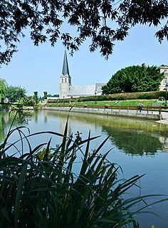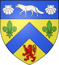
Seine-Maritime is a department of France in the Normandy region of northern France. It is situated on the northern coast of France, at the mouth of the Seine, and includes the cities of Rouen and Le Havre. Until 1955 it was named Seine-Inférieure. It had a population of 759,684 in 2019.

The arrondissement of Bernay is an arrondissement of France in the Eure department in the Normandy region. It has 297 communes. Its population is 227,054 (2016), and its area is 3,226.7 km2 (1,245.8 sq mi).

The arrondissement of Le Havre is an arrondissement of France in the Seine-Maritime department in the Normandy region. It has 149 communes. Its population is 387,520 (2016), and its area is 1,221.2 km2 (471.5 sq mi).

Manneville-ès-Plains is a commune in the Seine-Maritime department in the Normandy region in northern France.

Saint-Pierre-de-Manneville is a commune in the Seine-Maritime department in the Normandy region in northern France.
Thil-Manneville is a commune in the Seine-Maritime department in the Normandy region in north-western France.

Hénouville is a commune in the Seine-Maritime department in the Normandy region in northern France.
Colmesnil-Manneville is a commune in the Seine-Maritime department in the Normandy region in north-western France.
Val-de-la-Haye is a commune in the Seine-Maritime department in the Normandy region in north-western France.

Les Grandes-Ventes is a commune in the Seine-Maritime department in the Normandy region in northern France.
Le Mesnil-Durdent is a commune in the Seine-Maritime department in the Normandy region in northern France.

Saint-Pierre-le-Vieux is a commune in the Seine-Maritime department in the Normandy region in north-western France.

Torcy-le-Grand is a commune in the Seine-Maritime department in the Normandy region in northern France.
The Canton of Saint-Valery-en-Caux is a canton situated in the Seine-Maritime département and in the Normandy region of northern France.
The Canton of Goderville is a former canton situated in the Seine-Maritime département and in the Haute-Normandie region of northern France. It was disbanded following the French canton reorganisation which came into effect in March 2015. It consisted of 22 communes, which joined the canton of Saint-Romain-de-Colbosc in 2015. It had a total of 15,022 inhabitants (2012).
The Canton of Saint-Romain-de-Colbosc is a canton situated in the Seine-Maritime département and in the Normandy region of northern France.
The communauté de communes Campagne de Caux is located in the Seine-Maritime département of the Normandy region of northern France. It was created on 31 December 1997. Its seat is Goderville. Its area is 145.3 km2, and its population was 15,059 in 2018.

Métropole Rouen Normandie is the métropole, an intercommunal structure, centred on the city of Rouen. It is located in the Seine-Maritime department, in the Normandy region, north-western France. It was created in January 2015, replacing the previous Communauté d'agglomération Rouen-Elbeuf-Austreberthe. Its area is 663.8 km2. Its population was 492,681 in 2014, of which 111,360 in Rouen proper.
The canton of Dieppe-1 is an administrative division of the Seine-Maritime department, in northern France. It was created at the French canton reorganisation which came into effect in March 2015. Its seat is in Dieppe.


